U.S. Geological Survey Mineral Resourc… |
|
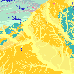
Arkansas_Geology

| Service health Now: |
|---|
- Interface
- Web Service, OGC Web Map Service 1.3.0
- Keywords
- Fees
- none
- Access constraints
- none
- Supported languages
- No INSPIRE Extended Capabilities (including service language support) given. See INSPIRE Technical Guidance - View Services for more information.
- Data provider
-
U.S. Geological Survey Mineral Resources Program (unverified)
Contact information:
Peter N. Schweitzer
U.S. Geological Survey Mineral Resources Program
mailing address:
Mail Stop 954 USGS National Center, 20192 Reston, USAEmail:
Phone: 703-648-6533
- Service metadata
- No INSPIRE Extended Capabilities (including service metadata) given. See INSPIRE Technical Guidance - View Services for more information.
Ads by Google
Available map layers (16)
Arkansas_Geology (Arkansas_Geology)
Arkansas_Geology
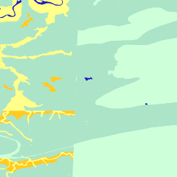
Arkansas_Lithology (Arkansas_Lithology)
Arkansas_Lithology
Arkansas_Lithology (lith-high)
USGS Web Mapping Service: Lithologic map derived from the Arkansas State Geologic Map
Arkansas_Lithology (lith-low)
USGS Web Mapping Service: Lithologic map derived from the Arkansas State Geologic Map
Arkansas_Contacts (Arkansas_Contacts)
Arkansas_Contacts
Arkansas_Contacts (contacts-high)
USGS Web Mapping Service: Lithologic map contacts derived from the Arkansas State Geologic Map
Arkansas_Contacts (contacts-low)
USGS Web Mapping Service: Lithologic map contacts derived from the Arkansas State Geologic Map
Arkansas_Age (Arkansas_Age)
Arkansas_Age
Arkansas_Age (age-high)
USGS Web Mapping Service: Geologic age map derived from the Arkansas State Geologic Map
Arkansas_Age (age-low)
USGS Web Mapping Service: Geologic age map derived from the Arkansas State Geologic Map
Arkansas_Faults (Arkansas_Faults)
Arkansas_Faults
Arkansas_Faults (faults-high)
USGS Web Mapping Service: Faults derived from the Arkansas State Geologic Map
Arkansas_Faults (faults-low)
USGS Web Mapping Service: Faults derived from the Arkansas State Geologic Map
Arkansas_Dikes (Arkansas_Dikes)
Arkansas_Dikes
Arkansas_Dikes (dikes-high)
USGS Web Mapping Service: Dikes derived from the Arkansas State Geologic Map
Arkansas_Dikes (dikes-low)
USGS Web Mapping Service: Dikes derived from the Arkansas State Geologic Map
There are currently no notifications for the service, click the feed icon to subscribe.