Autonome Provinz Bozen - Office 9.6 |
|
INSPIRE View Service - Autonome Provinz Bozen - Provincia Autonoma di Bolzano

| Service health Now: |
|---|
- Interface
- Web Service, OGC Web Map Service 1.3.0
- Keywords
- humanGeographicViewer, INSPIRE View service, Servizio di consultazione, Darstellungsdienst, INSPIRE, infoMapAccessService
- Fees
- No conditions apply
- Access constraints
- CONDIZIONI DI UTILIZZO: Il servizio e il suo contenuto possono essere utilizzati per le seguenti finalita': 1. Uso privato, 2. Ricerca, 3. Cultura 4. Uso nelle scuole / istruzione, 5. Produzione di Prodotti Open Data, 6. Utilizzo a fini delle associazioni ONLUS, 7. Utilizzo all'interno delle organizzazioni per i servizi di emergenza, 8. Utilizzo all'interno di amministrazioni pubbliche, ma solo per soddisfare obblighi di legge. 9. Utilizzo per la creazione di prodotti secondari che possono essere anche utilizzati commercialmente, ma ad esclusione del TileCaching permanente. Il Servizio ei suoi contenuti NON possono essere utilizzati per le seguenti finalita': 1. Utilizzo commerciale dei contenuti di questo servizio in altre applicazioni (uso commerciale dei layer in cascading) 2. Utilizzo commerciale e non commerciale per l'archiviazione sistematica e permanente dei dati del servizio al fine di generare set di dati paralleli (TileCaching permanente). Si prega di contattare informatica.geografica-statistica@provincia.bz.it per qualsiasi uso del servizio e di tutti i dati in esso contenuti che differisce dalle condizioni d'uso sopra descritti (ad esempio per l'uso commerciale o per altri usi interni). ============== NUTZUNGSBEDINGUNGEN: Der Dienst und dessen Inhalte koennen fuer folgende Zwecke verwendet werden: 1. Private Nutzung, 2. Forschung, 3. Bildung, 4. Schulische Nutzung / Unterricht, 5. Erzeugung von Open Data Folgeprodukten, 6. Nutzung fuer Vereinszwecke, 7. Nutzung innerhalb von Blaulichtorganisationen, 8. Nutzung innerhalb von Behoerden, jedoch nur zur Erfuellung gesetzlicher Aufgaben. 9. Nutzung fuer die Erstellung von Folgeprodukten die auch kommerziell genutzt werden koennen, jedoch ohne Permanent-TileCaching. Der Dienst und dessen Inhalte koennen fuer folgende Zwecke ausnahmslos NICHT verwendet werden: 1. Kommerzielle Nutzung der in andere Anwendungen eingebundenen Layer dieses Dienstes (Cascading), 2. Kommerzielle und nicht kommerzielle Nutzung fuer das systematische permanente Abspeichern der Daten des Dienstes zur Generierung eines Paralleldatensatzes (permanent TileCaching). Fuer jede von den oben beschriebenen Nutzungsbedingungen abweichende Nutzung (z.B. kommerzielle Nutzung oder innerbetriebliche Nutzung) des Dienstes und der darin enthaltenen Daten kontaktieren Sie bitte raumbezogene-statistische.informatik@provinz.bz.it. ============== TERMS OF USE: The Service and its contents can be used for the following purposes: 1. Private use, 2. Research, 3. Culture 4. Use in schools / education, 5. Production of Open Data derived products, 6. Use for club purposes, 7. Use within emergency service organizations, 8. Use within authorities, but only to meet statutory duties. 9. Use for the creation of secondary products that can be used commercially, but without permanent TileCaching. The Service and its contents may NOT be used for the following purposes: 1. Commercial use of the embedded layer of this service in other applications (cascading) 2. Commercial and non-commercial use for the systematic and permanent storage of the data of the service to generate parallel data sets (permanent TileCaching). Please contact raumbezogene-statistische.informatik@provinz.bz.it for any use of the service and any data included therein, which differs from the above-described conditions of use (eg commercial use or internal use).
- Supported languages
- No INSPIRE Extended Capabilities (including service language support) given. See INSPIRE Technical Guidance - View Services for more information.
- Data provider
-
Autonome Provinz Bozen - Office 9.6 (unverified)
Contact information:
Ivo Planoetscher
Autonome Provinz Bozen - Office 9.6
postal:
Kanonikus-Michael-Gamper-Strasse 1, 39100 Bozen, ItalyEmail:
Phone: +39 0471 41 83 73
- Service metadata
- No INSPIRE Extended Capabilities (including service metadata) given. See INSPIRE Technical Guidance - View Services for more information.
Ads by Google
Web Map Service with INSPIRE capabilities - Web Map Service mit INSPIRE-Funktionalitaet - Web Map Service con funzionalità di INSPIRE. - Supported coordinate systems (EPSG codes) ONLY for LOCAL LAYERS (not guaranteed for cascaded remote WMS layers): World: 4326, 900913, 3857 - Europe: 3034, 3035, 3043, 3044, 3045, 4258, 23031, 23032, 25832, 25833, 32631, 32632, 32633, 32634 - Italy: 3003, 3004, 3064, 3065, 23032, 23033 - Austria: 3416, 31251, 31252, 31253, 31254, 31255, 31256, 31257, 31258, 31259, 31281, 31282, 31283, 31284, 31285, 31286, 31287, 31288, 31289, 31290 - Germany: 2397, 2398, 2399, 3068, 3329, 3333, 3396, 3397, 3399, 3833, 3834, 3835, 3837, 3838, 31466, 31467, 31468, 31469 - Switzerland: 2056, 21781
Available map layers (33)
Administrative Boundary - Grenze der Verwaltungseinheit - Confine dell'unitá amministrativa (AU.AdministrativeBoundary)
Confini delle unità amministrative in uso presso il SIT della Provincia Autonoma di Bolzano. Modello dati ancora proprietario. Dataset utilizzato: AdministrativeBoudary.shp Grenzen der Verwaltungseinheiten die im TIS der Autonomen Provinz Bozen eingesetzt werden. Datenmodell noch proprietär. Verwendeter Datensatz: AdministrativeBoudary.shp
Administrative unit - Verwaltungseinheit - Unita' amministrativa (AU.AdministrativeUnit)
Unità amministrative in uso presso il SIT della Provincia Autonoma di Bolzano. Modello dati ancora proprietario. Dataset utilizzato: AdministrativeUnit.shp contenente i comuni dell'Alto Adige. Verwaltungseinheiten die im TIS der Autonomen Provinz Bozen eingesetzt werden. Datenmodell noch proprietär. Verwendeter Datensatz:AdministrativeUnit.shp beinhaltend die Gemeinden Südtirols.
AU.AdministrativeUnit.ProvBZ (AU.AdministrativeUnit.ProvBZ)
AU.AdministrativeUnit.ProvBZ
Cadastral Parcel - Flurstueck - Parcella catastale (CP.CadastralParcel)
Modello dati ancora proprietario. Dataset utilizzato: SDEADMIN_KATASTER.shp esportato dalla banca dati SDEADMIN su server FROR. Mappa catastale in uso presso il SIT della Provincia Autonoma di Bolzano. - Datenmodell noch proprietär. Verwendeter Datensatz: SDEADMIN_KATASTER.shp exportiert aus der SDEADMIN-Datenbank auf Server FROR. Katasterkarte die im TIS der Autonomen Provinz Bozen eingesetzt wird.
Contour Line - Hoehenlinie - Isoipsa (EL.ContourLine)
Isoipse calcolate dal DTM LIDAR 2006 con una risoluzione di 2,5 m. Modello dati ancora proprietario. Dataset utilizzato: SDEADMIN.DGM_2P5M_HOEHLIN - Höhenschichtenlinien berechnet aus dem LIDAR-DHM 2006 mit einer Auflösung von 2,5 m. Datenmodell noch proprietaer. Verwendeter Datensatz: SDEADMIN.DGM_2P5M_HOEHLIN
Hillshade 2.5m digitales Oberflächenmodell - Modello digitale della superficie - Digital Surface Model (EL.DSM-2P5M.HILLSHADE)
Hillshade of the Digital Surface Model (DSM) with resolution 2.5 meter - Schummerung des digitalen Oberflächenmodells (DSM) mit Auflösung 2.5 m. - Soleggiamento del modello digitale della superficie (DSM) con risoluzione 2.5 m
Hillshade 2.5m digitales Geländemodell - Modello digitale del terreno - Digital Terrain Model (EL.DTM-2P5M.HILLSHADE)
Hillshade of the Digital Terrain Model (DTM) with resolution 2.5 meter - Schummerung des digitalen Geländemodells (DGM) mit Auflösung 2.5 m. - Soleggiamento del modello digitale del terreno (DTM) con risoluzione 2.5 m
EL.DTM-ALPEN.HILLSHADE (EL.DTM-ALPEN.HILLSHADE)
kommt vom WMS-Layer EL.ALPEN_EPSG25832_RGB_MASK1.ECW der Erdas-Servers gis2.provinz.bz.it
EL.DTM-ALPEN.HILLSHADE30m.epsg3857 (EL.DTM-ALPEN.HILLSHADE30M.EPSG3857)
EL.DTM-ALPEN.HILLSHADE60m.epsg3857 (EL.DTM-ALPEN.HILLSHADE60M.EPSG3857)
Hillshade 2.5m digitales Gelände- und Oberflächenmodell - Modello digitale del terreno e della superficie - Digital Terrain and Surface Model (EL.DTM-DSM-2P5M.HILLSHADE)
Hillshade of the Digital Terrain and Surface Model (DTM-DSM) with resolution 2.5 meter Change from DTM to DSM will occur at scale 1:25000 - Schummerung des digitalen Gelände und Oberflächenmodells (DGM) mit Auflösung 2.5 m. Bei Massstab 1:25000 wird vom DGM auf das DSM gewechselt. - Soleggiamento del modello digitale del terreno (DTM) con risoluzione 2.5 m. Alla scala 1:25000 avviene il cambio da DTM a DSM.
Geografische Bezeichnungen - Nomi geografici - Geographical Names (GN.GeographicalNames)
Raccolta di località (località del censimento 2001, passi, cime) in uso presso il SIT della Provincia Autonoma di Bolzano. Modello dati ancora proprietario. Dataset utilizzato: NamedPlace.shp Sammlung von Örtlichkeiten (Ortschaften der Volkszählung 2001, Pässe und Bergspitzen) die im TIS der Autonomen Provinz Bozen eingesetzt wird. Datenmodell noch proprietär. Verwendeter Datensatz: NamedPlace.shp
Waterbodies - Gewaesser - Corpi idrici (HY.PhysicalWaters.Waterbodies)
Corpi idrici in uso presso il SIT della Provincia Autonoma di Bolzano. Modello dati ancora proprietario. Dataset utilizzato: SDEADMIN.SEEN contenente i laghi dell'Alto Adige. - Gewässer die im TIS der Autonomen Provinz Bozen eingesetzt werden. Datenmodell noch proprietär. Verwendeter Datensatz: SDEADMIN.SEEN beinhaltend die Seen Suedtirols.
Fliessgewaesser - Corso d'acqua - Watercourse (HY.PhysicalWaters.Waterbodies.Watercourse)
Corsi d'acqua in uso presso il SIT della Provincia Autonoma di Bolzano. Modello dati ancora proprietario. Dataset utilizzato: SDEADMIN.FIUMI contenente i corsi d'acqua dell'Alto Adige. - Fliessgewaesser die im TIS der Autonomen Provinz Bozen eingesetzt werden. Datenmodell noch proprietär. Verwendeter Datensatz: SDEADMIN.FIUMI beinhaltend die Fliessgewaesser Suedtirols.
Existing Land Use - Bestehende Landnutzung - Uso del suolo esistente (LandUse.ExistingLandUseCoverage)
Modello dati ancora proprietario. Dataset utilizzato: SDEADMIN.REAKART. Datenmodell noch proprietär. Verwendeter Datensatz: SDEADMIN.REAKART.
MTB_Routen (MTB_Routen)
NASA_BlueMarble_Next_Generation (NASA_BlueMarble_Next_Generation)
NASA Blue Marble Next Generation satellite imagery
Luftbild 2008 - Ortofotocarta 2008 (OI.ORTHOIMAGECOVERAGE.2008)
Luftbild 2008 - Ortofotocarta 2008
Luftbild 2011 - Ortofotocarta 2011 (OI.ORTHOIMAGECOVERAGE.2011)
Luftbild 2011 - Ortofotocarta 2011
Luftbild 2011 - Ortofotocarta 2011 (EPSG 3857) (OI.ORTHOIMAGECOVERAGE.2011.EPSG3857)
Luftbild 2011 (EPSG 3857) - Ortofotocarta 2011 (EPSG 3857)
Protected Sites - Natura 2000 Siti protetti - Natura 2000 Schutzgebiete - Natura 2000 (PS.ProtectedSitesNatura2000)
Siti Natura 2000 in uso presso il SIT della Provincia Autonoma di Bolzano. Modello dati ancora proprietario. Dataset utilizzato: SDEADMIN.LP_NATURA2000 Schutzgebiete Natura 2000 die im TIS der Autonomen Provinz Bozen eingesetzt werden. Datenmodell noch proprietär. Verwendeter Datensatz: SDEADMIN.LP_NATURA2000
Rad_Routen (Rad_Routen)
SDEADMIN.US_CABINET (SDEADMIN.US_CABINET)
SDEADMIN.US_MANHOLE (SDEADMIN.US_MANHOLE)
SDEADMIN.US_PIPE (SDEADMIN.US_PIPE)
SIS_for_Rendering_09_2014 (SIS_for_Rendering_09_2014)
TN.CableTransportNetwork.CablewayLink (TN.CableTransportNetwork.CablewayLink)
Cableway Link - Seilbahnverbindung - Collegamento a fune Modello dati ancora proprietario. Dataset utilizzato: V_WEGE_IMS_TUN.shp esportato dalla banca dati WEGE. Datenmodell noch proprietär. Verwendeter Datensatz: V_WEGE_IMS_TUN.shp aus der WEGE-Datenbank exportiert.
TN.RailTransportNetwork.RailwayLink (TN.RailTransportNetwork.RailwayLink)
Railway Link - Eisenbahnverbindung - Collegamento ferroviario Modello dati ancora proprietario. Dataset utilizzato: V_WEGE_IMS_TUN.shp esportato dalla banca dati WEGE. Le Gallerie vengono per intanto rappresentate in questo layer e non in layer separato. Datenmodell noch proprietär. Verwendeter Datensatz: V_WEGE_IMS_TUN.shp aus der WEGE-Datenbank exportiert. Tunnel werden einstweilen hier abgebildet und nicht in einem separaten Layer.
TN.RoadTransportNetwork.CIPPI (TN.RoadTransportNetwork.CIPPI)
TN.RoadTransportNetwork.CIPPI
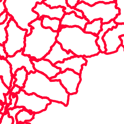
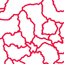
TN.RoadTransportNetwork.RoadLink (TN.RoadTransportNetwork.RoadLink)
Road Link - Strassensegment - Collegamento stradale Modello dati ancora proprietario. Dataset utilizzato: V_WEGE_IMS_TUN.shp esportato dalla banca dati WEGE. Le Gallerie vengono per intanto rappresentate in questo layer e non in layer separato. Datenmodell noch proprietär. Verwendeter Datensatz: V_WEGE_IMS_TUN.shp aus der WEGE-Datenbank exportiert. Tunnels werden einstweilen hier abgebildet und nicht in einem separaten Layer.
TN.RoadTransportNetwork.RoadNames (TN.RoadTransportNetwork.RoadNames)
Questo layer serve essenzialmente per la visualizzazione dei nomi delle strade (provenienti dal layer V_VIE della banca dati WEGE), le strade stesse devono essere visualizzate dal layer TN.RoadTransportNetwork.RoadLink Dieser Layer dient ausschliesslich der Darstellung der Strassennamen. Die Daten stammen von der Tabelle V_VIE deri WEGE-Datenbank). Die Darstellung der Strassen erfolgt über den layer TN.RoadTransportNetwork.RoadLink.
WMTS_CONTOURLINES_APB-PAB (WMTS_CONTOURLINES_APB-PAB)
Layer-Group type layer: WMTS_CONTOURLINES_APB-PAB
WMTS_OF2011_APB-PAB (WMTS_OF2011_APB-PAB)
Layer-Group type layer: WMTS_OF2011_APB-PAB
There are currently no notifications for the service, click the feed icon to subscribe.