Spatial Data Infrastructure Unit, Inst… |
|
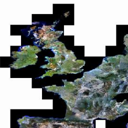
Europe Mapping Service based on the Image2000 European mosaic (multispectral)
http://ags-sdi-public.jrc.ec.europa.eu/arcgis/services/img2k_321_mos/MapServer/WMSServer

| Service health Now: |
|---|
- Interface
- Web Service, OGC Web Map Service 1.3.0
- Keywords
- humanGeographicViewer, infoMapAccessService, orthoimagery, satellite imagery
- Fees
- no conditions apply
- Access constraints
- otherRestrictions
- Supported languages
- eng
- Data provider
-
Spatial Data Infrastructure Unit, Institute for Environment & Sustainability, Joint Research Centre, European Commission (unverified)
Contact information:
Hildegard Gerlach
Spatial Data Infrastructure Unit, Institute for Environment & Sustainability, Joint Research Centre, European Commission
Postal:
Via Fermi 2749, 21027 Ispra, ItalyEmail:
Phone: +390332785638
- Service metadata
Ads by Google
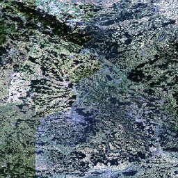
Map Service of a European Mosaic. The mosaic is a harmonised dataset and is based on the individual orthorectified scenes from the Image 2000 project. This service covers the Landsat 7 multispectral bands 3, 2 and 1.
Available map layers (1)
Mosaic (0)
Image 2000 Multispectral Mosaic with band combination 3,2,1
There are currently no notifications for the service, click the feed icon to subscribe.