Natural Resources Canada Government of… |
|
Canada Base Map – Transportation Service
| Service health Now: |
|---|
- Interface
- Web Service, OGC Web Map Service 1.1.1
- Keywords
- Map, Basemap, Thematic, Topographic, Framework, Web map service, WMS, OpenGIS Consortium, OGC, Topography, Built-up areas, Populated places, Designated areas, Constructions, Contours, Hypsography, Water features, Hydrography, Rivers, Landforms, Power network, Railway, Road network, Structures, Water saturated soils, Feature names, Vegetation
- Fees
- Free (or No cost) Free for download
- Access constraints
- The Canada Base Map - Transportation WMS can be accessed at no cost and without restrictions according to the terms of the licence (http://www.geogratis.ca/geogratis/en/licence.jsp). Open Government Licence - Canada (http://open.canada.ca/en/open-government-licence-canada)
- Data provider
-
Natural Resources Canada Government of canada, Natural Resources Canada, Earth Sciences Sector (unverified)
Contact information:
GeoGratis Client Services GeoGratis Client Services
Natural Resources Canada Government of canada, Natural Resources Canada, Earth Sciences Sector
Physical and postal address :
2144, King West Street, suite 010 , J1J 2E8 Sherbrooke , CanadaEmail:
Phone: +01-819-564-4857 / 1-800-661-2638 (Canada and United States) +01-819-564-5600 / 1-800-661-2638 (Canada and United States)
Ads by Google
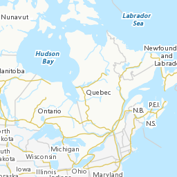
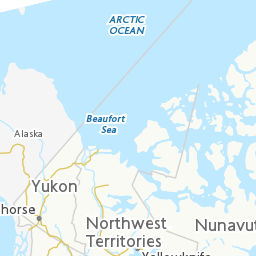
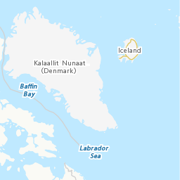
The Canada Transportation Base Map (CBMT) web map service of the Earth Sciences Sector at Natural Resources Canada, is an Internet service which is intended primarily for online map application users and developers. This service is compatible with OpenGIS® Consortium (OGC) (http://www.opengeospatial.org/) Web Map Service (WMS) standards and specifications, version 1.1.1. This base map service has been created to provide locational context with an emphasis on transportation networks over which thematic information can be overlaid. Cartography (colour, symbology, etc.) of the base map has been specifically designed so that thematic information will be more prominent than the locational context information. The range of viewing scales for this service is between 1:60,000,000 and 1:10,000. Features from the following data sets are used by the CBMT service: CanVec, GeoBase, the National Topographic Data Base and base data from the Atlas of Canada National Scale datasets.
Available map layers (5)
Canada Base Map – Transportation (CBMT)
National View (National)
The National View is comprised of a set of layers from the Atlas of Canada National Scale Data 1:15,000,000. Features rendered from this set of layers includes: populated places, feature names, rivers, water bodies, coasts, railways, roads, road ferries and boundaries. The range of viewing scales for the National View is between 60,000,000 and 13,750,001.
Sub-national View (Sub_national)
The Sub-national View is primarily comprised of a set of layers from the Atlas of Canada National Scale Data 1:7,500,000. Features rendered from this set of layers includes: populated places, feature names, rivers, water bodies, coasts, glaciers, railways, roads, road ferries and boundaries. The range of viewing scales for the Sub-national View is between 13,750,000 and 2,750,001.
Regional View (Regional)
The Regional View is primarily comprised of a set of layers from the Atlas of Canada National Scale Data 1:1,000,000. Features rendered from this set of layers includes: populated places, feature names, rivers, water bodies, coasts, glaciers, protected areas, railways, roads, road ferries and boundaries. The range of viewing scales for the Regional View is between 2,750,000 and 550,001.
Sub-regional View (Sub_regional)
The Sub-regional View is primarily comprised of a set of layers from the National Topographic Data Base (250,000), CanVec (50,000) and GeoBase. Features rendered from this set of layers includes: populated places, feature names, rivers, water bodies, coasts, glaciers, railways, roads, road ferries, built-up areas, vegetation, designated areas, elevation, landforms, water saturated soils, manmade structures, water features, power network, and boundaries. The range of view scales for the Sub-regional View is between 550,001 and 10,000.
There are currently no notifications for the service, click the feed icon to subscribe.