Regierungspraesidium Freiburg - Dept. … |
|
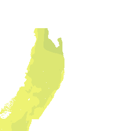
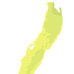
GeORG position data

| Service health Now: |
|---|
- Interface
- Web Service, OGC Web Map Service 1.3.0
- Keywords
- GeORG, Geology
- Fees
- none
- Access constraints
- unknown
- Supported languages
- No INSPIRE Extended Capabilities (including service language support) given. See INSPIRE Technical Guidance - View Services for more information.
- Data provider
-
Regierungspraesidium Freiburg - Dept. 9 State Authority for Geology, Mineral Resources and Mining (unverified)
Contact information:
Guenter Sokol
Regierungspraesidium Freiburg - Dept. 9 State Authority for Geology, Mineral Resources and Mining
POSTAL:
Regierungspräsidium Freiburg - Abteilung 9 Landesamt für Geologie, Rohstoffe und Bergbau, Albertstraße 5, D-79104 Freiburg i. Br., D-79104 Freiburg i. Br., GermanyEmail:
Phone: +49 (0)761-208-3000
- Service metadata
- No INSPIRE Extended Capabilities (including service metadata) given. See INSPIRE Technical Guidance - View Services for more information.
Ads by Google
Interreg IV project "GeORG": Position maps of modelled units in the geological 3D-model.
Available map layers (59)
GeORG position data (lgrb_georg_pos_en)
Interreg IV project "GeORG": Position maps of modelled units in the geological 3D-model.
Position of base unconsolidated rocks (g_posblg)
The map shows the position (m NN) at the base of unconsolidated rocks for the inner project area. The model accuracy is shown in the additional map of data density. For details see final report of INTERREG IV project "GeORG".
Depth base unconsolidated rocks [m asl] (g_posblgg)
Occurrence base unconsolidated rocks (g_vblgf)
Isolines base unconsolidated rocks (g_posblgl)
Position of base Landau Formation (g_posbhy)
The map shows the position (m NN) at the base of the Landau Formation for the inner project area. Colours and contour values are similar for further maps of this kind and are therefore comparable. The model accuracy is shown in the additional map of data density. Faults and fault zones in the same depth are also shown. For details see final report of INTERREG IV project "GeORG".
Depth mNN base Landau formation [m asl] (g_posbhyg)
Occurrence base Landau formation (g_vbhyf)
Fault zone base Landau formation (g_tecbhyf)
Faults base Landau formation (g_tecbhyl)
Isolines base Landau formation (g_posbhyl)
Position of base Froidefontaine Formation (g_posbff)
The map shows the position (m NN) at the base of the Froidefontaine Formation for the inner project area. Colours and contour values are similar for further maps of this kind and are therefore comparable. The model accuracy is shown in the additional map of data density. Faults and fault zones in the same depth are also shown. For details see final report of INTERREG IV project "GeORG".
Depth base Froidefontaine formation [m asl] (g_posbffg)
Occurrence base Froidefontaine formation (g_vbfff)
Fault zone base Froidefontaine formation (g_tecbfff)
Faults base Froidefontaine formation (g_tecbffl)
Isolines base Froidefontaine formation (g_posbffl)
Position of base Tertiary (g_posbt)
The map shows the position (m NN) at the base of Tertiary for the inner project area. Colours and contour values are similar for further maps of this kind and are therefore comparable. The model accuracy is shown in the additional map of data density. Faults and fault zones in the same depth are also shown. For details see final report of INTERREG IV project "GeORG".
Depth base tertiary [m asl] (g_posbtg)
Occurrence base tertiary (g_vbtf)
Fault zone base tertiary (g_tecbtf)
Faults base tertiary (g_tecbtl)
Isolines base tertiary (g_posbtl)
Position of base Upper Jurassic limestones (g_posbjo)
The map shows the position (m NN) at the base of Upper Jurassic limestones for the inner project area. Colours and contour values are similar for further maps of this kind and are therefore comparable. The model accuracy is shown in the additional map of data density. Faults and fault zones in the same depth are also shown. For details see final report of INTERREG IV project "GeORG".
Depth base upper jurassic limestones [m asl] (g_posbjog)
Occurrence base upper jurassic limestones (g_vbjof)
Fault zone base upper jurassic limestones (g_tecbjof)
Faults base upper jurassic limestones (g_tecbjol)
Isolines base upper jurassic limestones (g_posbjol)
Position of top Main Oolite (g_posthr)
The map shows the position (m NN) at the top of the Main Oolite for the inner project area. Colours and contour values are similar for further maps of this kind and are therefore comparable. The model accuracy is shown in the additional map of data density. Faults and fault zones in the same depth are also shown. For details see final report of INTERREG IV project "GeORG".
Depth top Main Oolite [m asl] (g_posthrg)
Occurrence top Main Oolite (g_vthrf)
Fault zone top Main Oolite (g_tecthrf)
Faults top Main Oolite (g_tecthrl)
Isolines top Main Oolite (g_posthrl)
Position of base Keuper (g_posbku)
The map shows the position (m NN) at the base of Keuper for the inner project area. Colours and contour values are similar for further maps of this kind and are therefore comparable. The model accuracy is shown in the additional map of data density. Faults and fault zones in the same depth are also shown. For details see final report of INTERREG IV project "GeORG".
Depth Base Lower Keuper [m asl] (g_posbkug)
Occurrence base lower keuper (g_vbkuf)
Fault zone base lower keuper (g_tecbkuf)
Faults base lower keuper (g_tecbkul)
Isolines base lower keuper (g_posbkul)
Position of top Muschelkalk evaporites (g_postms)
The map shows the position (m NN) at the top of Muschelkalk evaporites for the inner project area. Colours and contour values are similar for further maps of this kind and are therefore comparable. The model accuracy is shown in the additional map of data density. Faults and fault zones in the same depth are also shown. For details see final report of INTERREG IV project "GeORG".
Depth top Muschelkalk evaporites [m asl] (g_postmsg)
Occurrence top Muschelkalk evaporites (g_vtmsf)
Fault zone top Muschelkalk evaporites (g_tectmsf)
Faults top Muschelkalk evaporites (g_tectmsl)
Isolines top Muschelkalk evaporites (g_postmsl)
Position of base Muschelkalk (g_posbmu)
The map shows the position (m NN) at the base of Lower Muschelkalk for the inner project area. Colours and contour values are similar for further maps of this kind and are therefore comparable. The model accuracy is shown in the additional map of data density. Faults and fault zones in the same depth are also shown. For details see final report of INTERREG IV project "GeORG".
Depth base lower muschelkalk [m asl] (g_posbmug)
Occurrence base lower muschelkalk (g_vbmuf)
Fault zone base lower muschelkalk (g_tecbmuf)
Faults base lower muschelkalk (g_tecbmul)
Isolines base lower muschelkalk (g_posbmul)
Position of top basement (g_postkr)
The map shows the position (m NN) at the top of basement for the inner project area. Colours and contour values are similar for further maps of this kind and are therefore comparable. The model accuracy is shown in the additional map of data density. Faults and fault zones in the same depth are also shown. For details see final report of INTERREG IV project "GeORG".
Depth top Basement [m asl] (g_postkrg)
Occurrence top Basement (g_vtkrf)
Fault zone top Basement (g_tectkrf)
Faults top Basement (g_tectkrl)
Isolines top Basement (g_postkrl)
There are currently no notifications for the service, click the feed icon to subscribe.