Delaware Geological Survey |
|
Delaware Geologic Information Resource WMS Server

| Service health Now: |
|---|
- Interface
- Web Service, OGC Web Map Service 1.3.0
- Keywords
- WFS, WMS, GEOSERVER, DGIR, groundwater, mapping, Delaware, OneGeology, MD_DATE@2012-12-21, MD_LANG@ENG, geology
- Fees
- NONE
- Access constraints
- NONE
- Supported languages
- No INSPIRE Extended Capabilities (including service language support) given. See INSPIRE Technical Guidance - View Services for more information.
- Data provider
-
Delaware Geological Survey (unverified)
Contact information:
DGS
Delaware Geological Survey
Office:
257 Academy St, 19716 Newark, USAEmail:
Phone: 302-831-2833
- Service metadata
- No INSPIRE Extended Capabilities (including service metadata) given. See INSPIRE Technical Guidance - View Services for more information.
Ads by Google
The Delaware Geological Survey (DGS) Delaware Geologic Information Resource (DGIR) map server. Built upon GeoServer, it is a compliant implementation of WMS plus most of the SLD extension (dynamic styling). Can also generate PDF, SVG, KML, GeoRSS.
Available map layers (55)
BoreholeTemperature (BoreholeTemperature)
HeatFlow (HeatFlow)
ThermalConductivity (ThermalConductivity)
WellLog (WellLog)
Wellheader (Wellheader)
Delaware State and County Boundaries (de_boundary)
Depth to Water - Dry Conditions (de_dry_dtw)
Water Table Elevation - Dry Conditions (de_dry_wt)
Depth to Water - Normal Conditions (de_norm_dtw)
Water Table Elevation - Normal Conditions (de_norm_wt)
Depth to Water - Wet Conditions (de_wet_dtw)
Water Table Elevation - Wet Conditions (de_wet_wt)
Delaware DEM (dedem2m)
DGS Well 1-min Index Grid (dgswell_grid1)
DGS Well 5-min Index Grid (dgswell_grid5)
DGS Geologic Map No. 8 Milford and Mispillion River (geomap08)
DGS Geologic Map No. 8 Milford and Mispillion River
DGS Geologic Map No. 9 Seaford Area (geomap09)
DGS Geologic Map No. 9 Seaford Area
DGS Geologic Map No. 10 Bedrock Geologic Map of the Piedmont of Delaware and Adjacent Pennsylvania (geomap10)
DGS Geologic Map No. 10 Bedrock Geologic Map of the Piedmont of Delaware and Adjacent Pennsylvania
DGS Geologic Map No. 11 Milton Ellendale Area (geomap11)
DGS Geologic Map No. 11 Milton Ellendale Area
DGS Geologic Map No. 12 Lewes Cape Henlopen Area (geomap12)
DGS Geologic Map No. 12 Lewes Cape Henlopen Area
DGS Geologic Map No. 13 New Castle County (geomap13)
DGS Geologic Map No. 13 New Castle County
DGS Geologic Map No. 14 Kent County (geomap14)
DGS Geologic Map No. 14 Kent County
DGS Geologic Map No. 15 Georgetown (geomap15)
DGS Geologic Map No. 15 Georgetown
DGS Geologic Map No. 16 Fairmount Rehoboth Beach (geomap16)
DGS Geologic Map No. 16 Fairmount Rehoboth Beach
DGS Geologic Map No. 17 Harbeson (geomap17)
DGS Geologic Map No. 17 Harbeson
DGS Geologic Map No. 18 Bethany Beach and Assawoman Bay (geomap18)
DGS Geologic Map No. 18 Bethany Beach and Assawoman Bay
DGS Geologic Map No. 19 Frankford and Selbyville Quadrangles, Delaware (geomap19)
DGS Geologic Map No. 19 Frankford and Selbyville Quadrangles, Delaware
DGS Geologic Map No. 20 Millsboro and Whaleysville Quadrangles, Delaware (geomap20)
DGS Geologic Map No. 20 Millsboro and Whaleysville Quadrangles, Delaware
DGS Geologic Map No. 21 Trap Pond and Pittsville Quadrangles, Delaware (geomap21)
DGS Geologic Map No. 21 Trap Pond and Pittsville Quadrangles, Delaware
DGS Geologic Map No. 22 Sharptown, Laurel, Hebron, and Delmar Quadrangles, Delaware (geomap22)
DGS Geologic Map No. 22 Sharptown, Laurel, Hebron, and Delmar Quadrangles, Delaware
Statewide 1:100K Maps (geomaps100k)
Statewide 1:100K Contacts (geomaps100k_contacts)
Statewide 1:24K Maps (geomaps24k)
Sites with Downhole Geophysical Logs (geophysical_logs)
Sites with Lithologic Logs (lithsites)
major_roads (major_roads)
Municipal Boundaries (municipal_boundaries)
Hydrography (NHD) areas (nhd_areas)
Hydrography (NHD) lines (nhd_lines)
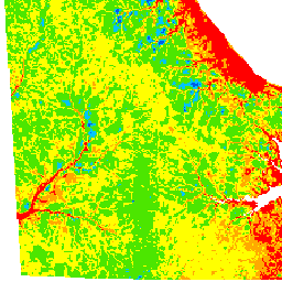
Kent and Sussex Groundwater Recharge Potential (recharge)
Kent and Sussex Groundwater Recharge Potential
New Castle County Recharge RPAs (recharge_ncc)
Unconfined Aquifer Elevation - Sussex County (suss_elev)
Unconfined Aquifer Thickness - Sussex County (suss_thick)
Unconfined Aquifer Transmissivity - Sussex County (suss_trans)
USGS Quadrangles (usgs_de_quads)
watersheds_10huc (watersheds_10huc)
huc_watersheds (watersheds_12huc)
watersheds_8huc (watersheds_8huc)
watersheds_coastal (watersheds_coastal)
Sites with Groundwater Observations (wellobs_all)
Sites with Groundwater Hydrograph (wellobs_primary)
Sites with Digital Photos (wellphotos)
wetlands2007 (wetlands)
wetlands2007_tidal (wetlands2007_tidal)
Wellhead Protection Areas (whpa_2008a)
There are currently no notifications for the service, click the feed icon to subscribe.