PDOK |
|
Agrarisch Areaal Nederland WMS
| Service health Now: |
|---|
- Interface
- Web Service, OGC Web Map Service 1.3.0
- Keywords
- Landbouw, Landgebruik, Veeteelt, infoMapAccessService
- Fees
- NONE
- Access constraints
- otherRestrictions; http://creativecommons.org/publicdomain/mark/1.0/deed.nl
- Supported languages
- No INSPIRE Extended Capabilities (including service language support) given. See INSPIRE Technical Guidance - View Services for more information.
- Data provider
-
PDOK (unverified)
Contact information:
KlantContactCenter PDOK
PDOK
Work:
Apeldoorn, NederlandEmail:
- Service metadata
- No INSPIRE Extended Capabilities (including service metadata) given. See INSPIRE Technical Guidance - View Services for more information.
Ads by Google
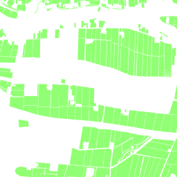
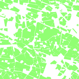
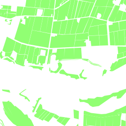
Geografische afbakening van landbouwgrond in Nederland (grond die wordt gebruikt als bouwland, blijvend grasland of de teelt van blijvende gewassen).
Available map layers (1)
aan (aan)
Agrarisch Areaal Nederland (AAN). Geografische afbakening van landbouwgrond in Nederland (grond die wordt gebruikt als bouwland, blijvend grasland of de teelt van blijvende gewassen).
There are currently no notifications for the service, click the feed icon to subscribe.