Centro de Informacion Cartografica y T… |
|
10220-Rosalejo_Normativa_(defin)_-_20091009132044

| Service health Now: |
|---|
- Interface
- Web Service, OGC Web Map Service 1.3.0
- Keywords
- 11/07/2013, WMS, servidor de mapas en red, Extremadura, Urbanismo, Infraestructuras de Datos Espaciales
- Fees
- Gratuito/free
- Access constraints
- Servicio libre y gratuito siempre que se utilice con fines no comerciales y se mencione a los autores y propietarios de la información. Para otros fines se deberá contactar con el CICTEx de la Junta de Extremadura
- Supported languages
- No INSPIRE Extended Capabilities (including service language support) given. See INSPIRE Technical Guidance - View Services for more information.
- Data provider
-
Centro de Informacion Cartografica y Territorial de Extremadura. Junta de Extremadura (unverified)
Contact information:
Jefe de Sección de Ordenación del Territorio
Centro de Informacion Cartografica y Territorial de Extremadura. Junta de Extremadura
Postal:
Avda. de las Comunidades s/n, 06800 Mérida, EspañaEmail:
Phone: +34 924 332000
- Service metadata
- No INSPIRE Extended Capabilities (including service metadata) given. See INSPIRE Technical Guidance - View Services for more information.
Ads by Google
Servicio WMS del Centro de Información Cartográfica y Territorial de Extremadura. Junta de Extremadura
Available map layers (19)
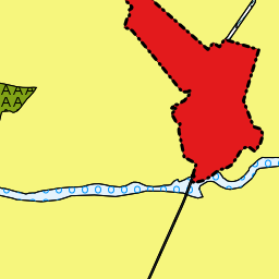
10220-Rosalejo_Normativa_(defin)_-_20091009132044 (ROSALEJO)
Servicio WMS del Centro de Información Cartográfica y Territorial de Extremadura. Junta de Extremadura
E1 Clasificacion_polygons (Clasificacion_del_Suelo-e1_clasificacion_polygons)
generated by gvSIG
E1 Clasificacion_points (Clasificacion_del_Suelo-e1_clasificacion_points)
generated by gvSIG
E2 Gestion_polygons (Areas_de_Reparto__Unidades_de_Actuacion_Urbanizadoras_Y_Sectores-e2_gestion_polygo)
generated by gvSIG
E2 Gestion_points (Areas_de_Reparto__Unidades_de_Actuacion_Urbanizadoras_Y_Sectores-e2_gestion_points)
generated by gvSIG
D1 Ordenanzas, Usos y Alineaciones (Refundido Julio 2013)_polygons (Usos_Pormenorizados_e_Intensidades-d1_ordenanzas_polygons)
generated by gvSIG
D1 Ordenanzas, Usos y Alineaciones (Refundido Julio 2013)_points (Usos_Pormenorizados_e_Intensidades-d1_ordenanzas_points)
generated by gvSIG
D2 Propuesta de pavimentaciones_polygons (Red_Detallada_Dotacional-d2_pavimentaciones_polygons)
generated by gvSIG
D2 Propuesta de pavimentaciones_points (Red_Detallada_Dotacional-d2_pavimentaciones_points)
generated by gvSIG
D3 Propuesta de saneamiento_polygons (Red_Detallada_Dotacional-d3_saneamiento_polygons)
generated by gvSIG
D3 Propuesta de saneamiento_lines (Red_Detallada_Dotacional-d3_saneamiento_lines)
generated by gvSIG
D3 Propuesta de saneamiento_points (Red_Detallada_Dotacional-d3_saneamiento_points)
generated by gvSIG
D4 Propuesta de abastecimiento_polygons (Red_Detallada_Dotacional-d4_abastecimiento_polygons)
generated by gvSIG
D4 Propuesta de abastecimiento_lines (Red_Detallada_Dotacional-d4_abastecimiento_lines)
generated by gvSIG
D4 Propuesta de abastecimiento_points (Red_Detallada_Dotacional-d4_abastecimiento_points)
generated by gvSIG
D5 Propuesta de alumbrado publico_polygons (Red_Detallada_Dotacional-d5_alumbrado_polygons)
generated by gvSIG
D5 Propuesta de alumbrado publico_lines (Red_Detallada_Dotacional-d5_alumbrado_lines)
generated by gvSIG
D5 Propuesta de alumbrado publico_points (Red_Detallada_Dotacional-d5_alumbrado_points)
generated by gvSIG
info_polygons (info_polygons)
generated by gvSIG
There are currently no notifications for the service, click the feed icon to subscribe.