MINES ParisTech |
|
Webservice-Energy (WMS)
http://geoserver.webservice-energy.org/geoserver/merra_full/ows

| Service health Now: |
|---|
- Interface
- Web Service, OGC Web Map Service 1.3.0
- Keywords
- WFS, WMS, GEOSERVER
- Fees
- NONE
- Access constraints
- NONE
- Supported languages
- No INSPIRE Extended Capabilities (including service language support) given. See INSPIRE Technical Guidance - View Services for more information.
- Data provider
-
MINES ParisTech (unverified)
Contact information:
Lionel MENARD
MINES ParisTech
Work:
1, rue Claude Daunesse - CS 10207, 06904 SOPHIA ANTIPOLIS, FRANCEEmail:
- Service metadata
- No INSPIRE Extended Capabilities (including service metadata) given. See INSPIRE Technical Guidance - View Services for more information.
Ads by Google
A compliant implementation of WMS plus most of the SLD extension (dynamic styling). Can also generate PDF, SVG, KML, GeoRSS
Available map layers (28)
merra_year_1985 (merra_year_1985)
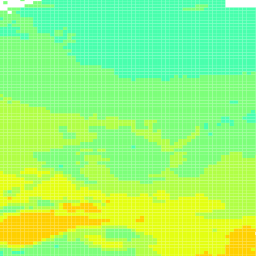
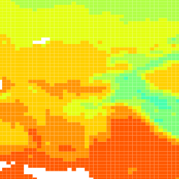
The shapefile includes yearly mean fields from MERRA. Fields included in the file are: Latitude and longitude in decimal degree. t2m_k: 2-m-temperature in Kelvin ps_pa: Surface pressure in Pa. rh_percent: Relative humidity in %. tdp_k: dewpoint temperature in Kelvin ws10_mpers: wind speed at 10 m in m/s. dir10_deg : wind direction at 10 m in degree.
merra_year_1986 (merra_year_1986)
The shapefile includes yearly mean fields from MERRA. Fields included in the file are: Latitude and longitude in decimal degree. t2m_k: 2-m-temperature in Kelvin ps_pa: Surface pressure in Pa. rh_percent: Relative humidity in %. tdp_k: dewpoint temperature in Kelvin ws10_mpers: wind speed at 10 m in m/s. dir10_deg : wind direction at 10 m in degree.
merra_year_1987 (merra_year_1987)
The shapefile includes yearly mean fields from MERRA. Fields included in the file are: Latitude and longitude in decimal degree. t2m_k: 2-m-temperature in Kelvin ps_pa: Surface pressure in Pa. rh_percent: Relative humidity in %. tdp_k: dewpoint temperature in Kelvin ws10_mpers: wind speed at 10 m in m/s. dir10_deg : wind direction at 10 m in degree.
merra_year_1988 (merra_year_1988)
The shapefile includes yearly mean fields from MERRA. Fields included in the file are: Latitude and longitude in decimal degree. t2m_k: 2-m-temperature in Kelvin ps_pa: Surface pressure in Pa. rh_percent: Relative humidity in %. tdp_k: dewpoint temperature in Kelvin ws10_mpers: wind speed at 10 m in m/s. dir10_deg : wind direction at 10 m in degree.
merra_year_1989 (merra_year_1989)
The shapefile includes yearly mean fields from MERRA. Fields included in the file are: Latitude and longitude in decimal degree. t2m_k: 2-m-temperature in Kelvin ps_pa: Surface pressure in Pa. rh_percent: Relative humidity in %. tdp_k: dewpoint temperature in Kelvin ws10_mpers: wind speed at 10 m in m/s. dir10_deg : wind direction at 10 m in degree.
merra_year_1990 (merra_year_1990)
The shapefile includes yearly mean fields from MERRA. Fields included in the file are: Latitude and longitude in decimal degree. t2m_k: 2-m-temperature in Kelvin ps_pa: Surface pressure in Pa. rh_percent: Relative humidity in %. tdp_k: dewpoint temperature in Kelvin ws10_mpers: wind speed at 10 m in m/s. dir10_deg : wind direction at 10 m in degree.
merra_year_1991 (merra_year_1991)
The shapefile includes yearly mean fields from MERRA. Fields included in the file are: Latitude and longitude in decimal degree. t2m_k: 2-m-temperature in Kelvin ps_pa: Surface pressure in Pa. rh_percent: Relative humidity in %. tdp_k: dewpoint temperature in Kelvin ws10_mpers: wind speed at 10 m in m/s. dir10_deg : wind direction at 10 m in degree.
merra_year_1992 (merra_year_1992)
The shapefile includes yearly mean fields from MERRA. Fields included in the file are: Latitude and longitude in decimal degree. t2m_k: 2-m-temperature in Kelvin ps_pa: Surface pressure in Pa. rh_percent: Relative humidity in %. tdp_k: dewpoint temperature in Kelvin ws10_mpers: wind speed at 10 m in m/s. dir10_deg : wind direction at 10 m in degree.
merra_year_1993 (merra_year_1993)
The shapefile includes yearly mean fields from MERRA. Fields included in the file are: Latitude and longitude in decimal degree. t2m_k: 2-m-temperature in Kelvin ps_pa: Surface pressure in Pa. rh_percent: Relative humidity in %. tdp_k: dewpoint temperature in Kelvin ws10_mpers: wind speed at 10 m in m/s. dir10_deg : wind direction at 10 m in degree.
merra_year_1994 (merra_year_1994)
The shapefile includes yearly mean fields from MERRA. Fields included in the file are: Latitude and longitude in decimal degree. t2m_k: 2-m-temperature in Kelvin ps_pa: Surface pressure in Pa. rh_percent: Relative humidity in %. tdp_k: dewpoint temperature in Kelvin ws10_mpers: wind speed at 10 m in m/s. dir10_deg : wind direction at 10 m in degree.
merra_year_1995 (merra_year_1995)
The shapefile includes yearly mean fields from MERRA. Fields included in the file are: Latitude and longitude in decimal degree. t2m_k: 2-m-temperature in Kelvin ps_pa: Surface pressure in Pa. rh_percent: Relative humidity in %. tdp_k: dewpoint temperature in Kelvin ws10_mpers: wind speed at 10 m in m/s. dir10_deg : wind direction at 10 m in degree.
merra_year_1996 (merra_year_1996)
The shapefile includes yearly mean fields from MERRA. Fields included in the file are: Latitude and longitude in decimal degree. t2m_k: 2-m-temperature in Kelvin ps_pa: Surface pressure in Pa. rh_percent: Relative humidity in %. tdp_k: dewpoint temperature in Kelvin ws10_mpers: wind speed at 10 m in m/s. dir10_deg : wind direction at 10 m in degree.
merra_year_1997 (merra_year_1997)
The shapefile includes yearly mean fields from MERRA. Fields included in the file are: Latitude and longitude in decimal degree. t2m_k: 2-m-temperature in Kelvin ps_pa: Surface pressure in Pa. rh_percent: Relative humidity in %. tdp_k: dewpoint temperature in Kelvin ws10_mpers: wind speed at 10 m in m/s. dir10_deg : wind direction at 10 m in degree.
merra_year_1998 (merra_year_1998)
The shapefile includes yearly mean fields from MERRA. Fields included in the file are: Latitude and longitude in decimal degree. t2m_k: 2-m-temperature in Kelvin ps_pa: Surface pressure in Pa. rh_percent: Relative humidity in %. tdp_k: dewpoint temperature in Kelvin ws10_mpers: wind speed at 10 m in m/s. dir10_deg : wind direction at 10 m in degree.
merra_year_1999 (merra_year_1999)
The shapefile includes yearly mean fields from MERRA. Fields included in the file are: Latitude and longitude in decimal degree. t2m_k: 2-m-temperature in Kelvin ps_pa: Surface pressure in Pa. rh_percent: Relative humidity in %. tdp_k: dewpoint temperature in Kelvin ws10_mpers: wind speed at 10 m in m/s. dir10_deg : wind direction at 10 m in degree.
merra_year_2000 (merra_year_2000)
The shapefile includes yearly mean fields from MERRA. Fields included in the file are: Latitude and longitude in decimal degree. t2m_k: 2-m-temperature in Kelvin ps_pa: Surface pressure in Pa. rh_percent: Relative humidity in %. tdp_k: dewpoint temperature in Kelvin ws10_mpers: wind speed at 10 m in m/s. dir10_deg : wind direction at 10 m in degree.
merra_year_2001 (merra_year_2001)
The shapefile includes yearly mean fields from MERRA. Fields included in the file are: Latitude and longitude in decimal degree. t2m_k: 2-m-temperature in Kelvin ps_pa: Surface pressure in Pa. rh_percent: Relative humidity in %. tdp_k: dewpoint temperature in Kelvin ws10_mpers: wind speed at 10 m in m/s. dir10_deg : wind direction at 10 m in degree.
merra_year_2002 (merra_year_2002)
The shapefile includes yearly mean fields from MERRA. Fields included in the file are: Latitude and longitude in decimal degree. t2m_k: 2-m-temperature in Kelvin ps_pa: Surface pressure in Pa. rh_percent: Relative humidity in %. tdp_k: dewpoint temperature in Kelvin ws10_mpers: wind speed at 10 m in m/s. dir10_deg : wind direction at 10 m in degree.
merra_year_2003 (merra_year_2003)
The shapefile includes yearly mean fields from MERRA. Fields included in the file are: Latitude and longitude in decimal degree. t2m_k: 2-m-temperature in Kelvin ps_pa: Surface pressure in Pa. rh_percent: Relative humidity in %. tdp_k: dewpoint temperature in Kelvin ws10_mpers: wind speed at 10 m in m/s. dir10_deg : wind direction at 10 m in degree.
merra_year_2004 (merra_year_2004)
The shapefile includes yearly mean fields from MERRA. Fields included in the file are: Latitude and longitude in decimal degree. t2m_k: 2-m-temperature in Kelvin ps_pa: Surface pressure in Pa. rh_percent: Relative humidity in %. tdp_k: dewpoint temperature in Kelvin ws10_mpers: wind speed at 10 m in m/s. dir10_deg : wind direction at 10 m in degree.
merra_year_2005 (merra_year_2005)
The shapefile includes yearly mean fields from MERRA. Fields included in the file are: Latitude and longitude in decimal degree. t2m_k: 2-m-temperature in Kelvin ps_pa: Surface pressure in Pa. rh_percent: Relative humidity in %. tdp_k: dewpoint temperature in Kelvin ws10_mpers: wind speed at 10 m in m/s. dir10_deg : wind direction at 10 m in degree.
merra_year_2006 (merra_year_2006)
The shapefile includes yearly mean fields from MERRA. Fields included in the file are: Latitude and longitude in decimal degree. t2m_k: 2-m-temperature in Kelvin ps_pa: Surface pressure in Pa. rh_percent: Relative humidity in %. tdp_k: dewpoint temperature in Kelvin ws10_mpers: wind speed at 10 m in m/s. dir10_deg : wind direction at 10 m in degree.
merra_year_2007 (merra_year_2007)
The shapefile includes yearly mean fields from MERRA. Fields included in the file are: Latitude and longitude in decimal degree. t2m_k: 2-m-temperature in Kelvin ps_pa: Surface pressure in Pa. rh_percent: Relative humidity in %. tdp_k: dewpoint temperature in Kelvin ws10_mpers: wind speed at 10 m in m/s. dir10_deg : wind direction at 10 m in degree.
merra_year_2008 (merra_year_2008)
The shapefile includes yearly mean fields from MERRA. Fields included in the file are: Latitude and longitude in decimal degree. t2m_k: 2-m-temperature in Kelvin ps_pa: Surface pressure in Pa. rh_percent: Relative humidity in %. tdp_k: dewpoint temperature in Kelvin ws10_mpers: wind speed at 10 m in m/s. dir10_deg : wind direction at 10 m in degree.
merra_year_2009 (merra_year_2009)
The shapefile includes yearly mean fields from MERRA. Fields included in the file are: Latitude and longitude in decimal degree. t2m_k: 2-m-temperature in Kelvin ps_pa: Surface pressure in Pa. rh_percent: Relative humidity in %. tdp_k: dewpoint temperature in Kelvin ws10_mpers: wind speed at 10 m in m/s. dir10_deg : wind direction at 10 m in degree.
merra_year_2010 (merra_year_2010)
The shapefile includes yearly mean fields from MERRA. Fields included in the file are: Latitude and longitude in decimal degree. t2m_k: 2-m-temperature in Kelvin ps_pa: Surface pressure in Pa. rh_percent: Relative humidity in %. tdp_k: dewpoint temperature in Kelvin ws10_mpers: wind speed at 10 m in m/s. dir10_deg : wind direction at 10 m in degree.
merra_year_2011 (merra_year_2011)
The shapefile includes yearly mean fields from MERRA. Fields included in the file are: Latitude and longitude in decimal degree. t2m_k: 2-m-temperature in Kelvin ps_pa: Surface pressure in Pa. rh_percent: Relative humidity in %. tdp_k: dewpoint temperature in Kelvin ws10_mpers: wind speed at 10 m in m/s. dir10_deg : wind direction at 10 m in degree.
merra_year_2012 (merra_year_2012)
The shapefile includes yearly mean fields from MERRA. Fields included in the file are: Latitude and longitude in decimal degree. t2m_k: 2-m-temperature in Kelvin ps_pa: Surface pressure in Pa. rh_percent: Relative humidity in %. tdp_k: dewpoint temperature in Kelvin ws10_mpers: wind speed at 10 m in m/s. dir10_deg : wind direction at 10 m in degree.
There are currently no notifications for the service, click the feed icon to subscribe.