IRENA |
|
IRENA Web Map Service
| Service health Now: |
|---|
- Interface
- Web Service, OGC Web Map Service 1.3.0
- Keywords
- WFS, WMS, GEOSERVER
- Fees
- NONE
- Access constraints
- NONE
- Supported languages
- No INSPIRE Extended Capabilities (including service language support) given. See INSPIRE Technical Guidance - View Services for more information.
- Data provider
-
IRENA (unverified)
Contact information:
Jacinto Estima
IRENA
Business:
Masdar City, PO. Box 236 Abu Dhabi, United Arab EmiratesEmail:
- Service metadata
- No INSPIRE Extended Capabilities (including service metadata) given. See INSPIRE Technical Guidance - View Services for more information.
Ads by Google
Web Map Service that supports the IRENA Global Atlas for Renewable Energy
Available map layers (14)
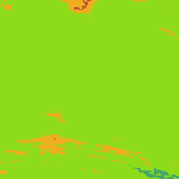
Elevation South Africa East Cape 250m WASA May 2013 (EC_250m_Elevation)
Elevation of modelling site in [m] above mean sea level for East Cape. Purpose This data set was created for the WASA project and the Department of Energy, South Africa. The wind resource maps were designed specifically for inclusion in GIS-based strategic environmental assessments (SEA) for wind power in Western Cape and parts of Northern and Eastern Cape. Methodology Reference is made to the information and documentation available from http://www.wasaproject.info Limitations The data set is limited by the operational envelopes of the wind atlas methodology and the WAsP models. The accuracy depends on a) the accuracy of the VNWA, which has been verified against the data from 10 WASA measurement masts, b) the WAsP microscale modelling and c) the input topographical data. In complex terrain (RIX > 5%), the wind resources may be significantly over-estimated by the WAsP microscale modelling. Above and close to built-up areas like cities, towns and villages, the results are less reliable. Close to and above forested areas, the results are also less reliable and should be interpreted and used accordingly. The data set was designed specifically for planning purposes and should be used with utmost care for design, development and detailed assessments of actual wind farms; where local, on-site meas-urements are strongly recommended. The wind resource maps are subject to change without notice if and when more accurate and reliable data, models and procedures become available. Available documentation The wind atlas methodology is described in the European Wind Atlas (1989); the application of WAsP in the program documentation, see www.wasp.dk. The First Verified Numerical Wind Atlas for South Africa is a product of the Wind Atlas for South Africa project and is described further on the WASA download pages http://wasadata.csir.co.za/wasa1/WASAData Acknowledgements SANEDI (South African National Energy Development Institute) for managing WASA CSIR Environmental Management Services for providing height contour data for Eastern Cape and Northern Cape. MetroGIS (Pty) Ltd. for providing height contour data for Western Cape in WAsP-compatible format. WASA Implementation team: UCT (CSAG), CSIR, SAWS, DTU Wind Energy and World in a Box Oy for Frogfoot development. Please access he data quality information for this dataset at: http://globalatlas.irena.org/dqif/publishdata.aspx?datasetid=2031. Also for additional information please download the data quality framework report at: goo.gl/T2wMaq
Mean Power Density South Africa East Cape 250m WASA May 2013 (EC_250m_PD_2013_130)
Mean power density P [Wm−2] @ 100 m above ground level for East Cape. Purpose This data set was created for the WASA project and the Department of Energy, South Africa. The wind resource maps were designed specifically for inclusion in GIS-based strategic environmental assessments (SEA) for wind power in Western Cape and parts of Northern and Eastern Cape. Methodology Reference is made to the information and documentation available from http://www.wasaproject.info Limitations The data set is limited by the operational envelopes of the wind atlas methodology and the WAsP models. The accuracy depends on a) the accuracy of the VNWA, which has been verified against the data from 10 WASA measurement masts, b) the WAsP microscale modelling and c) the input topographical data. In complex terrain (RIX > 5%), the wind resources may be significantly over-estimated by the WAsP microscale modelling. Above and close to built-up areas like cities, towns and villages, the results are less reliable. Close to and above forested areas, the results are also less reliable and should be interpreted and used accordingly. The data set was designed specifically for planning purposes and should be used with utmost care for design, development and detailed assessments of actual wind farms; where local, on-site meas-urements are strongly recommended. The wind resource maps are subject to change without notice if and when more accurate and reliable data, models and procedures become available. Available documentation The wind atlas methodology is described in the European Wind Atlas (1989); the application of WAsP in the program documentation, see www.wasp.dk. The First Verified Numerical Wind Atlas for South Africa is a product of the Wind Atlas for South Africa project and is described further on the WASA download pages http://wasadata.csir.co.za/wasa1/WASAData Acknowledgements SANEDI (South African National Energy Development Institute) for managing WASA CSIR Environmental Management Services for providing height contour data for Eastern Cape and Northern Cape. MetroGIS (Pty) Ltd. for providing height contour data for Western Cape in WAsP-compatible format. WASA Implementation team: UCT (CSAG), CSIR, SAWS, DTU Wind Energy and World in a Box Oy for Frogfoot development. Please access he data quality information for this dataset at: http://globalatlas.irena.org/dqif/publishdata.aspx?datasetid=2031. Also for additional information please download the data quality framework report at: goo.gl/T2wMaq
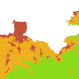
Site RIX value South Africa East Cape 250m WASA May 2013 (EC_250m_RIX)
Site RIX value calculated by WAsP (standard parameter setup) for East Cape. Purpose This data set was created for the WASA project and the Department of Energy, South Africa. The wind resource maps were designed specifically for inclusion in GIS-based strategic environmental assessments (SEA) for wind power in Western Cape and parts of Northern and Eastern Cape. Methodology Reference is made to the information and documentation available from http://www.wasaproject.info Limitations The data set is limited by the operational envelopes of the wind atlas methodology and the WAsP models. The accuracy depends on a) the accuracy of the VNWA, which has been verified against the data from 10 WASA measurement masts, b) the WAsP microscale modelling and c) the input topographical data. In complex terrain (RIX > 5%), the wind resources may be significantly over-estimated by the WAsP microscale modelling. Above and close to built-up areas like cities, towns and villages, the results are less reliable. Close to and above forested areas, the results are also less reliable and should be interpreted and used accordingly. The data set was designed specifically for planning purposes and should be used with utmost care for design, development and detailed assessments of actual wind farms; where local, on-site meas-urements are strongly recommended. The wind resource maps are subject to change without notice if and when more accurate and reliable data, models and procedures become available. Available documentation The wind atlas methodology is described in the European Wind Atlas (1989); the application of WAsP in the program documentation, see www.wasp.dk. The First Verified Numerical Wind Atlas for South Africa is a product of the Wind Atlas for South Africa project and is described further on the WASA download pages http://wasadata.csir.co.za/wasa1/WASAData Acknowledgements CSIR Environmental Management Services for providing height contour data for Eastern Cape and Northern Cape. MetroGIS (Pty) Ltd. for providing height contour data for Western Cape in WAsP-compatible format. WASA Implementation team: UCT (CSAG), CSIR, SAWS, DTU Wind Energy and World in a Box Oy for Frogfoot development. Acknowledgements SANEDI (South African National Energy Development Institute) for managing WASA CSIR Environmental Management Services for providing height contour data for Eastern Cape and Northern Cape. MetroGIS (Pty) Ltd. for providing height contour data for Western Cape in WAsP-compatible format. WASA Implementation team: UCT (CSAG), CSIR, SAWS, DTU Wind Energy and World in a Box Oy for Frogfoot development. Please access he data quality information for this dataset at: http://globalatlas.irena.org/dqif/publishdata.aspx?datasetid=2031. Also for additional information please download the data quality framework report at: goo.gl/T2wMaq
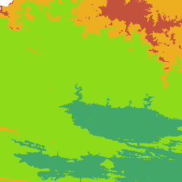
Mean wind speed South Africa East Cape 250m WASA May 2013 (EC_250m_U)
Mean wind speed U [ms−1] @ 100 m above ground level for East Cape. Purpose This data set was created for the WASA project and the Department of Energy, South Africa. The wind resource maps were designed specifically for inclusion in GIS-based strategic environmental assessments (SEA) for wind power in Western Cape and parts of Northern and Eastern Cape. Methodology Reference is made to the information and documentation available from http://www.wasaproject.info Limitations The data set is limited by the operational envelopes of the wind atlas methodology and the WAsP models. The accuracy depends on a) the accuracy of the VNWA, which has been verified against the data from 10 WASA measurement masts, b) the WAsP microscale modelling and c) the input topographical data. In complex terrain (RIX > 5%), the wind resources may be significantly over-estimated by the WAsP microscale modelling. Above and close to built-up areas like cities, towns and villages, the results are less reliable. Close to and above forested areas, the results are also less reliable and should be interpreted and used accordingly. The data set was designed specifically for planning purposes and should be used with utmost care for design, development and detailed assessments of actual wind farms; where local, on-site meas-urements are strongly recommended. The wind resource maps are subject to change without notice if and when more accurate and reliable data, models and procedures become available. Available documentation The wind atlas methodology is described in the European Wind Atlas (1989); the application of WAsP in the program documentation, see www.wasp.dk. The First Verified Numerical Wind Atlas for South Africa is a product of the Wind Atlas for South Africa project and is described further on the WASA download pages http://wasadata.csir.co.za/wasa1/WASAData Acknowledgements SANEDI (South African National Energy Development Institute) for managing WASA CSIR Environmental Management Services for providing height contour data for Eastern Cape and Northern Cape. MetroGIS (Pty) Ltd. for providing height contour data for Western Cape in WAsP-compatible format. WASA Implementation team: UCT (CSAG), CSIR, SAWS, DTU Wind Energy and World in a Box Oy for Frogfoot development. Please access he data quality information for this dataset at: http://globalatlas.irena.org/dqif/publishdata.aspx?datasetid=2031. Also for additional information please download the data quality framework report at: goo.gl/T2wMaq
Elevation South Africa North Cape 250m WASA May 2013 (NC_250m_Elevation)
Elevation of modelling site in [m] above mean sea level for North Cape. Purpose This data set was created for the WASA project and the Department of Energy, South Africa. The wind resource maps were designed specifically for inclusion in GIS-based strategic environmental assessments (SEA) for wind power in Western Cape and parts of Northern and Eastern Cape. Methodology Reference is made to the information and documentation available from http://www.wasaproject.info Limitations The data set is limited by the operational envelopes of the wind atlas methodology and the WAsP models. The accuracy depends on a) the accuracy of the VNWA, which has been verified against the data from 10 WASA measurement masts, b) the WAsP microscale modelling and c) the input topographical data. In complex terrain (RIX > 5%), the wind resources may be significantly over-estimated by the WAsP microscale modelling. Above and close to built-up areas like cities, towns and villages, the results are less reliable. Close to and above forested areas, the results are also less reliable and should be interpreted and used accordingly. The data set was designed specifically for planning purposes and should be used with utmost care for design, development and detailed assessments of actual wind farms; where local, on-site meas-urements are strongly recommended. The wind resource maps are subject to change without notice if and when more accurate and reliable data, models and procedures become available. Available documentation The wind atlas methodology is described in the European Wind Atlas (1989); the application of WAsP in the program documentation, see www.wasp.dk. The First Verified Numerical Wind Atlas for South Africa is a product of the Wind Atlas for South Africa project and is described further on the WASA download pages http://wasadata.csir.co.za/wasa1/WASAData Acknowledgements SANEDI (South African National Energy Development Institute) for managing WASA CSIR Environmental Management Services for providing height contour data for Eastern Cape and Northern Cape. MetroGIS (Pty) Ltd. for providing height contour data for Western Cape in WAsP-compatible format. WASA Implementation team: UCT (CSAG), CSIR, SAWS, DTU Wind Energy and World in a Box Oy for Frogfoot development. Please access he data quality information for this dataset at: http://globalatlas.irena.org/dqif/publishdata.aspx?datasetid=2031. Also for additional information please download the data quality framework report at: goo.gl/T2wMaq
Mean Power Density South Africa North Cape 250m WASA May 2013 (NC_250m_PD_2013_130)
Mean power density P [Wm−2] @ 100 m above ground level for North Cape. Purpose This data set was created for the WASA project and the Department of Energy, South Africa. The wind resource maps were designed specifically for inclusion in GIS-based strategic environmental assessments (SEA) for wind power in Western Cape and parts of Northern and Eastern Cape. Methodology Reference is made to the information and documentation available from http://www.wasaproject.info Limitations The data set is limited by the operational envelopes of the wind atlas methodology and the WAsP models. The accuracy depends on a) the accuracy of the VNWA, which has been verified against the data from 10 WASA measurement masts, b) the WAsP microscale modelling and c) the input topographical data. In complex terrain (RIX > 5%), the wind resources may be significantly over-estimated by the WAsP microscale modelling. Above and close to built-up areas like cities, towns and villages, the results are less reliable. Close to and above forested areas, the results are also less reliable and should be interpreted and used accordingly. The data set was designed specifically for planning purposes and should be used with utmost care for design, development and detailed assessments of actual wind farms; where local, on-site meas-urements are strongly recommended. The wind resource maps are subject to change without notice if and when more accurate and reliable data, models and procedures become available. Available documentation The wind atlas methodology is described in the European Wind Atlas (1989); the application of WAsP in the program documentation, see www.wasp.dk. The First Verified Numerical Wind Atlas for South Africa is a product of the Wind Atlas for South Africa project and is described further on the WASA download pages http://wasadata.csir.co.za/wasa1/WASAData Acknowledgements SANEDI (South African National Energy Development Institute) for managing WASA CSIR Environmental Management Services for providing height contour data for Eastern Cape and Northern Cape. MetroGIS (Pty) Ltd. for providing height contour data for Western Cape in WAsP-compatible format. WASA Implementation team: UCT (CSAG), CSIR, SAWS, DTU Wind Energy and World in a Box Oy for Frogfoot development. Please access he data quality information for this dataset at: http://globalatlas.irena.org/dqif/publishdata.aspx?datasetid=2031. Also for additional information please download the data quality framework report at: goo.gl/T2wMaq
Site RIX value South Africa North Cape 250m WASA May 2013 (NC_250m_RIX)
Site RIX value calculated by WAsP (standard parameter setup) for North Cape . Purpose This data set was created for the WASA project and the Department of Energy, South Africa. The wind resource maps were designed specifically for inclusion in GIS-based strategic environmental assessments (SEA) for wind power in Western Cape and parts of Northern and Eastern Cape. Methodology Reference is made to the information and documentation available from http://www.wasaproject.info Limitations The data set is limited by the operational envelopes of the wind atlas methodology and the WAsP models. The accuracy depends on a) the accuracy of the VNWA, which has been verified against the data from 10 WASA measurement masts, b) the WAsP microscale modelling and c) the input topographical data. In complex terrain (RIX > 5%), the wind resources may be significantly over-estimated by the WAsP microscale modelling. Above and close to built-up areas like cities, towns and villages, the results are less reliable. Close to and above forested areas, the results are also less reliable and should be interpreted and used accordingly. The data set was designed specifically for planning purposes and should be used with utmost care for design, development and detailed assessments of actual wind farms; where local, on-site meas-urements are strongly recommended. The wind resource maps are subject to change without notice if and when more accurate and reliable data, models and procedures become available. Available documentation The wind atlas methodology is described in the European Wind Atlas (1989); the application of WAsP in the program documentation, see www.wasp.dk. The First Verified Numerical Wind Atlas for South Africa is a product of the Wind Atlas for South Africa project and is described further on the WASA download pages http://wasadata.csir.co.za/wasa1/WASAData Acknowledgements CSIR Environmental Management Services for providing height contour data for Eastern Cape and Northern Cape. MetroGIS (Pty) Ltd. for providing height contour data for Western Cape in WAsP-compatible format. WASA Implementation team: UCT (CSAG), CSIR, SAWS, DTU Wind Energy and World in a Box Oy for Frogfoot development. Acknowledgements SANEDI (South African National Energy Development Institute) for managing WASA CSIR Environmental Management Services for providing height contour data for Eastern Cape and Northern Cape. MetroGIS (Pty) Ltd. for providing height contour data for Western Cape in WAsP-compatible format. WASA Implementation team: UCT (CSAG), CSIR, SAWS, DTU Wind Energy and World in a Box Oy for Frogfoot development. Please access he data quality information for this dataset at: http://globalatlas.irena.org/dqif/publishdata.aspx?datasetid=2031. Also for additional information please download the data quality framework report at: goo.gl/T2wMaq
Mean wind speed South Africa North Cape 250m WASA May 2013 (NC_250m_U)
Mean wind speed U [ms−1] @ 100 m above ground level for North Cape. Purpose This data set was created for the WASA project and the Department of Energy, South Africa. The wind resource maps were designed specifically for inclusion in GIS-based strategic environmental assessments (SEA) for wind power in Western Cape and parts of Northern and Eastern Cape. Methodology Reference is made to the information and documentation available from http://www.wasaproject.info Limitations The data set is limited by the operational envelopes of the wind atlas methodology and the WAsP models. The accuracy depends on a) the accuracy of the VNWA, which has been verified against the data from 10 WASA measurement masts, b) the WAsP microscale modelling and c) the input topographical data. In complex terrain (RIX > 5%), the wind resources may be significantly over-estimated by the WAsP microscale modelling. Above and close to built-up areas like cities, towns and villages, the results are less reliable. Close to and above forested areas, the results are also less reliable and should be interpreted and used accordingly. The data set was designed specifically for planning purposes and should be used with utmost care for design, development and detailed assessments of actual wind farms; where local, on-site meas-urements are strongly recommended. The wind resource maps are subject to change without notice if and when more accurate and reliable data, models and procedures become available. Available documentation The wind atlas methodology is described in the European Wind Atlas (1989); the application of WAsP in the program documentation, see www.wasp.dk. The First Verified Numerical Wind Atlas for South Africa is a product of the Wind Atlas for South Africa project and is described further on the WASA download pages http://wasadata.csir.co.za/wasa1/WASAData Acknowledgements SANEDI (South African National Energy Development Institute) for managing WASA CSIR Environmental Management Services for providing height contour data for Eastern Cape and Northern Cape. MetroGIS (Pty) Ltd. for providing height contour data for Western Cape in WAsP-compatible format. WASA Implementation team: UCT (CSAG), CSIR, SAWS, DTU Wind Energy and World in a Box Oy for Frogfoot development. Please access he data quality information for this dataset at: http://globalatlas.irena.org/dqif/publishdata.aspx?datasetid=2031. Also for additional information please download the data quality framework report at: goo.gl/T2wMaq
Generalized annual mean wind speed at 100m South Africa 5Km RISOE 1980-2009 (SAFSA2050_02_z100.51_U_layer)
This map contains the generalize annual mean wind speed [m/s] at 100 m a.g.l. over the flat terrain and uniform roughness of 0.03 m. The Wind Atlas for South Africa (WASA) Project is an initiative of the South African Dept of Energy (DoE) with the South African National Energy Development Institute (SANEDI) executing, managing WASA and contracting the Implementation Partners: The South African Council for Scientific and Industrial Research (CSIR), University of Cape Town (Climate Systems Analysis Group) (UCT CSAG), South African Weather Services (SAWS) and Department of Wind Energy, Technical University of Denmark (DTU Wind Energy). The main objective of WASA through capacity development and research cooperation is to develop and employ numerical (modelled) wind atlas methods and to develop capacity to enable long term planning of large-scale exploitation of wind power in South Africa, including dedicated wind resource assessment and siting tools for planning purposes, i.e. a Verified with physical wind measurements Numerical (modelled) Wind Atlas and database for South Africa. More information can be found following the link: http://www.wasaproject.info/. Please access he data quality information for this dataset at: http://globalatlas.irena.org/dqif/publishdata.aspx?datasetid=2031. Also for additional information please download the data quality framework report at: goo.gl/T2wMaq
Generalized annual mean wind power density at 100m South Africa 5Km RISOE 1980-2009 (SAFSA2050_02_z100.52_E_layer)
This map contains the generalized annual mean wind power density [W/m^2] at 100 m a.g.l. over the flat terrain and uniform roughness of 0.03 m. The Wind Atlas for South Africa (WASA) Project is an initiative of the South African Dept of Energy (DoE) with the South African National Energy Development Institute (SANEDI) executing, managing WASA and contracting the Implementation Partners: The South African Council for Scientific and Industrial Research (CSIR), University of Cape Town (Climate Systems Analysis Group) (UCT CSAG), South African Weather Services (SAWS) and Department of Wind Energy, Technical University of Denmark (DTU Wind Energy). The main objective of WASA through capacity development and research cooperation is to develop and employ numerical (modelled) wind atlas methods and to develop capacity to enable long term planning of large-scale exploitation of wind power in South Africa, including dedicated wind resource assessment and siting tools for planning purposes, i.e. a Verified with physical wind measurements Numerical (modelled) Wind Atlas and database for South Africa. More information can be found following the link: http://www.wasaproject.info/. Please access he data quality information for this dataset at: http://globalatlas.irena.org/dqif/publishdata.aspx?datasetid=2031. Also for additional information please download the data quality framework report at: goo.gl/T2wMaq
Elevation South Africa West Cape 250m WASA May 2013 (WC_250m_Elevation)
Elevation of modelling site in [m] above mean sea level for West Cape. Purpose This data set was created for the WASA project and the Department of Energy, South Africa. The wind resource maps were designed specifically for inclusion in GIS-based strategic environmental assessments (SEA) for wind power in Western Cape and parts of Northern and Eastern Cape. Methodology Reference is made to the information and documentation available from http://www.wasaproject.info Limitations The data set is limited by the operational envelopes of the wind atlas methodology and the WAsP models. The accuracy depends on a) the accuracy of the VNWA, which has been verified against the data from 10 WASA measurement masts, b) the WAsP microscale modelling and c) the input topographical data. In complex terrain (RIX > 5%), the wind resources may be significantly over-estimated by the WAsP microscale modelling. Above and close to built-up areas like cities, towns and villages, the results are less reliable. Close to and above forested areas, the results are also less reliable and should be interpreted and used accordingly. The data set was designed specifically for planning purposes and should be used with utmost care for design, development and detailed assessments of actual wind farms; where local, on-site meas-urements are strongly recommended. The wind resource maps are subject to change without notice if and when more accurate and reliable data, models and procedures become available. Available documentation The wind atlas methodology is described in the European Wind Atlas (1989); the application of WAsP in the program documentation, see www.wasp.dk. The First Verified Numerical Wind Atlas for South Africa is a product of the Wind Atlas for South Africa project and is described further on the WASA download pages http://wasadata.csir.co.za/wasa1/WASAData Acknowledgements SANEDI (South African National Energy Development Institute) for managing WASA CSIR Environmental Management Services for providing height contour data for Eastern Cape and Northern Cape. MetroGIS (Pty) Ltd. for providing height contour data for Western Cape in WAsP-compatible format. WASA Implementation team: UCT (CSAG), CSIR, SAWS, DTU Wind Energy and World in a Box Oy for Frogfoot development. Please access he data quality information for this dataset at: http://globalatlas.irena.org/dqif/publishdata.aspx?datasetid=2031. Also for additional information please download the data quality framework report at: goo.gl/T2wMaq
Mean Power Density South Africa West Cape 250m WASA May 2013 (WC_250m_PD_2013_130)
Mean power density P [Wm−2] @ 100 m above ground level for West Cape. Purpose This data set was created for the WASA project and the Department of Energy, South Africa. The wind resource maps were designed specifically for inclusion in GIS-based strategic environmental assessments (SEA) for wind power in Western Cape and parts of Northern and Eastern Cape. Methodology Reference is made to the information and documentation available from http://www.wasaproject.info Limitations The data set is limited by the operational envelopes of the wind atlas methodology and the WAsP models. The accuracy depends on a) the accuracy of the VNWA, which has been verified against the data from 10 WASA measurement masts, b) the WAsP microscale modelling and c) the input topographical data. In complex terrain (RIX > 5%), the wind resources may be significantly over-estimated by the WAsP microscale modelling. Above and close to built-up areas like cities, towns and villages, the results are less reliable. Close to and above forested areas, the results are also less reliable and should be interpreted and used accordingly. The data set was designed specifically for planning purposes and should be used with utmost care for design, development and detailed assessments of actual wind farms; where local, on-site meas-urements are strongly recommended. The wind resource maps are subject to change without notice if and when more accurate and reliable data, models and procedures become available. Available documentation The wind atlas methodology is described in the European Wind Atlas (1989); the application of WAsP in the program documentation, see www.wasp.dk. The First Verified Numerical Wind Atlas for South Africa is a product of the Wind Atlas for South Africa project and is described further on the WASA download pages http://wasadata.csir.co.za/wasa1/WASAData Acknowledgements SANEDI (South African National Energy Development Institute) for managing WASA CSIR Environmental Management Services for providing height contour data for Eastern Cape and Northern Cape. MetroGIS (Pty) Ltd. for providing height contour data for Western Cape in WAsP-compatible format. WASA Implementation team: UCT (CSAG), CSIR, SAWS, DTU Wind Energy and World in a Box Oy for Frogfoot development. Please access he data quality information for this dataset at: http://globalatlas.irena.org/dqif/publishdata.aspx?datasetid=2031. Also for additional information please download the data quality framework report at: goo.gl/T2wMaq
Site RIX value South Africa West Cape 250m WASA May 2013 (WC_250m_RIX)
Site RIX value calculated by WAsP (standard parameter setup) for West Cape. Purpose This data set was created for the WASA project and the Department of Energy, South Africa. The wind resource maps were designed specifically for inclusion in GIS-based strategic environmental assessments (SEA) for wind power in Western Cape and parts of Northern and Eastern Cape. Methodology Reference is made to the information and documentation available from http://www.wasaproject.info Limitations The data set is limited by the operational envelopes of the wind atlas methodology and the WAsP models. The accuracy depends on a) the accuracy of the VNWA, which has been verified against the data from 10 WASA measurement masts, b) the WAsP microscale modelling and c) the input topographical data. In complex terrain (RIX > 5%), the wind resources may be significantly over-estimated by the WAsP microscale modelling. Above and close to built-up areas like cities, towns and villages, the results are less reliable. Close to and above forested areas, the results are also less reliable and should be interpreted and used accordingly. The data set was designed specifically for planning purposes and should be used with utmost care for design, development and detailed assessments of actual wind farms; where local, on-site meas-urements are strongly recommended. The wind resource maps are subject to change without notice if and when more accurate and reliable data, models and procedures become available. Available documentation The wind atlas methodology is described in the European Wind Atlas (1989); the application of WAsP in the program documentation, see www.wasp.dk. The First Verified Numerical Wind Atlas for South Africa is a product of the Wind Atlas for South Africa project and is described further on the WASA download pages http://wasadata.csir.co.za/wasa1/WASAData Acknowledgements SANEDI (South African National Energy Development Institute) for managing WASA CSIR Environmental Management Services for providing height contour data for Eastern Cape and Northern Cape. MetroGIS (Pty) Ltd. for providing height contour data for Western Cape in WAsP-compatible format. WASA Implementation team: UCT (CSAG), CSIR, SAWS, DTU Wind Energy and World in a Box Oy for Frogfoot development. Please access he data quality information for this dataset at: http://globalatlas.irena.org/dqif/publishdata.aspx?datasetid=2031. Also for additional information please download the data quality framework report at: goo.gl/T2wMaq
Mean wind speed South Africa West Cape 250m WASA May 2013 (WC_250m_U)
Mean wind speed U [ms−1] @ 100 m above ground level for West Cape. Purpose This data set was created for the WASA project and the Department of Energy, South Africa. The wind resource maps were designed specifically for inclusion in GIS-based strategic environmental assessments (SEA) for wind power in Western Cape and parts of Northern and Eastern Cape. Methodology Reference is made to the information and documentation available from http://www.wasaproject.info Limitations The data set is limited by the operational envelopes of the wind atlas methodology and the WAsP models. The accuracy depends on a) the accuracy of the VNWA, which has been verified against the data from 10 WASA measurement masts, b) the WAsP microscale modelling and c) the input topographical data. In complex terrain (RIX > 5%), the wind resources may be significantly over-estimated by the WAsP microscale modelling. Above and close to built-up areas like cities, towns and villages, the results are less reliable. Close to and above forested areas, the results are also less reliable and should be interpreted and used accordingly. The data set was designed specifically for planning purposes and should be used with utmost care for design, development and detailed assessments of actual wind farms; where local, on-site meas-urements are strongly recommended. The wind resource maps are subject to change without notice if and when more accurate and reliable data, models and procedures become available. Available documentation The wind atlas methodology is described in the European Wind Atlas (1989); the application of WAsP in the program documentation, see www.wasp.dk. The First Verified Numerical Wind Atlas for South Africa is a product of the Wind Atlas for South Africa project and is described further on the WASA download pages http://wasadata.csir.co.za/wasa1/WASAData Acknowledgements SANEDI (South African National Energy Development Institute) for managing WASA CSIR Environmental Management Services for providing height contour data for Eastern Cape and Northern Cape. MetroGIS (Pty) Ltd. for providing height contour data for Western Cape in WAsP-compatible format. WASA Implementation team: UCT (CSAG), CSIR, SAWS, DTU Wind Energy and World in a Box Oy for Frogfoot development. Please access he data quality information for this dataset at: http://globalatlas.irena.org/dqif/publishdata.aspx?datasetid=2031. Also for additional information please download the data quality framework report at: goo.gl/T2wMaq
There are currently no notifications for the service, click the feed icon to subscribe.