British Geological Survey (BGS) |
|
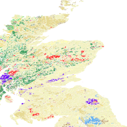
BGS OGE bedrock and surface geology


| Service health Now: |
|---|
- Interface
- Web Service, OGC Web Map Service 1.3.0
- Keywords
- OneGeology, OneGeology-Europe, 1G-E, harmonized geology, harmonized data, harmonized structure, harmonized age, harmonized geologic units, surface geology, surface, bedrock, fault, United Kingdom, MD_LANG@ENG, MD_DATE@2014-01-07
- Fees
- none
- Access constraints
- The 1:625k DiGMap data is available for free download for your personal, teaching, research or non-commercial use as described at http://www.bgs.ac.uk/products/digitalmaps/digmapgb_625.html. Your use of any information provided by the British Geological Survey (BGS) is at your own risk. Neither BGS nor the Natural Environment Research Council (NERC) gives any warranty, condition or representation as to the quality, accuracy or completeness of the information or its suitability for any use or purpose. All implied conditions relating to the quality or suitability of the information, and all liabilities arising from the supply of the information (including any liability arising in negligence) are excluded to the fullest extent permitted by law.
- Supported languages
- No INSPIRE Extended Capabilities (including service language support) given. See INSPIRE Technical Guidance - View Services for more information.
- Data provider
-
British Geological Survey (BGS) (unverified)
Contact information:
Mr Matthew Harrison
British Geological Survey (BGS)
postal:
Environmental Science Centre, NG12 5GG Keyworth, United KingdomEmail:
Phone: +44 (0)115 936 3100
- Service metadata
- No INSPIRE Extended Capabilities (including service metadata) given. See INSPIRE Technical Guidance - View Services for more information.
Ads by Google
The 1:625k DiGMap data covering the whole of the United Kingdom is available in this OGC WMS service for your personal, non-commercial use only and is being served as a contribution to the OneGeology-Europe initiative. The layers can be portrayed by age or lithology. For information about more of the British Geological Survey's maps that are available digitally please visit http://www.bgs.ac.uk/products/digitalmaps/digmapgb.html.
Available map layers (4)
BGS OGE bedrock and surface geology (BGS_OGE_Bedrock_and_Surface_Geology)
The 1:625k DiGMap data covering the whole of the United Kingdom is available in this OGC WMS service for your personal, non-commercial use only and is being served as a contribution to the OneGeology-Europe initiative. The layers can be portrayed by age or lithology. For information about more of the British Geological Survey's maps that are available digitally please visit http://www.bgs.ac.uk/products/digitalmaps/digmapgb.html.
1GE BGS 1M surface Geologic Structure (OGE_1M_surface_GeologicStructure)
BGS surface fault geology for OneGeology Europe.
1GE BGS 1M surface geologic unit (OGE_1M_surface_GeologicUnit)
BGS surface geology for OneGeology Europe. The surface layer shows the rocks and superficial deposits present at the land surface.
1GE BGS 1M surface geologic unit age (OGE_1M_surface_GeologicUnit_age)
BGS surface geology for OneGeology Europe. The surface layer shows the rocks and superficial deposits present at the land surface.
There are currently no notifications for the service, click the feed icon to subscribe.