IRENA |
|
IRENA Web Map Service
| Service health Now: |
|---|
- Interface
- Web Service, OGC Web Map Service 1.3.0
- Keywords
- WFS, WMS, GEOSERVER
- Fees
- NONE
- Access constraints
- NONE
- Supported languages
- No INSPIRE Extended Capabilities (including service language support) given. See INSPIRE Technical Guidance - View Services for more information.
- Data provider
-
IRENA (unverified)
Contact information:
Jacinto Estima
IRENA
Business:
Masdar City, PO. Box 236 Abu Dhabi, United Arab EmiratesEmail:
- Service metadata
- No INSPIRE Extended Capabilities (including service metadata) given. See INSPIRE Technical Guidance - View Services for more information.
Ads by Google
Web Map Service that supports the IRENA Global Atlas for Renewable Energy
Available map layers (2)
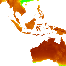
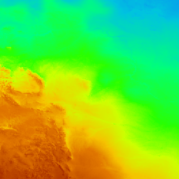
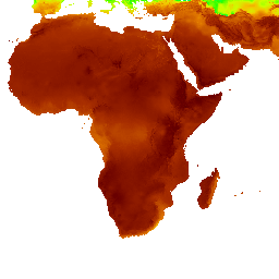
VAISALA Global Solar Dataset 3km with units in W/m²/day (GHI_Global_3km_3TIER)
VAISALA Global Solar Dataset 3km with units in W/m²/day VAISALA Global Solar Dataset provides average annual GHI at a 3km spatial resolution. Average values are based on more than 10 years of hourly GHI data and derived from actual, half-hourly, high-resolution visible satellite imagery observations via the broadband visible wavelength channel at a 2 arc minute resolution. VAISALA processed this information using on a combination of in-house research and algorithms published in peer-reviewed scientific literature. The dataset validated well when compared with observations from 120 geographically distributed surface stations around the globe (validation paper available here: http://www.vaisala.com/en/energy/Documents/WEA-ERG-3TIER-Global%20Wind%20Dataset.pdf). The information provided in the Global Atlas is meant to inform high-level policy debate (identification of opportunity areas for further prospection, preliminary assessment of technical potentials), or to perform market screening (cross referencing the resource information with policy information). It is suitable for decision-making activities, excluding financial commitments. It is a subset of a more detailed, long-term dataset, which includes hourly values of GHI, DNI, and other weather variables. VAISALA can provide this information and other customized services to facilitate project-specific or regional development, financial planning, and energy scheduling. By using this dataset, the user accepts VAISALA Terms and Conditions shown here: http://globalatlas.irena.org/VAISALA-terms-conditions.aspx Please access he data quality information for this dataset at: http://globalatlas.irena.org/dqif/publishdata.aspx?datasetid=3033. Also for additional information please download the data quality framework report at: goo.gl/T2wMaq
VAISALA Global Wind Dataset 5km onshore wind speed at 80m height units in m/s (Wind_Speed_Global_5km_80m_3TIER)
VAISALA Global Wind Dataset 5km onshore wind speed at 80m height units in m/s. VAISALA Global Wind Dataset provides average annual wind speed at 80 meters above ground. Average values are based on over 10 years of hourly data created through advanced computer model simulations. VAISALA created this dataset using a combination of statistical methods and physics-based numerical weather prediction models, which create realistic wind fields throughout the world by simulating the interaction between the entire atmosphere and the Earth’s surface. The wind speed dataset validated well when compared with more than 4000 NCEP-ADP networks stations (validation paper available here: http://www.vaisala.com/en/energy/Documents/WEA-ERG-3TIER-Global%20Wind%20Dataset.pdf). The information provided in the Global Atlas is meant to inform high-level policy debate (identification of opportunity areas for further prospection, preliminary assessment of technical potentials), or to perform market screening (cross referencing the resource information with policy information). It is suitable for decision-making activities, excluding financial commitments. It is a subset of a more detailed, long-term dataset, which includes additional hourly wind information such as wind direction, power density, and wind distribution. VAISALA can provide this information as well as information at higher spatial and temporal resolutions in addition to other customized energy services to facilitate project-specific or regional development, financial planning, and energy trading and scheduling. By using this dataset, the user accepts VAISALA Terms and Conditions shown here: http://globalatlas.irena.org/VAISALA-terms-conditions.aspx Please access he data quality information for this dataset at: http://globalatlas.irena.org/dqif/publishdata.aspx?datasetid=3032. Also for additional information please download the data quality framework report at: goo.gl/T2wMaq
There are currently no notifications for the service, click the feed icon to subscribe.