Earth Observation Center (EOC), DLR |
|
EOC Elevation Map Service

| Service health Now: |
|---|
- Interface
- Web Service, OGC Web Map Service 1.3.0
- Keywords
- DLR, EOC, SRTM, X-SAR, inspireidentifiziert, Elevation, TanDEM-X, TDM90
- Fees
- NONE
- Access constraints
- NONE
- Supported languages
- eng
- Data provider
-
Earth Observation Center (EOC), DLR (unverified)
Contact information:
Geoservice Manager
Earth Observation Center (EOC), DLR
Postal:
Münchnerstraße 20, 82234 Weßling, GermanyEmail:
- Service metadata
Ads by Google
This Web Mapping Service provides access to geospatial elevation map products within the Earth Observation Center (EOC).
Available map layers (16)
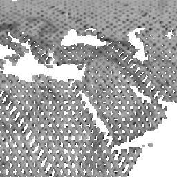
SRTM X-SAR Mosaic (srtm_x-sar_mosaic)
Mosaic of SRTM X-SAR tiles
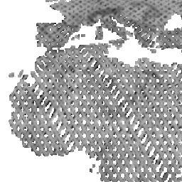
SRTM X-SAR Hillshade Mosaic (srtm_x-sar_hillshade_mosaic)
The SRTM X-SAR Hillshade Mosaic is a greyscale shaded relief based on the SRTM X-SAR Elevation Mosaic. Combined with the latter, it can be used to add a 3d effect and enhance the visual resolution by pronouncing peaks and valleys.
SRTM X-SAR Elevation Mosaic (srtm_x-sar_dem_mosaic)
The SRTM X-SAR Elevation Mosaic is an aggregation of DLR's SRTM X-SAR DTED files. The DTED Level-2 files have been generated from Synthetic Aperture Radar (SAR) data acquired by the German-Italian X-band interferometric SAR system during the Shuttle Radar Topography Mission (SRTM) between February 11 and 22, 2000. The X-band system was flown and operated onboard the Space Shuttle Endeavor, along with a NASA C-Band SAR system. The SRTM project page at DLR provides additional information on the SRTM X-band mission ( http://www.dlr.de/caf/en/desktopdefault.aspx/tabid-5515 /9214_read-17716/ ). Further details on the mission in general, the technology, accuracies, and applications are available in http://www2.jpl.nasa.gov/srtm/SRTM_paper.pdf . The original DTED files have been grouped and mosaicked into 30 x 30 degree tiles. Six out of the total of 48 tiles were empty since they do not contain any DTED files. The resulting 42 tiles are stored as uncompressed GeoTIFF files. The files have been supplemented with nine cubic convolution resampled overviews for fast web delivery.
TDM90 Amplitude Min (AM2) (TDM90_AM2)
The AM2 layer contains the minimum value of all calibrated amplitude values from the contributing DEM scenes (in general between 2 and up to 10 scenes).
TDM90 Amplitude Mean (AMP) (TDM90_AMP)
The AMP layer contains the mean value of all calibrated amplitude values from the contributing DEM scenes (in general between 2 and up to 10 scenes).
TDM90 Consistency Map (COM) (TDM90_COM)
The consistency mask (COM) indicates DEM pixels, which have height inconsistencies among the contributing DEM scenes.
TDM90 Coverage Map (COV) (TDM90_COV)
The coverage map (COV) indicates how many valid height values from different DEM acquisitions were available for mosaicking.
TDM90 Elevation (DEM) (TDM90_DEM)
The DEM elevation values represent the ellipsoidal heights relative to the WGS84 ellipsoid in the WGS84-G1150 datum.
TDM90 Height Error Map (HEM) (TDM90_HEM)
The height error map (HEM) values represent for each DEM pixel the corresponding height error in form of the standard deviation.
TDM90 Layover & Shadow Mask (LSM) (TDM90_LSM)
The layover and shadow mask (LSM) is based on the SRTM-C DEM and the GLOBE DEM regarding the TanDEM-X geometry of each individual scene.
TDM90 Water Indication Mask (WAM) (TDM90_WAM)
The water indication mask (WAM) layer represents the water bodies indentified during processing.
TanDEM-X PolarDEM 90m of Antarctica (DEM) (TDM_POLARDEM90_ANT_DEM)
This layer is a gap-free and edited version of the TanDEM-X 90m DEM. The TanDEM-X PolarDEM 90m of Antarctica is provided in Antarctic Polar Stereographic projection (EPSG:3031) with a pixel spacing of 90 meters. The DEM elevation values represent the ellipsoidal heights relative to the WGS84 ellipsoid. The majority of the data were acquired between April 2013 to September 2014. The TanDEM-X PolarDEM 90m of Antarctica is split into 4 tiles.
TanDEM-X PolarDEM 90m Hillshade Combined of Antarctica (HSC) (TDM_POLARDEM90_ANT_HSC)
A hillshade generated from the TanDEM-X PolarDEM 90m elevation layer. This shading represents a combination slope and oblique shading.
TanDEM-X PolarDEM 90m Hillshade Multidirectional of Antarctica (HSM) (TDM_POLARDEM90_ANT_HSM)
A hillshade generated from the TanDEM-X PolarDEM 90m elevation layer. This multidirectional shading combines of hillshading illuminated from 225 deg, 270 deg, 315 deg, and 360 deg azimuth.
TanDEM-X PolarDEM Coastline of Antarctica (TDM_POLARDEM_ANT_COASTLINE)
Coastline derived from the TanDEM-X PolarDEM elevation layer.
SRTM X-SAR Error Mosaic (srtm_x-sar_hem_mosaic)
The SRTM X-SAR Error Mosaic is based on the height error map (HEM, see SRTM PDF http://www.dlr.de/eoc/Portaldata/60/Resources/dokumente/7_sat_miss/SRTM-XSAR-DEM-DTED-1.1.pdf) and provides a local measure of the achieved accuracy. It is statistically determined from a neighborhood of image cells mainly considering the phase and baseline stability. Thus it describes the precision relative to the surrounding. The determination of the absolute accuracy requires the consideration of reference measures.
There are currently no notifications for the service, click the feed icon to subscribe.