[unknown data provider] |
|
Serveur WMS GeoVendee


| Service health Now: |
|---|
- Interface
- Web Service, OGC Web Map Service 1.3.0
- Keywords
- Fees
- unknown
- Access constraints
- unknown
- Supported languages
- No INSPIRE Extended Capabilities (including service language support) given. See INSPIRE Technical Guidance - View Services for more information.
- Data provider
-
unknown (unverified)
Contact information:
- Service metadata
- No INSPIRE Extended Capabilities (including service metadata) given. See INSPIRE Technical Guidance - View Services for more information.
Ads by Google
Serveur WMS GeoVendee
Available map layers (12)
Serveur WMS GeoVendee (Carte WMS)
Serveur WMS GeoVendee
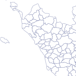
Administratif - EPCI (AdministratifEPCI)
communautés de communes et d'agglomération
Administratif - Commune (AdministratifCommune)
commune
SCAN Express 25 (SCANExpress25)
scan25
Plan cadastral Informatise - Batiment (pci_batiment)
Plan cadastral Informatise - Parcelle (pci_parcelle)
Plan cadastral Informatisé - Section (pci_sectioncadastrale)
section
Document d'urbanisme - Zone urba (DocumentdurbanismeZoneurba)
Zonage urba
Document d'urbanisme - Secteur carte communale (DocumentdurbanismeSecteurcarte)
Secteurs carte communale
BD ORTHO® 2016 - 85 - Résolution 50cm (BDORTHO2016resolution50cm)
Photographie aérienne 2016 - IGN
BD ORTHO® 2013 - 85 - Résolution 50cm (BDORTHO2013resolution50cm)
Photographie aérienne 2013 - IGN
PCRS Image - Démo - Rocheservière (donneesIMGPCRS2020_3564_66590t)
There are currently no notifications for the service, click the feed icon to subscribe.