Gemeinde Blankenfelde-Mahlow |
|
WMS LP_Blankenfelde-Mahlow
http://geoportal.teltow-flaeming.de/wss/service/WMS_LP_Blankenfelde-Mahlow/guest

| Service health Now: |
|---|
- Interface
- Web Service, OGC Web Map Service 1.3.0
- Keywords
- WMS Blankenfelde-Mahlow LP Landschaftsplan Brandenburg
- Fees
- siehe Zugriffsbedingungen, für kommerzielle Nutzung auf Anfrage
- Access constraints
- copyright
- Supported languages
- No INSPIRE Extended Capabilities (including service language support) given. See INSPIRE Technical Guidance - View Services for more information.
- Data provider
-
Gemeinde Blankenfelde-Mahlow (unverified)
Contact information:
Frau Ines Haserodt
Gemeinde Blankenfelde-Mahlow
Karl-Marx-Straße 4, 15827 Blankenfelde, Germany
Email:
- Service metadata
- No INSPIRE Extended Capabilities (including service metadata) given. See INSPIRE Technical Guidance - View Services for more information.
Ads by Google
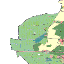
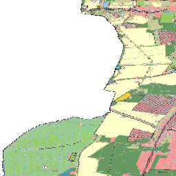
Landschaftsplan der Gemeinde Blankenfelde-Mahlow
Available map layers (11)
Landschaftsplan_Plan (Landschaftsplan_Plan)
Allgemeine_Nutzung (Allgemeine_Nutzung)
Geltungsbereich_FNP (Geltungsbereich_FNP)
LP_SchutzobjektBundesrecht_PG (LP_SchutzobjektBundesrecht_PG)
LP_Forstrecht_PG (LP_Forstrecht_PG)
LP_AllgGruenflaeche_PG (LP_AllgGruenflaeche_PG)
SO_Strassenverkehrsrecht_PG (SO_Strassenverkehrsrecht_PG)
LP_Biotopverbundflaeche_PG (LP_Biotopverbundflaeche_PG)
LP_SchutzPflegeEntwicklung_PG (LP_SchutzPflegeEntwicklung_PG)
LP_SchutzPflegeEntwicklung_PL (LP_SchutzPflegeEntwicklung_PL)
Strassenverkehr_Punktsymbol (Strassenverkehr_Punktsymbol)
There are currently no notifications for the service, click the feed icon to subscribe.