Geological Survey Department, Ghana |
|
GGS Geological Units

| Service health Now: |
|---|
- Interface
- Web Service, OGC Web Map Service 1.3.0
- Keywords
- OneGeology, Geology, continent@Africa, subcontinent@West Africa, geographicarea@Ghana, serviceprovider@Federal Institute for Geosciences and Natural Resources - Germany, dataprovider@Geological Survey Department - Ghana, Stratigraphy, Ghana, Birimian, Eburnean, Tarkwaian, Voltaian, Buem, Togo, Belts, Dahomeyide Mobile Belt, Panafrican, granitoids, metamorphic rocks, Ghana, West African Craton, Tamnean, Kwahu-Morago, Oti-Pendjari, Obosum, Paleoproterozoic, Neoproterozoic, Paleozoic, Mesozoic
- Fees
- none
- Access constraints
- none
- Supported languages
- No INSPIRE Extended Capabilities (including service language support) given. See INSPIRE Technical Guidance - View Services for more information.
- Data provider
-
Geological Survey Department, Ghana (unverified)
Contact information:
Kwame Odame Boamah
Geological Survey Department, Ghana
postal:
6 Seventh Avenue, P.O. Box M 80, Acccra, GhanaEmail:
Phone: +233-(0)21-679236
- Service metadata
- No INSPIRE Extended Capabilities (including service metadata) given. See INSPIRE Technical Guidance - View Services for more information.
Ads by Google
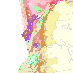
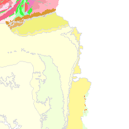
The NEW Geological map of Ghana at the scale of 1:1,000,000
Available map layers (2)
GGS Geological Units (ONEGEOLOGY)
The NEW Geological map of Ghana at the scale of 1:1,000,000
GHA GGS 1M Geological Units (GHA_GGS_1M_GeoUnits)
Geology of Ghana at the scale of 1:1,000,000
There are currently no notifications for the service, click the feed icon to subscribe.