[unknown data provider] |
|
NDGISHUB_WMS_All_LanduseLandcover
http://ndgishub.nd.gov/arcgis/services/All_LanduseLandcover/MapServer/WMSServer
| Service health Now: |
|---|
- Interface
- Web Service, OGC Web Map Service 1.3.0
- Keywords
- Fees
- unknown
- Access constraints
- unknown
- Supported languages
- No INSPIRE Extended Capabilities (including service language support) given. See INSPIRE Technical Guidance - View Services for more information.
- Data provider
-
unknown (unverified)
Contact information:
- Service metadata
- No INSPIRE Extended Capabilities (including service metadata) given. See INSPIRE Technical Guidance - View Services for more information.
Ads by Google
WMS
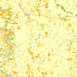
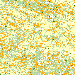
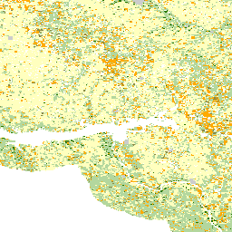
Available map layers (36)
NDHUB.LANDCLASS_USFWS_2002 (NDHUB.LANDCLASS_USFWS_2002)
http://web.apps.state.nd.us/hubdataportal?uuid=37c641e4-a860-463b-bd0d-cce553ad4991
NDHUB.LANDCLASS_USFWS_1996 (NDHUB.LANDCLASS_USFWS_1996)
http://web.apps.state.nd.us/hubdataportal?uuid=6c67022d-9a5c-4fe3-9d6a-aa1f23335f42
NDHUB.LANDCLASS_NLC_2019 (NDHUB.LANDCLASS_NLC_2019)
NDHUB.LANDCLASS_NLC_2016 (NDHUB.LANDCLASS_NLC_2016)
NDHUB.LANDCLASS_NLC_2013 (NDHUB.LANDCLASS_NLC_2013)
NDHUB.LANDCLASS_NLC_2011 (NDHUB.LANDCLASS_NLC_2011)
http://apps.nd.gov/hubdataportal?uuid=91dad5b3-310e-49d1-b1ce-b156d4e8cb54
NDHUB.LANDCLASS_NLC_2006 (NDHUB.LANDCLASS_NLC_2006)
http://web.apps.state.nd.us/hubdataportal?uuid=a050ee92-9297-41af-8bdd-3a785d114eb4
NDHUB.LANDCLASS_NLC_2001 (NDHUB.LANDCLASS_NLC_2001)
http://web.apps.state.nd.us/hubdataportal?uuid=42712780-061d-447c-bc3f-9f9d945ba1f5
NDHUB.LANDCLASS_NLC_1992 (NDHUB.LANDCLASS_NLC_1992)
http://web.apps.state.nd.us/hubdataportal?uuid=b52d4f78-f9c2-4b4b-9842-3df80a9bc02c
NDHUB.LANDCLASS_NASS_2021 (NDHUB.LANDCLASS_NASS_2021)
NDHUB.LANDCLASS_NASS_2020 (NDHUB.LANDCLASS_NASS_2020)
NDHUB.LANDCLASS_NASS_2019 (NDHUB.LANDCLASS_NASS_2019)
NDHUB.LANDCLASS_NASS_2018 (NDHUB.LANDCLASS_NASS_2018)
NDHUB.LANDCLASS_NASS_2017 (NDHUB.LANDCLASS_NASS_2017)
NDHUB.LANDCLASS_NASS_2016 (NDHUB.LANDCLASS_NASS_2016)
The USDA, NASS Cropland Data Layer (CDL) is a raster, geo-referenced, crop-specific land cover data layer. The 2016 CDL has a ground resolution of 30 meters. The CDL is produced using satellite imagery from the Landsat 8 OLI/TIRS sensor and the Disaster Monitoring Constellation (DMC) DEIMOS-1 and UK2 sensors collected during the current growing season. Some CDL states used additional satellite imagery and ancillary inputs to supplement and improve the classification. These additional sources can include the United States Geological Survey (USGS) National Elevation Dataset (NED) and the imperviousness and canopy data layers from the USGS National Land Cover Database 2011 (NLCD 2011). Agricultural training and validation data are derived from the Farm Service Agency (FSA) Common Land Unit (CLU) Program. The most current version of the NLCD is used as non-agricultural training and validation data. Please refer to the 'Supplemental_Information' Section of this metadata file for a complete list of all imagery, ancillary data, and training/validation data used to generate this state's CDL. The strength and emphasis of the CDL is agricultural land cover. Please note that no farmer reported data are derivable from the Cropland Data Layer.
NDHUB.LANDCLASS_NASS_2015 (NDHUB.LANDCLASS_NASS_2015)
The USDA, NASS Cropland Data Layer (CDL) is a raster, geo-referenced, crop-specific land cover data layer. The 2015 CDL has a ground resolution of 30 meters. The CDL is produced using satellite imagery from the Landsat 8 OLI/TIRS sensor and the Disaster Monitoring Constellation (DMC) DEIMOS-1 and UK2 sensors collected during the current growing season. Some CDL states used additional satellite imagery and ancillary inputs to supplement and improve the classification. These additional sources can include the United States Geological Survey (USGS) National Elevation Dataset (NED) and the imperviousness and canopy data layers from the USGS National Land Cover Database 2011 (NLCD 2011). Agricultural training and validation data are derived from the Farm Service Agency (FSA) Common Land Unit (CLU) Program. The most current version of the NLCD is used as non-agricultural training and validation data. Please refer to the 'Supplemental_Information' Section of this metadata file for a complete list of all imagery, ancillary data, and training/validation data used to generate this state's CDL. The strength and emphasis of the CDL is agricultural land cover. Please note that no farmer reported data are derivable from the Cropland Data Layer.
NDHUB.LANDCLASS_NASS_2014 (NDHUB.LANDCLASS_NASS_2014)
The USDA, NASS Cropland Data Layer (CDL) is a raster, geo-referenced, crop-specific land cover data layer. The 2014 CDL has a ground resolution of 30 meters. The CDL is produced using satellite imagery from the Landsat 8 OLI/TIRS sensor and the Disaster Monitoring Constellation (DMC) DEIMOS-1 and UK2 sensors collected during the current growing season. Some CDL states used additional satellite imagery and ancillary inputs to supplement and improve the classification. These additional sources can include the United States Geological Survey (USGS) National Elevation Dataset (NED) and the imperviousness and canopy data layers from the USGS National Land Cover Database 2011 (NLCD 2011). Agricultural training and validation data are derived from the Farm Service Agency (FSA) Common Land Unit (CLU) Program. The most current version of the NLCD is used as non-agricultural training and validation data. Please refer to the 'Supplemental_Information' Section of this metadata file for a complete list of all imagery, ancillary data, and training/validation data used to generate this state's CDL. The strength and emphasis of the CDL is agricultural land cover. Please note that no farmer reported data are derivable from the Cropland Data Layer.
NDHUB.LANDCLASS_NASS_2013 (NDHUB.LANDCLASS_NASS_2013)
http://apps.nd.gov/hubdataportal?uuid=5f812bff-867c-40ca-ae7c-c10d90ffee2e
NDHUB.LANDCLASS_NASS_2012 (NDHUB.LANDCLASS_NASS_2012)
http://apps.nd.gov/hubdataportal?uuid=2e0f3eeb-b39c-4b0c-af63-938e28dfa538
NDHUB.LANDCLASS_NASS_2011 (NDHUB.LANDCLASS_NASS_2011)
http://web.apps.state.nd.us/hubdataportal?uuid=fd8674d1-d4a9-4568-ac0a-6e4b4af9c3b6
NDHUB.LANDCLASS_NASS_2010 (NDHUB.LANDCLASS_NASS_2010)
http://web.apps.state.nd.us/hubdataportal?uuid=bc60ad24-e3d7-49e9-b3ae-83251b15ba0e
NDHUB.LANDCLASS_NASS_2009 (NDHUB.LANDCLASS_NASS_2009)
http://web.apps.state.nd.us/hubdataportal?uuid=173ce973-7f9c-4c54-ab9f-fbbdc3836e3b
NDHUB.LANDCLASS_NASS_2008 (NDHUB.LANDCLASS_NASS_2008)
http://web.apps.state.nd.us/hubdataportal?uuid=b5f3ccce-c5ad-41c5-86cd-5fe83138fb84
NDHUB.LANDCLASS_NASS_2007 (NDHUB.LANDCLASS_NASS_2007)
http://web.apps.state.nd.us/hubdataportal?uuid=98c25f47-d9b7-4f04-91be-2f599205b41a
NDHUB.LANDCLASS_NASS_2006 (NDHUB.LANDCLASS_NASS_2006)
http://web.apps.state.nd.us/hubdataportal?uuid=b732a284-ae59-43a7-814a-81a41c91b5ef
NDHUB.LANDCLASS_NASS_2005 (NDHUB.LANDCLASS_NASS_2005)
http://web.apps.state.nd.us/hubdataportal?uuid=4c3dbdef-3d7f-4a20-8321-f882920c0f5b
NDHUB.LANDCLASS_NASS_2004 (NDHUB.LANDCLASS_NASS_2004)
http://web.apps.state.nd.us/hubdataportal?uuid=fed1044f-d1ba-4897-a915-e701ebce47c0
NDHUB.LANDCLASS_NASS_2003 (NDHUB.LANDCLASS_NASS_2003)
http://web.apps.state.nd.us/hubdataportal?uuid=71c78a55-c505-43ce-8e9a-ae02446504fd
NDHUB.LANDCLASS_NASS_2002 (NDHUB.LANDCLASS_NASS_2002)
http://web.apps.state.nd.us/hubdataportal?uuid=846b88f5-7688-4216-b3e9-a7f894f6aba1
NDHUB.LANDCLASS_NASS_2001 (NDHUB.LANDCLASS_NASS_2001)
http://web.apps.state.nd.us/hubdataportal?uuid=68472123-cbd3-4cde-8ac2-9f2f2180b2db
NDHUB.LANDCLASS_NASS_2000 (NDHUB.LANDCLASS_NASS_2000)
http://web.apps.state.nd.us/hubdataportal?uuid=c9222716-4ea1-4b95-9f37-60251f017771
NDHUB.LANDCLASS_NASS_1999 (NDHUB.LANDCLASS_NASS_1999)
http://web.apps.state.nd.us/hubdataportal?uuid=b27cba2c-2b08-4127-8b4a-0c29f9e01f73
NDHUB.LANDCLASS_NASS_1998 (NDHUB.LANDCLASS_NASS_1998)
http://web.apps.state.nd.us/hubdataportal?uuid=f9c45457-e63f-4499-888c-05fd960d4378
NDHUB.LANDCLASS_NASS_1997 (NDHUB.LANDCLASS_NASS_1997)
http://web.apps.state.nd.us/hubdataportal?uuid=717ddd70-fb6b-47c1-b57f-e03041b7aba3
NDHUB.LANDCLASS_GAP_2010 (NDHUB.LANDCLASS_GAP_2010)
http://web.apps.state.nd.us/hubdataportal?uuid=89ac4ebb-3da9-4e36-bced-cc2d5cd2601b
NDHUB.LANDCLASS_GAP_2005 (NDHUB.LANDCLASS_GAP_2005)
http://web.apps.state.nd.us/hubdataportal?uuid=a3ae305f-506a-435c-a5f3-f253c03f9c88
There are currently no notifications for the service, click the feed icon to subscribe.