Food and Agriculture Organization (FAO) |
|
FAO GeoNetwork OGC Web Map Server
| Service health Now: |
|---|
- Interface
- Web Service, OGC Web Map Service 1.1.1
- Keywords
- FAO, WMS, OGC, GeoNetwork
- Fees
- none
- Access constraints
- none
- Data provider
-
Food and Agriculture Organization (FAO) (unverified)
Contact information:
Jeroen Ticheler
Food and Agriculture Organization (FAO)
postal:
Viale delle Terme di Caracalla, 00153 Rome, ItalyEmail:
Phone: +39-06 57051
Ads by Google
Available map layers (2)
FAO GeoNetwork OGC Web Map Server (GNW)
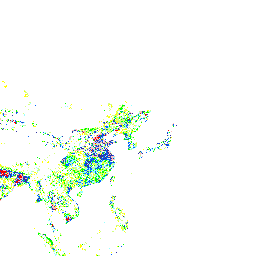
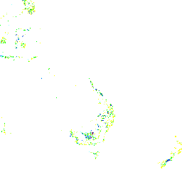
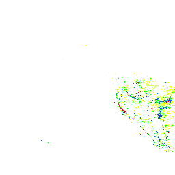
Global map of irrigated areas - version 5 (irrigated_areas)
Grid with percentage of area equiped for irrigation with a spatial resolution of 5 arc minutes or 0.083333 decimal degrees. This dataset is developed by he Land and Water Development Division of Food and Agriculture Organization of the United Nations and the Johann Wolfgang Goethe Universität, Frankfurt am Main, Germany.
There are currently no notifications for the service, click the feed icon to subscribe.