[unknown data provider] |
|
2007_madison_A


| Service health Now: |
|---|
- Interface
- Web Service, OGC Web Map Service 1.1.1
- Keywords
- USGS, urban, 1-foot, imagery
- Fees
- unknown
- Access constraints
- unknown
- Data provider
-
unknown (unverified)
Contact information:
Ads by Google
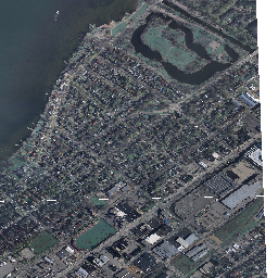
This WMS mapservice is a test of different tiling and overview schemes for performance in high-resolution mapping.
Available map layers (2)
2007_madison_A (2007_madison_A)
2007_madison_A (2007_madison_A)
This is a 1-foot resolution imagery mosaic from the USGS compiled in 2007.Imagery available for download at WisconsinView. Contact Sam Batzli for details.
There are currently no notifications for the service, click the feed icon to subscribe.