Federal Institute for Geosciences and … |
|
BGR Groundwater: WHYMAP
| Service health Now: |
|---|
- Interface
- Web Service, OGC Web Map Service 1.3.0
- Keywords
- geodata, geo information system, groundwater, hydrogeology, map, world map, vector data, water, aquifer, WMS, Web Map Service, OGC, Open GIS, web mapping, GIS, WHYMAP
- Fees
- NONE
- Access constraints
- General terms and conditions, see http://www.bgr.bund.de/AGB_en - Allgemeine Geschäftsbedingungen, siehe http://www.bgr.bund.de/AGB. The information made available shall be quoted as follows in case of reuse: Data source: WHYMAP, (C) BGR Hannover & UNESCO Paris
- Supported languages
- No INSPIRE Extended Capabilities (including service language support) given. See INSPIRE Technical Guidance - View Services for more information.
- Data provider
-
Federal Institute for Geosciences and Natural Resources (BGR) (unverified)
Contact information:
Dr. Stefan Broda
Federal Institute for Geosciences and Natural Resources (BGR)
postal:
Wilhelmstr. 25-30, 13593 Berlin, DEEmail:
Phone: +49-30-36993-0
- Service metadata
- No INSPIRE Extended Capabilities (including service metadata) given. See INSPIRE Technical Guidance - View Services for more information.
Ads by Google
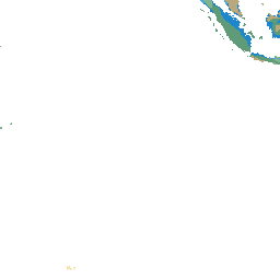
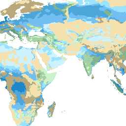
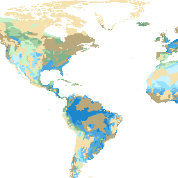
The World-wide Hydrogeological Mapping and Assessment Programme (WHYMAP) compiles data on groundwater from national, regional and global sources, and visualises them as printed maps, web map application and web map service. Internet: http://www.whymap.org/
Available map layers (15)
BGR Groundwater: WHYMAP (bgr_groundwater_whymap)
The World-wide Hydrogeological Mapping and Assessment Programme (WHYMAP) compiles data on groundwater from national, regional and global sources, and visualises them as printed maps, web map application and web map service. Internet: http://www.whymap.org/
Groundwater (gp_groundwater)
Groundwater resources and recharge (Hydrogeo1)
groundwater resources and recharge (three main hydrogeological units and up to five different recharge categories)
area of low rainfall (Nonreneg)
area of low rainfall ( < 200 mm/year)
area of saline groundwater (Salinegr)
area of saline groundwater ( > 5g/l total dissolved solids)
natural groundwater discharge area in arid regions (discharge)
No further information
area of heavy groundwater abstraction with over-exploitation (overexploitation_1)
No further information
area of groundwater mining (overexploitation_2)
No further information
Surface Water (gp_surface_water)
continuous ice sheet (ice)
No further information
major river (River)
No further information
large freshwater lake (Lake)
No further information
large saltwater lake (Saltlake)
No further information
River / Lake basin (gp_riverlakebasin)
river / lake basin (RiverLakeBasin)
No further information
There are currently no notifications for the service, click the feed icon to subscribe.