Food and Agriculture Organization (FAO) |
|
FAO GeoNetwork OGC Web Map Server
| Service health Now: |
|---|
- Interface
- Web Service, OGC Web Map Service 1.1.1
- Keywords
- FAO, WMS, OGC, GeoNetwork
- Fees
- none
- Access constraints
- none
- Data provider
-
Food and Agriculture Organization (FAO) (unverified)
Contact information:
Jeroen Ticheler
Food and Agriculture Organization (FAO)
postal:
Viale delle Terme di Caracalla, 00153 Rome, ItalyEmail:
Phone: +39-06 57051
Ads by Google
Available map layers (2)
FAO GeoNetwork OGC Web Map Server (GNW)
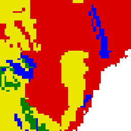
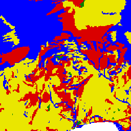
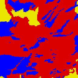
Soil suitability for ponds (soil_suitability_for_ponds)
Suitable areas for the construction of fish ponds based on a soils evaluation. Soils evaluation was based on FAO's Digital Soil Map of the World (DSMW) and included: texture, effective soil depth, pH, salinity, and the presence of catclays and gypsum.
There are currently no notifications for the service, click the feed icon to subscribe.