Food and Agriculture Organization (FAO) |
|
FAO GeoNetwork OGC Web Map Server


| Service health Now: |
|---|
- Interface
- Web Service, OGC Web Map Service 1.1.1
- Keywords
- FAO, WMS, OGC, GeoNetwork
- Fees
- none
- Access constraints
- none
- Data provider
-
Food and Agriculture Organization (FAO) (unverified)
Contact information:
Jeroen Ticheler
Food and Agriculture Organization (FAO)
postal:
Viale delle Terme di Caracalla, 00153 Rome, ItalyEmail:
Phone: +39-06 57051
Ads by Google
Available map layers (2)
FAO GeoNetwork OGC Web Map Server (GNW)
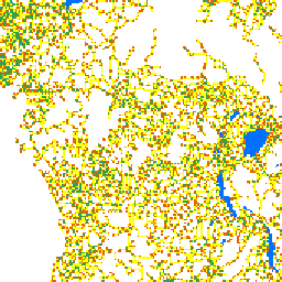
Roads (roads_africa)
Availability of road infrastructure for the development of commercial fish farming interpreted as density of paved and motorable. The density of paved and motorable roads was used as a surrogate for the general level of infrastructure. It was reasoned that were there are main, all weather roads, there are possibilities to transport inputs and supplies to fish farms and to send products to markets than in areas without such road infrastructure. It was also reasoned that with that where all-weather roads exist, the probability of other kinds of infrastructure in close proximity, such as electricity and communication, is enhanced. Roads data was derived from the US Defense Mapping Agency (DMA) Topographic Maps in Africa and from the DMA Global Navigation and Planning Charts of Africa.
There are currently no notifications for the service, click the feed icon to subscribe.