Earth Resources Observation and Scienc… |
|
USGS_EROS_LandCover_NLCD

| Service health Now: |
|---|
- Interface
- Web Service, OGC Web Map Service 1.3.0
- Keywords
- Land Cover, Canopy, Impervious Surface
- Fees
- unknown
- Access constraints
- None. Acknowledgment of the U.S. Geological Survey would be appreciated in products derived from these data.
- Supported languages
- No INSPIRE Extended Capabilities (including service language support) given. See INSPIRE Technical Guidance - View Services for more information.
- Data provider
-
Earth Resources Observation and Science (EROS) (unverified)
Contact information:
Customer Services Representative
Earth Resources Observation and Science (EROS)
postal:
47914 252nd Street, 57198 Sioux Falls, USAEmail:
Phone: (605) 594-6151
- Service metadata
- No INSPIRE Extended Capabilities (including service metadata) given. See INSPIRE Technical Guidance - View Services for more information.
Ads by Google
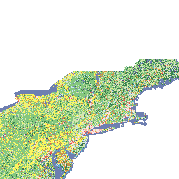
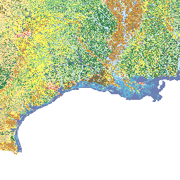
NLCD 1992, NLCD 2001, and NLCD 2006 are National Land Cover Database classification schemes based primarily on Landsat data along with ancillary data sources, such as topography, census and agricultural statistics, soil characteristics, wetlands, and other land cover maps. NLCD 1992 is a 21-class land cover classification scheme that has been applied consistently across the conterminous U.S. at a spatial resolution of 30 meters. NLCD 2001 is a 16-class land cover classification scheme that also has been applied to the conterminous U.S. at a spatial resolution of 30 meters, and includes Alaska, Hawaii, and Puerto Rico. NLCD 2006 quantifies land cover change for the conterminous U.S. between the years 2001 to 2006. Generation of NLCD 2006 helped identify and correct issues in the NLCD 2001 land cover and impervious surface products only, and no changes were made to the NLCD 2001 canopy product. For additional information, go to http://www.mrlc.gov/.
Available map layers (29)
Land_Cover_1992 (1)
Land_Cover_Footprint_1992 (2)
Canopy_2001_PR (5)
Canopy_2001_CONUS (6)
Canopy_2001_HI (7)
Canopy_2001_AK (8)
Impervious_Surface_2001_PR (10)
Impervious_Surface_2001_CONUS (11)
Impervious_Surface_2001_HI (12)
Impervious_Surface_2001_AK (13)
Land_Cover_2001_CONUS (15)
Land_Cover_2001_PR (16)
Land_Cover_2001_HI (17)
Land_Cover_2001_AK (18)
Canopy_Footprint_2001 (19)
Impervious_Surface_Footprint_2001 (20)
Land_Cover_Footprint_2001 (21)
Impervious_Surface_2006_CONUS (23)
Land_Cover_2006_CONUS (24)
Impervious_Surface_Footprint_2006 (25)
Land_Cover_Footprint_2006 (26)
Canopy_2011_CONUS (28)
The National Land Cover Database 2011 (NLCD2011) USFS percent tree canopy product was produced through a cooperative project conducted by the Multi-Resolution Land Characteristics (MRLC) Consortium (www.mrlc.gov). The MRLC Consortium is a partnership of federal agencies, consisting of the U.S. Geological Survey, the National Oceanic and Atmospheric Administration, the U.S. Environmental Protection Agency, the U.S. Department of Agriculture (USDA) National Agricultural Statistics Service, the U.S. Forest Service, the National Park Service, the U.S. Fish and Wildlife Service, the Bureau of Land Management, NASA, and the U.S. Army Corps of Engineers. One of the primary goals of the project was to generate current, consistent, and seamless national land cover, percent tree canopy, and percent impervious cover at medium spatial resolution. This product is the cartographic version of the NLCD2011 percent tree canopy cover dataset for CONUS at medium spatial resolution (30 m). It was produced by the USDA Forest Service Remote Sensing Applications Center (RSAC). Tree canopy values range from 0 to 100 percent. The analytic tree canopy layer was produced using a Random Forests™ regression algorithm. The cartographic product is a filtered version of the regression algorithm output.
Impervious_Surface_2011_CONUS (30)
Impervious_Surface_2011_AK (31)
Land_Cover_2011_CONUS (33)
Land_Cover_2011_AK (34)
Canopy_Footprint_2011 (35)
Impervious_Surface_Footprint_2011 (36)
Land_Cover_Footprint_2011 (37)
There are currently no notifications for the service, click the feed icon to subscribe.