The ancient geographes INC |
|
GeoServer Web Map Service

| Service health Now: |
|---|
- Interface
- Web Service, OGC Web Map Service 1.1.1
- Keywords
- WFS, WMS, GEOSERVER
- Fees
- NONE
- Access constraints
- NONE
- Data provider
-
The ancient geographes INC (unverified)
Contact information:
Claudius Ptolomaeus
The ancient geographes INC
Work:
Alexandria, EgyptEmail:
Ads by Google
A compliant implementation of WMS 1.1.1 plus most of the SLD 1.0 extension (dynamic styling). Can also generate PDF, SVG, KML, GeoRSS
Available map layers (29)
KATASTARSKA_CESTICA_Type (cite:111kat)
Generated from 1
KATASTARSKA_CESTICA_Type (cite:KATASTARSKA_CESTICA)
Generated from 1
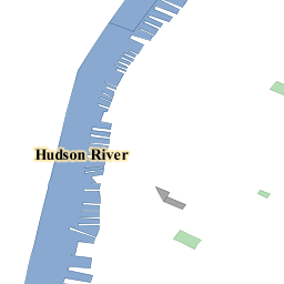
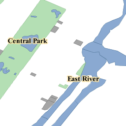
Manhattan (NY) landmarks (tiger:poly_landmarks)
Manhattan landmarks, identifies water, lakes, parks, interesting buildilngs
Manhattan (NY) points of interest (tiger:poi)
Points of interest in New York, New York (on Manhattan). One of the attributes contains the name of a file with a picture of the point of interest.
Manhattan (NY) roads (tiger:tiger_roads)
Highly simplified road layout of Manhattan in New York..
Spearfish archeological sites (sf:archsites)
Sample data from GRASS, archeological sites location, Spearfish, South Dakota, USA
Spearfish bug locations (sf:bugsites)
Sample data from GRASS, bug sites location, Spearfish, South Dakota, USA
Spearfish restricted areas (sf:restricted)
Sample data from GRASS, restricted areas, Spearfish, South Dakota, USA
Spearfish roads (sf:roads)
Sample data from GRASS, road layout, Spearfish, South Dakota, USA
Spearfish streams (sf:streams)
Sample data from GRASS, streams, Spearfish, South Dakota, USA
TRASA_Type (cite:TRASA)
Generated from 1
Tasmania cities (topp:tasmania_cities)
Cities in Tasmania (actually, just the capital)
Tasmania roads (topp:tasmania_roads)
Main Tasmania roads
Tasmania state boundaries (topp:tasmania_state_boundaries)
Tasmania state boundaries
Tasmania water bodies (topp:tasmania_water_bodies)
Tasmania water bodies
USA Population (topp:states)
This is some census data on the states.
World rectangle (tiger:giant_polygon)
A simple rectangular polygon covering most of the world, it's only used for the purpose of providing a background (WMS bgcolor could be used instead)
ZGRADA_Type (cite:ZGRADA)
Generated from 1
giant_polygon_Type (tiger:bla)
Generated from nyc
A sample ArcGrid file (nurc:Arc_Sample)
Generated from arcGridSample
North America sample imagery (nurc:Img_Sample)
A very rough imagery of North America
Sample PNG mosaic (nurc:mosaic)
Subsampled satellite imagery loaded as a mosaic of PNG images
Sample scanned and georerenced map (nurc:Pk50095)
This is a sample for the world image format (wld + prj + tiff)
sfdem is a Tagged Image File Format with Geographic information (sf:sfdem)
Generated from sfdem
katastar (katastar)
Layer-Group type layer: katastar
spearfish (spearfish)
Layer-Group type layer: spearfish
tasmania (tasmania)
Layer-Group type layer: tasmania
tiger-ny (tiger-ny)
Layer-Group type layer: tiger-ny
trasa (trasa)
Layer-Group type layer: trasa
There are currently no notifications for the service, click the feed icon to subscribe.