Scottish Natural Heritage |
|
SNH Habitats and Species WMS
http://mapgateway.snh.gov.uk/ServicesWMS/SNH_Habitats_and_Species/MapServer/WMSServer

| Service health Now: |
|---|
- Interface
- Web Service, OGC Web Map Service 1.3.0
- Keywords
- WMS
- Fees
- NONE
- Access constraints
- Variable licencing, please consult individual dataset metadata documents
- Supported languages
- eng
- Data provider
-
Scottish Natural Heritage (unverified)
Contact information:
Scottish Natural Heritage
Work:
Great Glen House, Leachkin Road, IV3 8NW Inverness, United KingdomEmail:
Phone: +44 01463 725000
- Service metadata
Ads by Google
Available map layers (27)
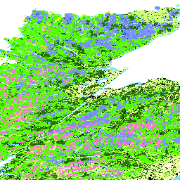
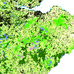
EUNIS Land Cover Scotland (0)
This is a Scotland raster based (10m) landcover made up of best available national data classified according to the EUNIS (EUropean Nature Information System).The main purpose of the landcover is to provide well-known, nationally consistent information for SNH’s national habitat network models. Secondary purposes include input for other analysis projects as well as map backdrops.
Ancient Woodland Inventory (1)
In response to a 1980 select committee which recommended that ancient woods should be recognised and treated as a separate category, the NCCs compiled the Inventories of Ancient, Long-established and Semi-natural woodlands. A more sophisticated classification was developed for woodlands in Scotland due to the nature of the available historical sources. IMPORTANT. For Scottish woods, the category Ancient comprises woods recorded as being of semi-natural origin on EITHER the 1750 Roy maps OR the 1st Edition Ordnance Survey maps of 1860. This is due a) to the likelihood of the latter having been omitted from the Roy maps and b) to render the Scottish classification compatible with that for England and Wales.
NVC Scotland (2)
Classifies British vegetation into a series of plant communities according to phytosociological groups using standard field methods and data analysis/classification techniques. The methodology is based on taking quadrats using a strict sampling system from stands of homogeneous vegetation.
IHN Woodland network (3)
The approach employs a detailed desk study using digital data within a geographic information system (GIS) to identify Integrates Habitat Networks (IHNs). The spatial position and extent of functional integrated habitat networks were determined through a landscape ecology model from the BEETLE (Biological and Environmental Evaluation Tools for Landscape Ecology) suite of tools. The BEETLE least-cost focal species approach negates the need to carry out a vast number of individual species analyses. The selection of the habitats to be modelled, and the species used to inform the analysis, were identified through a series of expert stakeholder workshops. The outputs can support the planning process, help prioritise conservation effort, prevent further fragmentation of biodiversity and aid connectivity of semi natural habitats. The BEETLE model analysis has been well referenced (Watts et al., 2005) and used in a variety of projects such as developing forest habitat networks across Scotland. The application of IHNs is the first time that the multiple habitat network approach has been used to solicit planning and development programmes in key areas.
IHN Woodland hotspots (4)
The approach employs a detailed desk study using digital data within a geographic information system (GIS) to identify Integrates Habitat Networks (IHNs). The spatial position and extent of functional integrated habitat networks were determined through a landscape ecology model from the BEETLE (Biological and Environmental Evaluation Tools for Landscape Ecology) suite of tools. The BEETLE least-cost focal species approach negates the need to carry out a vast number of individual species analyses. The selection of the habitats to be modelled, and the species used to inform the analysis, were identified through a series of expert stakeholder workshops. The outputs can support the planning process, help prioritise conservation effort, prevent further fragmentation of biodiversity and aid connectivity of semi natural habitats. The BEETLE model analysis has been well referenced (Watts et al., 2005) and used in a variety of projects such as developing forest habitat networks across Scotland. The application of IHNs is the first time that the multiple habitat network approach has been used to solicit planning and development programmes in key areas.
IHN Wetland network (5)
The approach employs a detailed desk study using digital data within a geographic information system (GIS) to identify Integrates Habitat Networks (IHNs). The spatial position and extent of functional integrated habitat networks were determined through a landscape ecology model from the BEETLE (Biological and Environmental Evaluation Tools for Landscape Ecology) suite of tools. The BEETLE least-cost focal species approach negates the need to carry out a vast number of individual species analyses. The selection of the habitats to be modelled, and the species used to inform the analysis, were identified through a series of expert stakeholder workshops. The outputs can support the planning process, help prioritise conservation effort, prevent further fragmentation of biodiversity and aid connectivity of semi natural habitats. The BEETLE model analysis has been well referenced (Watts et al., 2005) and used in a variety of projects such as developing forest habitat networks across Scotland. The application of IHNs is the first time that the multiple habitat network approach has been used to solicit planning and development programmes in key areas.
IHN Wetland hotspots (6)
The approach employs a detailed desk study using digital data within a geographic information system (GIS) to identify Integrates Habitat Networks (IHNs). The spatial position and extent of functional integrated habitat networks were determined through a landscape ecology model from the BEETLE (Biological and Environmental Evaluation Tools for Landscape Ecology) suite of tools. The BEETLE least-cost focal species approach negates the need to carry out a vast number of individual species analyses. The selection of the habitats to be modelled, and the species used to inform the analysis, were identified through a series of expert stakeholder workshops. The outputs can support the planning process, help prioritise conservation effort, prevent further fragmentation of biodiversity and aid connectivity of semi natural habitats. The BEETLE model analysis has been well referenced (Watts et al., 2005) and used in a variety of projects such as developing forest habitat networks across Scotland. The application of IHNs is the first time that the multiple habitat network approach has been used to solicit planning and development programmes in key areas.
IHN Neutral grassland network (7)
The approach employs a detailed desk study using digital data within a geographic information system (GIS) to identify Integrates Habitat Networks (IHNs). The spatial position and extent of functional integrated habitat networks were determined through a landscape ecology model from the BEETLE (Biological and Environmental Evaluation Tools for Landscape Ecology) suite of tools. The BEETLE least-cost focal species approach negates the need to carry out a vast number of individual species analyses. The selection of the habitats to be modelled, and the species used to inform the analysis, were identified through a series of expert stakeholder workshops. The outputs can support the planning process, help prioritise conservation effort, prevent further fragmentation of biodiversity and aid connectivity of semi natural habitats. The BEETLE model analysis has been well referenced (Watts et al., 2005) and used in a variety of projects such as developing forest habitat networks across Scotland. The application of IHNs is the first time that the multiple habitat network approach has been used to solicit planning and development programmes in key areas.
IHN Neutral grassland hotspots (8)
The approach employs a detailed desk study using digital data within a geographic information system (GIS) to identify Integrates Habitat Networks (IHNs). The spatial position and extent of functional integrated habitat networks were determined through a landscape ecology model from the BEETLE (Biological and Environmental Evaluation Tools for Landscape Ecology) suite of tools. The BEETLE least-cost focal species approach negates the need to carry out a vast number of individual species analyses. The selection of the habitats to be modelled, and the species used to inform the analysis, were identified through a series of expert stakeholder workshops. The outputs can support the planning process, help prioritise conservation effort, prevent further fragmentation of biodiversity and aid connectivity of semi natural habitats. The BEETLE model analysis has been well referenced (Watts et al., 2005) and used in a variety of projects such as developing forest habitat networks across Scotland. The application of IHNs is the first time that the multiple habitat network approach has been used to solicit planning and development programmes in key areas.
IHN Heathland network (9)
The approach employs a detailed desk study using digital data within a geographic information system (GIS) to identify Integrates Habitat Networks (IHNs). The spatial position and extent of functional integrated habitat networks were determined through a landscape ecology model from the BEETLE (Biological and Environmental Evaluation Tools for Landscape Ecology) suite of tools. The BEETLE least-cost focal species approach negates the need to carry out a vast number of individual species analyses. The selection of the habitats to be modelled, and the species used to inform the analysis, were identified through a series of expert stakeholder workshops. The outputs can support the planning process, help prioritise conservation effort, prevent further fragmentation of biodiversity and aid connectivity of semi natural habitats. The BEETLE model analysis has been well referenced (Watts et al., 2005) and used in a variety of projects such as developing forest habitat networks across Scotland. The application of IHNs is the first time that the multiple habitat network approach has been used to solicit planning and development programmes in key areas.
IHN Acid grassland network (10)
The approach employs a detailed desk study using digital data within a geographic information system (GIS) to identify Integrates Habitat Networks (IHNs). The spatial position and extent of functional integrated habitat networks were determined through a landscape ecology model from the BEETLE (Biological and Environmental Evaluation Tools for Landscape Ecology) suite of tools. The BEETLE least-cost focal species approach negates the need to carry out a vast number of individual species analyses. The selection of the habitats to be modelled, and the species used to inform the analysis, were identified through a series of expert stakeholder workshops. The outputs can support the planning process, help prioritise conservation effort, prevent further fragmentation of biodiversity and aid connectivity of semi natural habitats. The BEETLE model analysis has been well referenced (Watts et al., 2005) and used in a variety of projects such as developing forest habitat networks across Scotland. The application of IHNs is the first time that the multiple habitat network approach has been used to solicit planning and development programmes in key areas.
Deer Count Deer Densities (11)
1km Grid data showing the density of deer groups recorded on counting operations undertaken by or with assisstance from Scottish Natural Heritage (or the Deer Commission for Scotland as was).
Deer Count points (12)
Point dataset showing the location of deer groups recorded on counting operations undertaken by or with assisstance from Scottish Natural Heritage (or the Deer Commission for Scotland as was).
Deer Vehicle Collisions 2000-2014 (13)
Points showing the locations of traffic accidents involving deer(2000-2014)
Standing Waters Sample Points (14)
The Standing Waters Sample Points dataset is a GIS dataset of survey sample locations used during the course of the Scottish Loch Survey Project. The statutory nature conservation agencies in Scotland, England and Wales have a long history of carrying out routine aquatic plant (macrophyte) surveys of lakes. This involves identifying and estimating the abundance of emergent, submerged, floating leaved, and free-floating macrophytes that grow in or near the water. The results of these surveys are held in the Standing Waters Database which is available to view on the SNH website. (http://gateway.snh.gov.uk/pls/apex_cagdb2/f?p=111:1000:1289803086875801).
Oceanic bryophytes hydro planning database (15)
Oceanic bryophytes hydro planning database
Wildcat Priority Areas (16)
Wildcat Priority Areas
CVS Habitat Polygons (17)
CVS Habitat Polygons
CVS Transects (18)
CVS Transects
CVS Tartget Notes (19)
CVS Tartget Notes
Saltmarsh Survey of Scotland (20)
Saltmarsh Survey of Scotland
Sand Dune Vegetation Survey of Scotland (21)
Sand Dune Vegetation Survey of Scotland
HabMos - Native Woodland Survey Scotland - Part (22)
Part - Native Woodland Survey Scotland - NVC to AnnexI to Eunis conversion data Data from the Native Woodland survey has been extracted on the basis of NVC types mapping to specific AannexI habitats. H91A0 and H91C0
HabMoS - Sand Dune Vegetation Survey (23)
The Sand Dune Vegetation Survey of Scotland 2012 (SDVSS) is a digitised version of surveys completed by Dr. Tom Dargie between 1994-2000. Please see metadata for Sand Dune Vegetation Survey 2012 (SDVSS) for more details about this data. Qualifying habitat types, recorded in the SDVSS, were converted to Annex I habitats. The proportions for mosaics that were recorded as part of the original survey were maintained. The Annex I habitats were later also given EUNIS codes using the SNH Manual of terrestrial EUNIS habitats in Scotland. http://www.snh.gov.uk/publications-data-and-research/publications/search-the-catalogue/publication-detail/?id=2207 and the associated correspondence tables http://www.snh.gov.uk/docs/A1479700.xls Habitat types that did not qualify as Annex I habitats have not been reclassified as EUNIS. These records appear as Habitat_code – NONE if the habitat type did not qualify as an Annex habitat Habitat_name –NONE-ANNEXI NVC DATA if the habitat type did not qualify as an Annex I habitat. Habitats that were reclassified as Annex I habitats appear as Habitat_code – This can be a EUNIS code from EUNIS , the European Nature Information System Or a new EUNIS units as created in the SNH Manual of terrestrial EUNIS habitats in Scotland http://www.snh.gov.uk/publications-data-and-research/publications/search-the-catalogue/publication-detail/?id=2207 New EUNIS units can be • new sub-type that relates to an Annex I habitat type • new sub-type that does not relate to an Annex I habitat type • composite unit that includes a number of EUNIS types, all of which translate to the same Annex I habitat type. Habitat_name - Annex I habitat code and name as listed in http://www.snh.gov.uk/publications-data-and-research/publications/search-the-catalogue/publication-detail/?id=2207 EUNIS_COMPONENT This field is used to list the EUNIS type if Habitat_code is a composite unit. There are no EUNIS component values for the Sand Dune survey data because the habitat codes were converted to Annex1 and the EUNIS codes are the product of a mapping from Annex I to EUNIS. Therefore it is not possible to determine the components of the composite EUNIS codes. COMPONENT_NAME The name of the EUNIS component type. This field is not populated for the Sand Dune survey data for the reasons given for EUNIS_COMPONENT. This layer is included in the Habitat Map of Scotland and is used to provide information on the extent and distribution of 8 Annex I habitats H2110 Embryonic shifting dunes B1.31 H2120 Shifting dunes along the shoreline with Ammophila arenaria (`white dunes`) B1.32 H2130 Fixed dunes with herbaceous vegetation (`grey dunes`) B1.41€ H2140 Decalcified fixed dunes with Empetrum nigrum B1.51 H2150 Atlantic decalcified fixed dunes (Calluno-Ulicetea) B1.52 H2190 Humid dune slacks B1.8 H21A0-Machairs-B1.9 H2250-Coastal dunes with Juniperus spp. B1.63
HabMoS - Saltmarsh Survey (24)
From 2010-2012 all known saltmarshes larger than 3ha were surveyed across the Scottish mainland and offshore islands, to compile the first detailed comprehensive national survey of this habitat in Scotland. All saltmarsh and brackish swamp was mapped using the National Vegetation Classification. All mapped areas were digitised to a 1:4,000 scale GIS database. The condition of each saltmarsh site visited was assessed. The primary aims of the Scottish Saltmarsh Survey (SSS) were to obtain information on the morphology, vegetation community structure and species found on saltmarsh sites above 3ha in area or 500m in linear extent. The survey was a joint project between Scottish Natural Heritage (SNH) and the Scottish Environment Protection Agency (SEPA). Please see the metadata for Saltmarsh Survey of Scotland for more details about this data and the detailed report: http://www.snh.gov.uk/publications-data-and-research/publications/search-the-catalogue/publication-detail/?id=2404 Each habitat type recorded in the SSS was converted to EUNIS/Annex I in 2015 using the SNH Manual of terrestrial EUNIS habitats in Scotland http://www.snh.gov.uk/publications-data-and-research/publications/search-the-catalogue/publication-detail/?id=2207 and the associated correspondence tables http://www.snh.gov.uk/docs/A1479700.xls The proportions for mosaics that were recorded as part of the original survey were maintained. Habitat_code – This can be a EUNIS code from EUNIS , the European Nature Information System Or a new EUNIS units as created in the SNH Manual of terrestrial EUNIS habitats in Scotland http://www.snh.gov.uk/publications-data-and-research/publications/search-the-catalogue/publication-detail/?id=2207 New EUNIS units can be • new sub-type that relates to an Annex I habitat type • new sub-type that does not relate to an Annex I habitat type • composite unit that includes a number of EUNIS types, all of which translate to the same Annex I habitat type. Habitat_name – For EUNIS codes including EUNIS composite types that match Annex I habitats this is the Annex I habitat code and name as listed in http://www.snh.gov.uk/publications-data-and-research/publications/search-the-catalogue/publication-detail/? For EUNIS types that do not equal an Annex I habitat this is the EUNIS name as listed in the SNH EUNIS manual correspondence tables http://www.snh.gov.uk/docs/A1479700.xls EUNIS_COMPONENT This field is used to list the EUNIS type if Habitat_code is a composite unit. COMPONENT_NAME The name of the EUNIS type. This layer is included in the Habitat Map of Scotland and is used to provide information on the extent and distribution of 2 Annex I habitats H1310 Salicornia and other annuals colonising mud and sand A2.551 H1330 Atlantic salt meadows (Glauco-Puccinellietalia maritimae) A2.54€
HabMoS - Coastal and Vegetated Shingle (25)
GIS based habitat polygons representing coastal vegetated shingle for Scotland. The dataset is derived from existing sources, modified through aerial photographic interpretation and field survey. This layer is intended to be the final pass since subsequent work was undertakento further validate the original CVS GIS layer produced by the GeoData Institute to improve accuracy where no secondary data were available. Field validation was carried out in Scotland in September and October 2011 and August to November 2012 by Roland Randall, Ian Strachan, Jonathan Cox, Alan Booth, Frazer Milne and S. Smith (CES) and Clive Bealey. Contains Ordnance Survey data © Crown copyright and database right (2016) Ian Strachan, Alan Booth and CES, Jon Cox and Roland Randall collected the data in the field. All post processing was carried out inhouse at the GeoData Institute by Dan Hall Ballester, Dan Ellis, Andy Murdock and Gemma Gubbins Please see the metadata for Coastal Vegetated Shingle Survey of Scotland for more details about this data and the full report. http://www.snh.org.uk/pdfs/publications/commissioned_reports/739.pdf Each Coastal Vegetated Shingle polygon was given an Annex I code. The Annex I habitats were later also given EUNIS codes using the SNH Manual of terrestrial EUNIS habitats in Scotland. http://www.snh.gov.uk/publications-data-and-research/publications/search-the-catalogue/publication-detail/?id=2207 and the associated correspondence tables http://www.snh.gov.uk/docs/A1479700.xls. The Coastal Vegetated Shingle survey polygons do not contain mosaics, geometries have not been duplicated. Only Annex I habitats were recorded. Habitat_code – This can be a EUNIS code from EUNIS , the European Nature Information System Or a new EUNIS units as created in the SNH Manual of terrestrial EUNIS habitats in Scotland http://www.snh.gov.uk/publications-data-and-research/publications/search-the-catalogue/publication-detail/?id=2207 New EUNIS units can be • new sub-type that relates to an Annex I habitat type • new sub-type that does not relate to an Annex I habitat type • composite unit that includes a number of EUNIS types, all of which translate to the same Annex I habitat type. Habitat_name – This is the Annex I habitat code and name as listed in http://www.snh.gov.uk/publications-data-and-research/publications/search-the-catalogue/publication-detail/? This layer is included in the Habitat Map of Scotland and is used to provide information on the extent and distribution of 2 Annex I habitats H1210 - Annual vegetation of drift lines -B2.12 H1220 - Perennial vegetation of stony banks -B2.4€
HabMoS - NVC to Annex I to Eunis Conversion data (26)
Qualifying habitat types, recorded in the NVC surveys, were converted to Annex I habitats. The proportions for mosaics that were recorded as part of the original survey were maintained. The Annex I habitats were later also given EUNIS codes using the SNH Manual of terrestrial EUNIS habitats in Scotland. http://www.snh.gov.uk/publications-data-and-research/publications/search-the-catalogue/publication-detail/?id=2207 and the associated correspondence tables http://www.snh.gov.uk/docs/A1479700.xls Habitat types that did not qualify as Annex I habitats have not been reclassified as EUNIS. These records appear as Habitat_code – NONE if the habitat type did not qualify as an Annex habitat Habitat_name –NONE-ANNEXI NVC DATA if the habitat type did not qualify as an Annex I habitat. Habitats that were reclassified as Annex I habitats appear as Habitat_code – This can be a EUNIS code from EUNIS , the European Nature Information System Or a new EUNIS units as created in the SNH Manual of terrestrial EUNIS habitats in Scotland http://www.snh.gov.uk/publications-data-and-research/publications/search-the-catalogue/publication-detail/?id=2207 New EUNIS units can be • new sub-type that relates to an Annex I habitat type • new sub-type that does not relate to an Annex I habitat type • composite unit that includes a number of EUNIS types, all of which translate to the same Annex I habitat type. Habitat_name - Annex I habitat code and name as listed in http://www.snh.gov.uk/publications-data-and-research/publications/search-the-catalogue/publication-detail/?id=2207 EUNIS_COMPONENT This field is used to list the EUNIS type if Habitat_code is a composite unit. There are no EUNIS component values for the Sand Dune survey data because the habitat codes were converted to Annex1 and the EUNIS codes are the product of a mapping from Annex I to EUNIS. Therefore it is not possible to determine the components of the composite EUNIS codes. COMPONENT_NAME The name of the EUNIS component type. This field is not populated for the nvc conversion data for the reasons given for EUNIS_COMPONENT.
There are currently no notifications for the service, click the feed icon to subscribe.