The James Hutton Institute |
|
Hutton LCA250K UKSO
http://druid.hutton.ac.uk:6080/arcgis/services/Hutton_LCA250K_UKSO/MapServer/WmsServer
| Service health Now: |
|---|
- Interface
- Web Service, OGC Web Map Service 1.3.0
- Keywords
- Fees
- unknown
- Access constraints
- unknown
- Supported languages
- No INSPIRE Extended Capabilities (including service language support) given. See INSPIRE Technical Guidance - View Services for more information.
- Data provider
-
The James Hutton Institute (unverified)
Contact information:
Allan Lilly
The James Hutton Institute
AB15 8QH Aberdeen,
- Service metadata
- No INSPIRE Extended Capabilities (including service metadata) given. See INSPIRE Technical Guidance - View Services for more information.
Ads by Google
WMS
Available map layers (1)
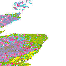
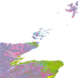
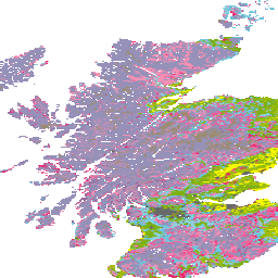
National scale land capability for agriculture (0)
The Land Capability Classification for Agriculture has as its objective the presentation of detailed information on soil, climate and relief in a form which will be of value to land use planners, agricultural advisers, farmers and others involved in optimising the use of land resources. The classification ranks land on the basis of its potential productivity and cropping flexibility determined by the extent to which its physical characteristics (soil, climate and relief) impose long term restrictions on its agricultural use.
There are currently no notifications for the service, click the feed icon to subscribe.