[unknown data provider] |
|
| Service health Now: |
|---|
- Interface
- Web Service, OGC Web Map Service 1.3.0
- Keywords
- Fees
- unknown
- Access constraints
- unknown
- Supported languages
- No INSPIRE Extended Capabilities (including service language support) given. See INSPIRE Technical Guidance - View Services for more information.
- Data provider
-
unknown (unverified)
Contact information:
- Service metadata
- No INSPIRE Extended Capabilities (including service metadata) given. See INSPIRE Technical Guidance - View Services for more information.
Ads by Google
WMS
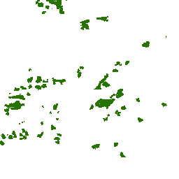
Available map layers (11)
Status 1:15,000,000 above (1)
A depiction of ROADMVUM that has data
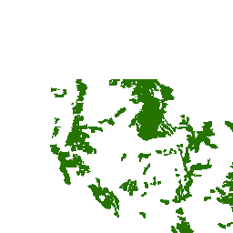
Status 1:15,000,000 (2)
A depiction of ROADMVUM that has data
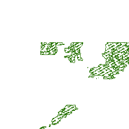
No Data (4)
A depiction of ROADMVUM that has data
Data Available (5)
A depiction of ROADMVUM that has data
No Data (7)
A depiction of ROADMVUM that has data
Data Available (8)
A depiction of ROADMVUM that has data
Status 1:400,000 (9)
A depiction of ROADMVUM that has data
Motor Vehicle Use Map: Trails (11)
The feature class indicates the specific types of motorized vehicles allowed on the designated routes and their seasons of use. The feature class is designed to be consistent with the MVUM (Motor Vehicle Use Map). It is compiled from the GIS Data Dictionary data and Infra tabular data that the administrative units have prepared for the creation of their MVUMs. Only trails with the symbol value of 5-12, 16, 17 are Forest Service System trails and contain data concerning their availability for motorized use. This data is published and refreshed on a unit by unit basis as needed. Individual unit's data must be verified and proved consistent with the published MVUMs prior to publication in the EDW. Go to this url for full metadata description: http://data.fs.usda.gov/geodata/edw/edw_resources/meta/S_USA.Trail_MVUM.xml
Motor Vehicle Use Map: Roads (12)
The feature class indicates the specific types of motorized vehicles allowed on the designated routes and their seasons of use. The feature class is designed to be consistent with the MVUM (Motor Vehicle Use Map). It is compiled from the GIS Data Dictionary data and NRM Infra tabular data that the administrative units have prepared for the creation of their MVUMs. Only roads with a SYMBOL attribute value of 1, 2, 3, 4, 11, and 12 are Forest Service System roads and contain data concerning their availability for OHV (Off Highway Vehicle) use. This data is published and refreshed on a unit by unit basis as needed. Data for each individual unit must be verified and proved consistent with the published MVUMs prior to publication.The Forest Service's Natural Resource Manager (NRM) Infrastructure (Infra) is the agency standard for managing and reporting information about inventory of constructed features and land units as well as the permits sold to the general public and to partners. Go to this url for full metadata description: http://data.fs.usda.gov/geodata/edw/edw_resources/meta/S_USA.Road_MVUM.xml
Motor Vehicle Use Map: Trails (14)
The feature class indicates the specific types of motorized vehicles allowed on the designated routes and their seasons of use. The feature class is designed to be consistent with the MVUM (Motor Vehicle Use Map). It is compiled from the GIS Data Dictionary data and Infra tabular data that the administrative units have prepared for the creation of their MVUMs. Only trails with the symbol value of 5-12, 16, 17 are Forest Service System trails and contain data concerning their availability for motorized use. This data is published and refreshed on a unit by unit basis as needed. Individual unit's data must be verified and proved consistent with the published MVUMs prior to publication in the EDW. Click this link for full metadata description: Go to this url for full metadata description: http://data.fs.usda.gov/geodata/edw/edw_resources/meta/S_USA.Trail_MVUM.xml
Motor Vehicle Use Map: Roads (15)
The feature class indicates the specific types of motorized vehicles allowed on the designated routes and their seasons of use. The feature class is designed to be consistent with the MVUM (Motor Vehicle Use Map). It is compiled from the GIS Data Dictionary data and NRM Infra tabular data that the administrative units have prepared for the creation of their MVUMs. Only roads with a SYMBOL attribute value of 1, 2, 3, 4, 11, and 12 are Forest Service System roads and contain data concerning their availability for OHV (Off Highway Vehicle) use. This data is published and refreshed on a unit by unit basis as needed. Data for each individual unit must be verified and proved consistent with the published MVUMs prior to publication.The Forest Service's Natural Resource Manager (NRM) Infrastructure (Infra) is the agency standard for managing and reporting information about inventory of constructed features and land units as well as the permits sold to the general public and to partners. Go to this url for full metadata description: http://data.fs.usda.gov/geodata/edw/edw_resources/meta/S_USA.Road_MVUM.xml
There are currently no notifications for the service, click the feed icon to subscribe.