Thüringer Ministerium für Infrastruktu… |
|
WMS TH DOP200 color
http://www.geoproxy.geoportal-th.de/geoproxy/services/DOP200RGB
| Service health Now: |
|---|
- Interface
- Web Service, OGC Web Map Service 1.3.0
- Keywords
- WMS_TH_DOP200_color, open data, opendata, Geobasisdaten, Geoproxy, TH, GDI TH, Freistaat Thüringen, Landesamt für Vermessung und Geoinformation, AdV, AdV-OWS-Basisprofil 1.0, AdV-WMS-Profil 4.0.0, WMS, Darstellungsdienst, Digitales Orthophoto, DOP, DOP200, farbig, view service, humanGeographicViewer, WMS
- Fees
- Dieses Angebot kann ab 2017-01-01 gemäß der "Datenlizenz Deutschland Namensnennung 2.0" (https://www.govdata.de/dl-de/by-2-0) genutzt werden. { "id": "dl-de-by-2.0", "name": "Datenlizenz Deutschland Namensnennung 2.0", "url": "https://www.govdata.de/dl-de/by-2-0 ", "quelle": "© GDI-Th" }
- Access constraints
- NONE. Es gelten keine Beschränkungen.
- Supported languages
- ger
- Data provider
-
Thüringer Ministerium für Infrastruktur und Landwirtschaft (unverified)
Contact information:
Kompetenzzentrum Geodateninfrastruktur Thüringen
Thüringer Ministerium für Infrastruktur und Landwirtschaft
postal:
Hohenwindenstr. 13 a, 99086 Erfurt, GermanyEmail:
Phone: +49 361 57-4176926
- Service metadata
Ads by Google
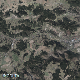
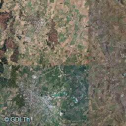
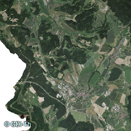
Geoproxy Thüringen WMS für DOP200 color. Der Web Map Service stellt flächendeckend DOP in der Ausprägung farbig (RBG) in der Bodenauflösung 200cm bereit.
Available map layers (1)
DOP Farbe 2m (DOP200RGB)
RGB200 Raster Data
There are currently no notifications for the service, click the feed icon to subscribe.