Geoscience Australia |
|
GA Bedrock and Surficial Geology
| Service health Now: |
|---|
- Interface
- Web Service, OGC Web Map Service 1.1.1
- Keywords
- OneGeology, Geology, Map, Australia, Bedrock, Surficial, Lithostratigraphy, Age, Contact, Fault, Shear
- Fees
- none
- Access constraints
- Copyright Commonwealth of Australia. This work is copyright. Unless otherwise specified on this website, you may display, print and reproduce this material in unaltered form only (retaining this notice) for your personal, non-commercial use, use within your organisation or, if you are an educational institution, use for educational purposes. Apart from any use as permitted under the Copyright Act 1968 or as otherwise specified on this website, all other rights are reserved. Requests and enquiries concerning copyright in the work should be addressed to the Information Services Branch, Geoscience Australia, GPO Box 378, CANBERRA, ACT, 2601 or email: copyright@ga.gov.au. See also http://www.ga.gov.au/about/copyright.jsp, and http://www.osdm.gov.au/OSDM/Policies+and+Guidelines/Spatial+Data+Access+and+Pricing/OSDM+Licence+Internet+-+no+registration/default.aspx
- Data provider
-
Geoscience Australia (unverified)
Contact information:
Web Operations Manager
Geoscience Australia
postal:
GPO Box 378, 2601 Canberra, AustraliaEmail:
Phone: +61 2 62499111
Ads by Google
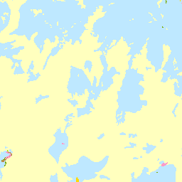
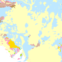
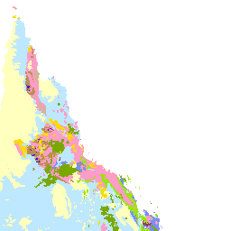
This OneGeology WMS service comprises a 1:2,500,000 scale digital geological map of Australia (2000) and 1:1,000,000 scale digital geological maps of Eastern Australia, Northern Territory, South Australia and Western Australia (2008). A scale limiter is placed upon the 1:1,000,000 scale data so that this detailed data can only be viewed when zoomed in to an appropriate viewing scale. The data represents the surface geology, including surficial unconsolidated deposits and outcropping (or near-outcropping) bedrock, geological unit contacts, faults and shear zones. The geological unit datasets are each represented by two layers - one classified according to the AGE of unit, and another classified according to LITHOSTRATIGRAPHY. Lithostratigraphic classification and description of the 1:1,000,000 scale data is according to the Australian Stratigraphic Units Database (https://www.ga.gov.au/oracle/stratnames/index.jsp). The 1:2,500,000 scale data employs a broader and more simplified classification of Australian geological units. This data and other digital geological datasets of Australia are available free from the Geoscience Australia website at https://www.ga.gov.au/products/servlet/controller?event=DEFINE_PRODUCTS.
Available map layers (21)
GA Bedrock and Surficial Geology (ONEGEOLOGY)
AUS GA 1:2.5M Geologic Unit - Lithostratigraphy (AUS_GA_2500k_BLS)
Geological units of Australia classified by lithostratigraphy, compiled at 1:2.5M scale, Geoscience Australia
AUS GA 1:2.5M Geologic Unit - Age (AUS_GA_2500k_BA)
Geological units of Australia classified by age, compiled at 1:2.5M scale, Geoscience Australia
East AUS GA 1:1M Geologic Unit - Lithostratigraphy (EastAUS_GA_1M_BLS)
Geological units of Eastern Australia classified by lithostratigraphy, compiled at 1:1M scale, Geoscience Australia
East AUS GA 1:1M Geologic Unit - Age (EastAUS_GA_1M_BA)
Geological units of Eastern Australia classified by age, compiled at 1:1M scale, Geoscience Australia
East AUS GA 1:1M Contacts (EastAUS_GA_1M_Contacts)
Geological unit contacts of Eastern Australia, compiled at 1:1M scale, Geoscience Australia
East AUS GA 1:1M Faults (EastAUS_GA_1M_Faults)
Faults of Eastern Australia, compiled at 1:1M scale, Geoscience Australia
East AUS GA 1:1M Shear Zones (EastAUS_GA_1M_Shears)
Shear Zones of Eastern Australia, compiled at 1:1M scale, Geoscience Australia
South AUS GA 1:1M Geologic Unit - Lithostratigraphy (SA_AUS_GA_1M_BLS)
Geological units of South Australia classified by lithostratigraphy, compiled at 1:1M scale, Geoscience Australia
South AUS GA 1:1M Geologic Unit - Age (SA_AUS_GA_1M_BA)
Geological units of South Australia classified by age, compiled at 1:1M scale, Geoscience Australia
South AUS GA 1:1M Contacts (SA_AUS_GA_1M_Contacts)
Geological unit contacts of South Australia, compiled at 1:1M scale, Geoscience Australia
South AUS GA 1:1M Faults (SA_AUS_GA_1M_Faults)
Faults of South Australia, compiled at 1:1M scale, Geoscience Australia
South AUS GA 1:1M Shear Zones (SA_AUS_GA_1M_Shears)
Shear Zones of South Australia, compiled at 1:1M scale, Geoscience Australia
Northern Territory AUS GA 1:1M Geologic Unit - Lithostratigraphy (NT_AUS_GA_1M_BLS)
Geological units of Northern Territory classified by lithostratigraphy, compiled at 1:1M scale, Geoscience Australia
Northern Territory AUS GA 1:1M Geologic Unit - Age (NT_AUS_GA_1M_BA)
Geological units of Northern Territory classified by age, compiled at 1:1M scale, Geoscience Australia
Northern Territory AUS GA 1:1M Contacts (NT_AUS_GA_1M_Contacts)
Geological unit contacts of Northern Territory, compiled at 1:1M scale, Geoscience Australia
Northern Territory AUS GA 1:1M Faults (NT_AUS_GA_1M_Faults)
Faults of Northern Territory, compiled at 1:1M scale, Geoscience Australia
Western AUS GA 1:1M Geologic Unit - Lithostratigraphy (WA_AUS_GA_1M_BLS)
Geological units of Western Australia classified by lithostratigraphy, compiled at 1:1M scale, Geoscience Australia
Western AUS GA 1:1M Geologic Unit - Age (WA_AUS_GA_1M_BA)
Geological units of Western Australia classified by age, compiled at 1:1M scale, Geoscience Australia
Western AUS GA 1:1M Contacts (WA_AUS_GA_1M_Contacts)
Geological unit contacts of Western Australia, compiled at 1:1M scale, Geoscience Australia
Western AUS GA 1:1M Faults (WA_AUS_GA_1M_Faults)
Faults of Western Australia, compiled at 1:1M scale, Geoscience Australia
There are currently no notifications for the service, click the feed icon to subscribe.