Direcció General de Protecció Civil |
|
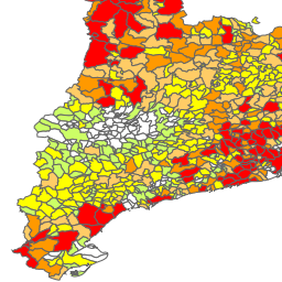
Mapa de Protecció Civil de Catalunya: Risc per Incendis Forestals.
| Service health Now: |
|---|
- Interface
- Web Service, OGC Web Map Service 1.3.0
- Keywords
- Protecció Civil, Catalunya, Riscos, Mapa
- Fees
- La informació subministrada a través del lloc web no pot ser reproduïda sense esmentar la font o sol¿licitar-ne l'autorització.
- Access constraints
- none
- Supported languages
- No INSPIRE Extended Capabilities (including service language support) given. See INSPIRE Technical Guidance - View Services for more information.
- Data provider
-
Direcció General de Protecció Civil (unverified)
Contact information:
Direcció General de Protecció Civil
MAILING ADDRESS:
Barcelona,Email:
- Service metadata
- No INSPIRE Extended Capabilities (including service metadata) given. See INSPIRE Technical Guidance - View Services for more information.
Ads by Google
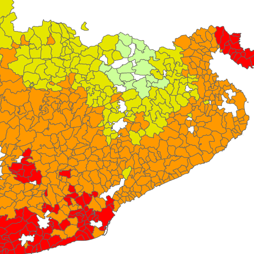
Identificació del perill d’incendi forestal per municipis, així com la vulnerabilitat.
Available map layers (3)
Mapa de Protecció Civil de Catalunya: Risc per Incendis Forestals. (Risc_Incendis)
Identificació del perill d’incendi forestal per municipis, així com la vulnerabilitat.
Vulnerabilitat (infocat_vulnerabilitat)
Perill (infocat_perill)
There are currently no notifications for the service, click the feed icon to subscribe.