Baltic Sea Hydrographic Commision, BSH… |
|
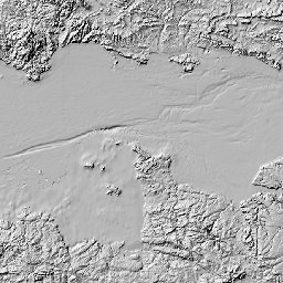
Baltic Sea Bathymetry Database v0.9.3, grid model 500m resolution
| Service health Now: |
|---|
- Interface
- Web Service, OGC Web Map Service 1.3.0
- Keywords
- Fees
- unknown
- Access constraints
- Licensed under Creative Commons CC-BY 3.0 Unported. Data, imagery and products derived from them are NOT to be used for navigation. See http://data.bshc.pro/legal/ for complete license, terms and conditions.
- Supported languages
- No INSPIRE Extended Capabilities (including service language support) given. See INSPIRE Technical Guidance - View Services for more information.
- Data provider
-
Baltic Sea Hydrographic Commision, BSHC c/o Swedish Maritime Administration (unverified)
Contact information:
Baltic Sea Hydrographic Commision, BSHC c/o Swedish Maritime Administration
Ostra Promenaden 7, 60228 Norrkoping, Sweden
Email:
- Service metadata
- No INSPIRE Extended Capabilities (including service metadata) given. See INSPIRE Technical Guidance - View Services for more information.
Ads by Google
This 500m bathymetric grid model is created using data from the countries around the baltic sea. Notice that this is modeled data, not actual measurements. The purpose of this database is to deliver a homogenous bathymetric model for the complete baltic sea at specfic resolutions. It is also important to notice that this data must not be used for navigation. Read the disclaimer for detailed terms and conditions. The model will be updated when new data is received from the participating countries.
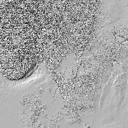
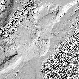
Available map layers (6)
Baltic Sea Bathymetry Database v0.9.3, grid model 500m resolution (bsbd-0.9.3)
This 500m bathymetric grid model is created using data from the countries around the baltic sea. Notice that this is modeled data, not actual measurements. The purpose of this database is to deliver a homogenous bathymetric model for the complete baltic sea at specfic resolutions. It is also important to notice that this data must not be used for navigation. Read the disclaimer for detailed terms and conditions. The model will be updated when new data is received from the participating countries.
land shaded relief (land)
land
landshade (landshade)
water color and shaded relief (water)
water
watercolor (watercolor)
watershade (watershade)
There are currently no notifications for the service, click the feed icon to subscribe.