[unknown data provider] |
|
OpenGeo Demo Web Map Service
| Service health Now: |
|---|
- Interface
- Web Service, OGC Web Map Service 1.3.0
- Keywords
- geoserver, wms
- Fees
- NONE
- Access constraints
- NONE
- Supported languages
- No INSPIRE Extended Capabilities (including service language support) given. See INSPIRE Technical Guidance - View Services for more information.
- Data provider
-
unknown (unverified)
Contact information:
- Service metadata
- No INSPIRE Extended Capabilities (including service metadata) given. See INSPIRE Technical Guidance - View Services for more information.
Ads by Google
Available map layers (72)
Dark Base Map (maps:dark)
Layer-Group type layer: maps:dark
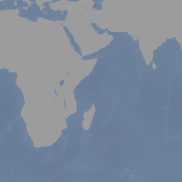
Natural Earth Base Map (ne:ne)
Base map composed of data from http://www.naturalearthdata.com.
osm:osm (osm:osm)
Layer-Group type layer: osm:osm
Tasmania Base Map (topp:tasmania)
Base map consisting of layers from Tasmania, taken from the vanilla GeoServer configuration.
North America sample imagery (nurc:Img_Sample)
Natural Earth 1 (ne:NE1_HR_LC_SR_W_DR)
With Shaded Relief, Water, and Drainages. Coloring based on land cover.
OB_LR_ti_ov (maps:OB_LR_ti_ov)
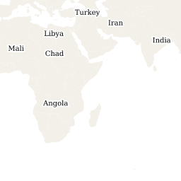
National Administrative Boundaries (osm:admin_01234)
Administrative boundary levels 0 through 4 including national borders as well as provincial/state boundaries.
Regional Administrative Boundaries (osm:admin_5678)
Administrative boundary levels 5 through 8 including county and municipality boundaries.
Other Administrative Boundaries (osm:admin_other)
Administrative boundary levels 9 and 10 including neighbourhoods.
archsites (og:archsites)
bluemarble (nasa:bluemarble)
bugsites (og:bugsites)
Buildings (osm:buildings)
Residential buildings.
Buildings (osm:buildings_lz)
Non-residential buildings including supermarkets, places of worship, and railway stations.
Urban Areas (osm:builtup_area)
Urban or "built-up" regions.
Glaciers (osm:glaciers_text)
Glacier names.
Highway Casing (osm:highway_area_casing)
Highway case lines.
Highway Fill (osm:highway_area_fill)
Fill lines for highways.
Landcover (osm:landcover)
Area land cover features representing physical material of the earth such as grass, trees, and water.
Cutlines (osm:landcover_line)
Forest cut lines.
landuse (maps:landuse)
Landuse (osm:landuse_overlay)
Human uses of land including military and nature reserves.
Minor Road Casing (osm:minor_roads_casing)
Minor road case lines.
Minor Road Fill (osm:minor_roads_fill)
Fill lines for minor roads.
natural (maps:natural)
Country Boundary Lines (ne:ne_10m_admin_0_boundary_lines_land)
Country boundaries on land and offshore.
Countries (ne:ne_10m_admin_0_countries)
The 247 countries in the world.
State Boundaries (ne:ne_10m_admin_1_states_provinces_lines_shp)
Internal administrative boundaries.
ne_10m_lakes (maps:ne_10m_lakes)
ne_10m_land (maps:ne_10m_land)
Populated Places (osm:ne_10m_populated_places)
Natural Earth 1:10m populated places.
Populated Places (ne:ne_10m_populated_places)
City and town points, from Tokyo to Wasilla, Cairo to Kandahar.
Roads (ne:ne_10m_roads)
Basic roads from CEC North America Environmental Atlas.
Roads North America (ne:ne_10m_roads_north_america)
Basic roads from CEC North America Environmental Atlas.
ne_10m_wgs84_bounding_box (maps:ne_10m_wgs84_bounding_box)
Land Boundaries (osm:ne_110m_admin_0_boundary_lines_land)
Natural Earth 1:100m land boundary lines.
ne_50m_admin_0_countries (maps:ne_50m_admin_0_countries)
ne_50m_land (maps:ne_50m_land)
National Elevation Dataset (usgs:ned)
Elevation from 1/3 arc second NED.
National Landcover Dataset (usgs:nlcd)
Ocean (maps:ocean)
parks (maps:parks)
Capital Cities (osm:placenames_capital)
Place names for capital cities and towns.
Countries and States (osm:placenames_large)
Large scale place names for countries and states.
Cities (osm:placenames_medium)
Medium scale place names for cities and towns.
placenames-small (osm:placenames_small)
Small scale place names for villages and suburbs.
Barriers (osm:polygon_barrier)
On the ground physical structures that block or impede movement.
Coastlines (osm:processed_p)
Coastlines.
restricted (og:restricted)
Roads (osm:roads)
OpenStreetMap roads.
roads (og:roads)
Road Names (osm:roads_text_name)
Road names.
Road Reference Names (osm:roads_text_ref)
Reference names for highways, exists, routes, etc...
Road Reference Names Large (osm:roads_text_ref_low_zoom)
Large scale reference names for highways, exists, routes, etc...
World (osm:shoreline_300)
World polygons.
Sporting Grounds (osm:sports_grounds)
Sporting facilities such as stadiums, pitches, and tracks.
USA Population (topp:states)
2000 census data for United States.
streams (og:streams)
Tasmania Cities (topp:tasmania_cities)
Cities in Tasmania.
Tasmania Roads (topp:tasmania_roads)
Primary Tasmania roads.
Tasmania State Boundaries (topp:tasmania_state_boundaries)
Tasmania state boundaries.
Tasmania Water Bodies (topp:tasmania_water_bodies)
Tasmania water bodies
Census Tracts (usgs:tracts)
Water Area (osm:water_areas)
Area water features such as lakes, reservoir, and basins.
Wetlands (osm:water_areas_overlay)
Wetlands and marshes.
Water Lines (osm:water_lines)
Linear water features such as rivers, streams, and canals.
Water Line Casing (osm:water_lines_casing)
Linear water feature case lines.
Rivers (osm:water_lines_low_zoom)
Rivers.
wps4623406955417507685tiff1569225987181868248 (ne:wps4623406955417507685tiff1569225987181868248)
wps4693812227741231645tiff1648145287719090274 (ne:wps4693812227741231645tiff1648145287719090274)
wps5380428517378077718tiff6289779593078582304 (ne:wps5380428517378077718tiff6289779593078582304)
There are currently no notifications for the service, click the feed icon to subscribe.