Environment Canada / Environnement Can… |
|
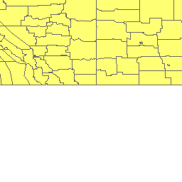
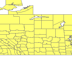
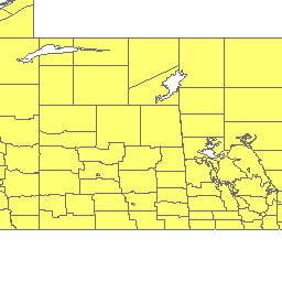
Public Program forecast location zones / Programme publique zones de localisation de prévision
http://ec.gc.ca/arcgis/services/data_donnees/be12386d/MapServer/WmsServer
| Service health Now: |
|---|
- Interface
- Web Service, OGC Web Map Service 1.3.0
- Keywords
- polygons, boundaries, shapes, forecast zones, forecast sites, forecast locations, shape files, locations, CLC, public program, standard level, polygones, limites, forme, de zones de prévision, de sites de prévision, d’emplacements de prévision, shape files, emplacements, CLC, programme public, niveau standard
- Fees
- None / Aucun
- Access constraints
- unknown
- Supported languages
- No INSPIRE Extended Capabilities (including service language support) given. See INSPIRE Technical Guidance - View Services for more information.
- Data provider
-
Environment Canada / Environnement Canada (unverified)
Contact information:
Inquiry Centre / Informathèque
Environment Canada / Environnement Canada
10 Wellington, 23rd Floor / 10, rue Wellington, 23e étage, K1A0H3 Gatineau, Canada
Email:
Phone: 800-668-6767
- Service metadata
- No INSPIRE Extended Capabilities (including service metadata) given. See INSPIRE Technical Guidance - View Services for more information.
The PubStdZone layer is a collection of public program forecast location zone polygons that represents bounded measurable locations at the Public program Standard level. The public program standard level is used in most forecasts, warnings, watches, advisories and special weather statement. With the exception of the Manitoba Lakes, the layer is made up of mostly the land kind of polygons. The layer is made up of three depictions, cartographic detailed (with proper shorelines and high resolution polygons), cartographic coarse (with generalized shorelines and low resolution polygons), and digital exaggerated (with exaggerated shorelines and low resolution polygons). The digital layer (exaggerated) is a collection of polygons where shoreline boundaries are stretched offshore for the land polygons and inland for the water polygons. In this “Exaggerated” layer, the boundaries are made smooth to reduce the number of polygon vertices. The PubStdZone layer is presented in the polygon package in two coordinate systems, "Projected" (Lambert Conformal Conic) and "Unprojected" (Geographical Coordinated System). / La couche PubStdZone est un ensemble de polygones d'emplacements de prévision des programmes publics qui représentent des emplacements délimités et mesurables au niveau standard du programme public. Le niveau standard du programme public est utilisé dans la majorité des prévisions, avertissements, veilles, avis et bulletins météorologiques spéciaux. À l'exception des lacs du Manitoba, la couche est constituée principalement de polygones de type terrestre. Elle comprend trois représentations : cartographique détaillée (lignes de rivage correctement indiquées et polygones en haute résolution), cartographique grossière (lignes de rivage approximatives et polygones en basse résolution) et numérique exagérée (lignes de rivage exagérées et polygones en basse résolution). La couche numérique (exagérée) est un ensemble de polygones où les limites des lignes de rivage sont étendues au large pour les polygones terrestres et à l'intérieur des terres pour les polygones de type eau. Dans cette couche « exagérée », les limites sont arrondies de façon à réduire le nombre de sommets des polygones. La couche PubStdZone est présentée dans le progiciel de polygones en deux systèmes de coordonnées : « projetées » (projection conique conforme de Lambert) et « non projetées » (système géographique coordonné).
Available map layers (1)
land_PubStdZone_detail_proj (0)