http://maps.gns.cri.nz/geoserver21/gwc… |
|
Web Map Tile Service - GeoWebCache
| Service health Now: |
|---|
- Interface
- Web Service, OGC Web Map Tiling Service WMTS_1.0.0
- Keywords
- Fees
- unknown
- Access constraints
- unknown
- Supported languages
- No INSPIRE Extended Capabilities (including service language support) given. See INSPIRE Technical Guidance - View Services for more information.
- Data provider
-
http://maps.gns.cri.nz/geoserver21/gwc/service/wmts (unverified)
Contact information:
GeoWebCache User
http://maps.gns.cri.nz/geoserver21/gwc/service/wmts
- Service metadata
- No INSPIRE Extended Capabilities (including service metadata) given. See INSPIRE Technical Guidance - View Services for more information.
Ads by Google
Available map layers (44)
SeabedTWTGridWM (gns:SeabedTWTgrid)
Gridded data representing Two Way Travel Time to Seabed
NZ_GNS_Landslide_Locations (gns:NZ_GNS_Landslide_Locations)
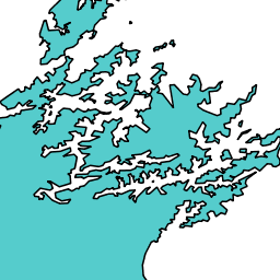
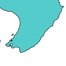
coast_1m_Type (gns:coast_1m)
PET_AKL (gns:PET_AKL)
PETROLEUM.NZ_BLOCKS_OFFER_2013 (gns:PETROLEUM.NZ_BLOCKS_OFFER_2013)
TopEarlyCretaceousZGridWM (gns:TopEarlyCretaceousDepthgrid)
Gridded data representing depth to Top Early Cretaceous
PET_CAB (gns:PET_CAB)
GIS.TERRITORIAL_COUNCIL (gns:GIS.TERRITORIAL_COUNCIL)
TopMioceneTWTGridWM (gns:TopMioceneTWTgrid)
Gridded data representing Two Way Travel Time to Top Miocene
FR.FRED_SITE_VIEW (gns:FR.FRED_SITE_VIEW)
PET_GNSP (gns:PET_GNSP)
PET_INSR (gns:PET_INSR)
PETROLEUM.DOC_PUBLICCONSERVATIONLAND (gns:PETROLEUM.DOC_PUBLICCONSERVATIONLAND)
PET_GEOP (gns:PET_GEOP)
TopEarlyCretaceousTopHikPlatIsopachGridWM (gns:TopEarlyCretaceousTopHikurangiPlateauisopachgrid)
TopMioceneTopPaleogeneIsopachZGridWM (gns:TopMioceneTopOligoceneisopachgrid)
Gridded data representing thickness of Top Miocene to Top Paleogene interval in metres
TopPaleogeneTopEarlyCretaceousIsopachZGridWM (gns:TopOligoceneTopEarlyCreatceousisopachgrid)
Gridded data representing thickness of Top Paleogene to Top Early Cretaceous interval in metres
PET_WIOF (gns:PET_WIOF)
PET_GNSC (gns:PET_GNSC)
PET_NZGS (gns:PET_NZGS)
PET_GNSD (gns:PET_GNSD)
SeabedTopMioceneIsopachZGridWM (gns:SeabedTopMioceneisopachgrid)
Gridded data representing thickness of Seabed to Top Miocene interval in metres
MASTERFILE_AREAS (gns:MASTERFILE_AREAS)
seismic (gns:2D_SEIS_LINES)
PET_MAS (gns:PET_MAS)
PET_WAK (gns:PET_WAK)
PSV (gns:PSV)
TopPaleogeneZGridWM (gns:TopPaleogeneDepthgrid)
Gridded data representing depth to Top Paleogene
SeabedTopHikurangiPlateauIsopachZGridWM (gns:SeabedTopHikurangiPlateauisopachgrid)
Gridded data representing thickness of Seabed to Top Hikurangi Plateau interval in metres
PET_OTH (gns:PET_OTH)
TopEarlyCretaceousDepthcontours (gns:TopEarlyCretaceousDepthcontours)
PET_ANU (gns:PET_ANU)
PET_DEVORA (gns:PET_DEVORA)
PETROLEUM.NZ_SINGLEBEAM (gns:PETROLEUM.NZ_SINGLEBEAM)
PETROLEUM.NZ_TERRITORIAL_12_MILE_WATERS (gns:PETROLEUM.NZ_TERRITORIAL_12_MILE_WATERS)
TopEarlyCretaceousTWTGridWM (gns:TopEarlyCretaceousTWTgrid)
Gridded data representing Two Way Travel Time to Top Early Cretaceous
TopPaleogeneTWTGridWM (gns:TopPaleogeneTWTgrid)
Gridded data representing Two Way Travel Time to Top Paleogene
PET_VIC (gns:PET_VIC)
NZ_GNS_Landslide_Features (gns:NZ_GNS_Landslide_Features)
TopHikurangiPlateauZGridWM (gns:TopHikurangiPlateauDepthgrid)
Gridded data representing depth to Top Hikurangi Plateau
SeabedZGridWM (gns:Seabeddepthgrid)
Gridded data representing depth to Seabed
fsv (gns:fsv)
TopMioceneZGridWM (gns:TopMioceneDepthGrid)
Gridded data representing depth to Top Miocene
PET_OTA (gns:PET_OTA)
There are currently no notifications for the service, click the feed icon to subscribe.