http://cdetux2.unibe.ch/geoserver/gwc/… |
|
Web Map Tile Service - GeoWebCache

| Service health Now: |
|---|
- Interface
- Web Service, OGC Web Map Tiling Service WMTS_1.0.0
- Keywords
- Fees
- unknown
- Access constraints
- unknown
- Supported languages
- No INSPIRE Extended Capabilities (including service language support) given. See INSPIRE Technical Guidance - View Services for more information.
- Data provider
-
http://cdetux2.unibe.ch/geoserver/gwc/service/wmts (unverified)
Contact information:
GeoWebCache User
http://cdetux2.unibe.ch/geoserver/gwc/service/wmts
- Service metadata
- No INSPIRE Extended Capabilities (including service metadata) given. See INSPIRE Technical Guidance - View Services for more information.
Ads by Google
Available map layers (55)
Laos: Share of households being farm household (w_pct_farmhh)
This layer depicts the share of households being farm household. Data have been collected during the Agricultural Census in 2011 and are provided through Lao DECIDE Info.
vw_map_sla_myjava_recare_2014 (wocat:vw_map_sla_myjava_recare_2014)
WOCAT QM base map RECARE project, Myjava, Slovakia, 2014
vw_map_nep_rolpa_2015 (wocat:vw_map_nep_rolpa_2015)
WOCAT basemap for Rolpa, Nepal. Published 2015
globgmbarugdtmpzwgs2 (mountain:globgmbarugdtmpzwgs2)
accessability (lo:accessability)
Estimated travel time to the nearest city of 50,000 or more people in year 2000.
Laos: Population density (pop_density)
This map shows the population density, expressed as the number of people per square kilometer (km²). It is calculated by dividing the number of people living in a particular village by its estimated area. The density indicates where people live, how many occupy a given space, and where services like education, health or transportation may be needed in the future. This layer is provided by Lao DECIDE Info.
vw_map_pol_wroclaw_2015 (wocat:vw_map_pol_wroclaw_2015)
WOCAT base map for Wroclaw, Poland Year of publication: 2015
vw_map_hai_les_irois_2015 (wocat:vw_map_hai_les_irois_2015)
WOCAT base map for Les Irois, Haiti Published 2015
vw_map_bol_sipesipe_2014 (wocat:vw_map_bol_sipesipe_2014)
WOCAT QM base map for Sipesipe, Bolivia, 2014
vw_map_hai_bonbon_2015 (wocat:vw_map_hai_bonbon_2015)
WOCAT basemap for Bonbon, Haiti Published 2015
vw_map_ice_recare_gunnarsholt_2014 (wocat:vw_map_ice_recare_gunnarsholt_2014)
WOCAT base map for Gunnarsholt, Iceland Year: 2004 Project: RECARE
vw_map_pol_poznan_2015 (wocat:vw_map_pol_poznan_2015)
WOCAT base map for Poznan, Poland Year of publication: 2015
vw_map_hai_abricots_2015 (wocat:vw_map_hai_abricots_2015)
WOCAT base map for the questionnaire on maps, Abricots, Haiti Year of publication: 2015
vw_map_hai_jeremie_2015 (wocat:vw_map_hai_jeremie_2015)
WOCAT base map for Jeremie, Haiti Year of publication: 2015
Seasonal road accessibility (lo:laos_w_road_access)
vw_map_tun_mkhachbiya_2014 (wocat:vw_map_tun_mkhachbiya_2014)
WOCAT base map for mkhachbiya, Tunesia, 2014
vw_map_rom_recare_2014 (wocat:vw_map_rom_recare_2014)
WOCAT base map for the recare project in Romania. Year: 2014
Accessibility to province capital (lo:laos_t_to_prov_capital_mean_min)
Mean travel time in minutes to province capital
Percentage of economically active population (lo:laos_pop_econ_active_pct)
Number of economically active persons aged 10 years and older as percent of the total population age 10 and older minus the number of the population with not stated main activity.
vw_map_net_berkenwoude_2014 (wocat:vw_map_net_berkenwoude_2014)
WOCAT base map for Berkenwoude, Netherlands. Year of publication: 2015 Based on the work in RECARE project
vw_map_hai_anse_d_hainault_2015 (wocat:vw_map_hai_anse_d_hainault_2015)
WOCAT base map for Anse d'Hainault, Haiti Published: 2015
vw_map_unk_isle_of_purbeck_2014_v2 (wocat:vw_map_unk_isle_of_purbeck_2014_v2)
WOCAT base map for Isle of Purbeck, United Kingdom This is an updated version 2 Published 2015
raster (topp:raster)
Raster demo layer
vw_map_spa_canyoles_2015 (wocat:vw_map_spa_canyoles_2015)
WOCAT base map for Canyoles, Spain Date of Publication: 2015 Project: RECARE
MODIS NDVI trend (vi-ts:modis_ndvi_trend)
Trend of MODIS NDVI time series 2001 to 2013. Used on vi-ts.org by Elias Hodel and Adrian Weber
vw_map_unk_isle_of_purbeck_2014 (wocat:vw_map_unk_isle_of_purbeck_2014)
WOCAT base map for Isle of Purbeck, United Kingdom Part of the RECARE project Year: 2014
vw_map_net_eibergen_2014 (wocat:vw_map_net_eibergen_2014)
WOCAT base map for Eibergen, Netherlands Created in the framework of the RECARE project. Year: 2014
Laos: Accessibility to province capitals (t_to_prov_capital_mean_min)
The province accessibility map depicts the travel time from any point in the country to the nearest provincial capital. This representation of accessibility is based on a cost-distance model that estimated travel time using the best means of transport available. This layer is provided by Lao DECIDE Info.
vw_map_spa_guadiamar_2014 (wocat:vw_map_spa_guadiamar_2014)
WOCAT base map for Guadiamar, Spain. Published 2015 Project: RECARE
Country boundaries (gn:gboundaries)
Derived from GAUL Country Boundaries
vw_map_hai_dame_marie_2015 (wocat:vw_map_hai_dame_marie_2015)
WOCAT base map for Dame Marie, Haiti Published in 2015.
Laos: Percentage of economically active population (pop_econ_active_pct)
The economically active population shown in this map is that population, which is engaged in daily work of many different kinds. The 2005 National Population and Housing Census indicated that 66.6% of the population aged 10 years and older was engaged in economic activities during the 12 months prior to the census. Among those considered “employed” are many self-employed or people working “on-their-own-account” as well as unpaid family workers, whereas the “unemployed” are those considered as looking for work. It is important to note that household duties are not regarded as economic activities. Normally, the class of economically active people starts at the age 15 years and older however the population census showed that 18% of children between 10 and 14 years are in formal employment while 81% are said to be students. Nevertheless, working children make up 5% of the Lao labor force and therefore this map consider the population 10 years of age and older. Data have been collected during the Population Census in 2005 and are provided through Lao DECIDE Info.
Population Density 2008 (lo:lspop_2008)
globmtedhilldtemreslwgs1 (mountain:globmtedhilldtemreslwgs1)
Laos: Incidence of Poverty (poverty_incidence)
This map depicts the poverty rates at the village level measured as a percentage of the population living below the poverty line. The poverty line used, is defined as the amount of money required to purchase 2,100 calories per person per day, plus a non-food allowance. While the national poverty rate was an estimated 34.7%, the poverty rates at the village level vary widely. Household per capita expenditure was estimated by applying small-area estimation techniques using Population and Housing Census of 2005 in combination with Lao Expenditure and Consumption Survey data of 2003 (LECS III). This layer is provided by Lao DECIDE Info.
Protected Area (lo:protected_area)
Protected Areas from www.opendevelopmentcambodia.net
Population density (lo:laos_pop_density)
vw_map_ita_veneto_2014 (wocat:vw_map_ita_veneto_2014)
Wocat basemap in Veneto, Italy Year: 2014
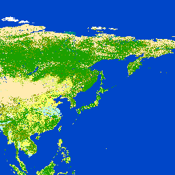
globcover_2009 (lo:globcover_2009)
Incidence of poverty (lo:laos_poverty_incidence)
Percent of population living below the poverty line
vw_map_swi_frienisberg_2015 (wocat:vw_map_swi_frienisberg_2015)
WOCAT base map for the questionnaire on Maps Country: Switzerland Location: Frienisberg Year: 2015
laos_protected_area (lo:laos_protected_area)
National protected areas in Laos.
Laos: Season the road is accessible (w_road_access)
This layer depicts in which seasons a village is accessible by road. Data have been collected during the Agricultural Census in 2011 and are provided through Lao DECIDE Info.
vw_map_gre_timpaki_2014 (wocat:vw_map_gre_timpaki_2014)
WOCAT base map for Tiimpaki, Greece. Year: 2014
vw_map_swe_recare_2013 (wocat:vw_map_swe_recare_2013)
WOCAT base map for Sweden, reated in the RECARE project Year of publication: 2014
vw_map_hai_moron_2015 (wocat:vw_map_hai_moron_2015)
WOCAT basemap for Moron, Haiti Published 2015
po_1072052_pansharpened (liberia:po_1072052_pansharpened)
po_1072052_pansharpened
vw_map_hai_chambellan_2015 (wocat:vw_map_hai_chambellan_2015)
WOCAT base map for Chambellan, Haiti Published 2015
Share of households being farm household (lo:laos_w_pct_farmhh)
community forests (lo:community_forest)
Community forests from www.opendevelopmentcambodia.net
vw_map_cyp_recare_2014 (wocat:vw_map_cyp_recare_2014)
WOCAT base map for the recare project site in Cyprus. Year of publication: 2014
vw_map_nor_recare_krakstad_2014 (wocat:vw_map_nor_recare_krakstad_2014)
WOCAT basemap for Krakstad, Norway, 2014 Part of the RECARE project.
globkapoclaswgs3 (mountain:globkapoclaswgs3)
Global mountain database
vw_map_por_caramulo_2014 (wocat:vw_map_por_caramulo_2014)
WOCAT base map for Caramulo, Portugal, part of the RECARE project. Year: 2014
Blue Marble world image (gn:world)
There are currently no notifications for the service, click the feed icon to subscribe.