Naval Research Lab |
|
NRL Tileserver
| Service health Now: |
|---|
- Interface
- Web Service, OGC Web Map Service 1.1.1
- Keywords
- NRL
- Fees
- none
- Access constraints
- none
- Data provider
-
Naval Research Lab (unverified)
Contact information:
NRL Geospatial Computing
Naval Research Lab
postal:
NRL Code 7440, 39529 Stennis Space Center, USAEmail:
Phone: +1 228 688-5185
Ads by Google
WMS-based access to NRL's Tileserver. Provides access to publically releasable imagery and maps.
Available map layers (35)
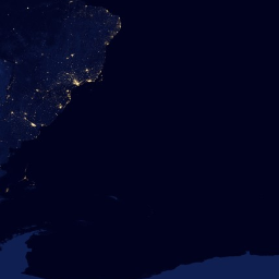
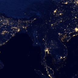
BlackMarble (BlackMarble)
NASA Nighttime imagery
BlueMarble (bluemarble)
NASA BlueMarble Imagery
Controlled Imagery Base 1m (CIB01)
NGA Controlled Image Base (CIB) 1 meter imagery. Limited to a small area approved for public release.
Controlled Imagery Base 5m (CIB05)
NGA Controlled Image Base (CIB) 5 meter imagery. Limited to a small area approved for public release.
Digital Raster Graphics (1:100K) (DRG_US_100K)
USGS Digital Raster Graphics Chart over Continental US and Hawaii - 1:100,000
Digital Raster Graphics (1:24K) (DRG_US_24K)
USGS Digital Raster Graphics Chart over Continental US and Hawaii - 1:24,000
Digital Raster Graphics (1:25K) (DRG_US_25K)
USGS Digital Raster Graphics Chart over Continental US - 1:25,000
Digital Raster Graphics Alaska (1:63K) (DRG_US_Alaska_63K)
USGS Digital Raster Graphics Chart over Alaska - 1:63,360
FAA Sectional Charts (FAASectionals)
FAA Sectional Charts
FAA Terminal Area Charts (FAATerminalAreaChart)
FAA Terminal Area Charts
FAA World Aeronautical Charts (FAAWorldAeronauticalCharts)
FAA World Aeronautical Charts
GLORIA Sidescan Sonar (GLORIASideScan)
Sidescan sonar in Gulf of Mexico
JOGA_250K (JOGA_250K)
Joint Operations Graphic--Air - 1:250,000
Landsat7 Imagery (Landsat7)
Imagery from Landsat7
NAIP (NAIP)
USGS National Agriculture Imagery Program. 1 meter imagery of the US
NOAA Raster Nautical Charts (1:10K) (RNC_10K)
NOAA Raster Nautical Charts (1:10K)
NOAA Raster Nautical Charts (1:10M) (RNC_10M)
NOAA Raster Nautical Charts (1:10M)
NOAA Raster Nautical Charts (1:120K) (RNC_120K)
NOAA Raster Nautical Charts (1:120K)
NOAA Raster Nautical Charts (1:1M) (RNC_1M)
NOAA Raster Nautical Charts (1:1M)
NOAA Raster Nautical Charts (1:20K) (RNC_20K)
NOAA Raster Nautical Charts (1:20K)
NOAA Raster Nautical Charts (1:300K) (RNC_300K)
NOAA Raster Nautical Charts (1:300K)
NOAA Raster Nautical Charts (1:3M) (RNC_3M)
NOAA Raster Nautical Charts (1:3M)
NOAA Raster Nautical Charts (1:40K) (RNC_40K)
NOAA Raster Nautical Charts (1:40K)
NOAA Raster Nautical Charts (1:4M) (RNC_4M)
NOAA Raster Nautical Charts (1:4M)
NOAA Raster Nautical Charts (1:80K) (RNC_80K)
NOAA Raster Nautical Charts (1:80K)
NOAA Raster Nautical Charts Oil and Gas Leases (1:300K) (RNC_300K_OilAndGasLeases)
NOAA Raster Nautical Charts Oil and Gas Leases (1:300K)
ONC_1M (ONC_1M)
Operational Navigation Charts - 1:1,000,000
Post-Katrina Imagery (GULFCOAST_KATRINA)
NOAA imagery of New Orleans and the Mississippi Gulf Coast after Hurrican Katrina
Pre-Katrina Imagery (PreKatrinaNewOrleans)
Pre-Katrina imagery of New Orleans
TLM_50K (TLM_50K)
Topographic Line Maps - 1:50,000
TLM_50K_ECRG (TLM_50K_ECRG)
Topographic Line Maps - 1:50,000--ECRG
TPC_500K (TPC_500K)
Tactical Pilotage Charts - 1:500,000
TPC_500K_ECRG (TPC_500K_ECRG)
Tactical Pilotage Charts - 1:500,000--ECRG
US Canada Border Imagery (US_CANADA_BorderImagery)
USGS High Resolution Color Orthorectified Imagery over the US/CANADA Border
US Mexico Border Imagery (US_MEXICO_BorderImagery)
USGS High Resolution Color Orthorectified Imagery over the US/MEXICO Border
There are currently no notifications for the service, click the feed icon to subscribe.