CREAF |
|
CREAF map server
| Service health Now: |
|---|
- Interface
- Web Service, OGC Web Map Service 1.3.0
- Keywords
- Land cover, Land use, Forest inventory
- Fees
- none
- Access constraints
- none
- Supported languages
- No INSPIRE Extended Capabilities (including service language support) given. See INSPIRE Technical Guidance - View Services for more information.
- Data provider
-
CREAF (unverified)
Contact information:
Joan Masó
CREAF
postal:
Fac. Ciencies. Universitat Autònoma de Barcelona, 08193 Bellaterra, SpainEmail:
Phone: +34 93 581 1312
- Service metadata
- No INSPIRE Extended Capabilities (including service metadata) given. See INSPIRE Technical Guidance - View Services for more information.
Ads by Google
CREAF map server build based on MiraMon technology. Contact: contacte@miramon.uab.es. Maps produced by CREAF: Land cover, Forest Inventary points...
Available map layers (26)
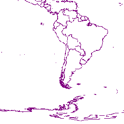
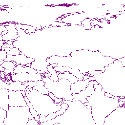
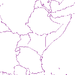
Administrative Boundaries - Country Level (admin_level0-world)
The sub Country Administrative Units 1998 GeoDataset represents a small-scale political map of the world. The data are generalized and were designed for display at scales to about 1:10,000,000. The data were generalized from ESRI's ArcWorld Supplement Map data. Country codes are from U.S. Federal Information Processing Standards (FIPS) version 10-4. World sub Country Administrative Units represent 2605 first level administrative units such as states and provinces with 14 descriptive fields.
Administrative Boundaries - First Level (admin_level1-world)
The sub Country Administrative Units 1998 GeoDataset represents a small-scale political map of the world. The data are generalized and were designed for display at scales to about 1:10,000,000. The data were generalized from ESRI's ArcWorld Supplement Map data. Country codes are from U.S. Federal Information Processing Standards (FIPS) version 10-4. World sub Country Administrative Units represent 2605 first level administrative units such as states and provinces with 14 descriptive fields.
Global Self-consistant Hierarchical High-resolution Shorelines (GSHHS) (gshhs_f-world)
GSHHS Version 1.2 May 18, 1999
Global Land Cover Characterization (GLCC) (glcc-world)
GLCC Version 2.0
Global Forest Resources Assessment (FRA 2000) (fra2000-world)
Near-global digital elevation model (DEM) of the Earth using radar interferometry (SRTM3-World)
Shuttle Radar Topography Mission - 3 arc-second. The Shuttle Radar Topography Mission (SRTM) data products result from a collaborative mission by the National Aeronautics and Space Administration (NASA), the National Imagery and Mapping Agency (NIMA), the German space agency (DLR) and Italian space agency (ASI), to generate a near-global digital elevation model (DEM) of the Earth using radar interferometry. The SRTM-1 (1 arc-second) and SRTM-3 (3 arc-second) digital elevation models are being developed from the SRTM C-band radar observations for selected regions to satisfy the needs of NASA related projects and to speed the evaluation of acquisition and processing and applications algorithms. The SRTM-1 and SRTM-3 result from special processing of the SRTM data in response to requests from Principal Investigators selected under NASA's Solid Earth and Natural Hazards Program, as well as other special requests from NIMA and NASA. The SRTM-1 and SRTM-3 data are preliminary products distributed for evaluation by the research and applications user community.
ETOPO2 - 2 minute Worldwide Bathymetry/Topography (ETOPO2-World)
Data taken from National Geophysical Data Center(NGDC) CD-ROM, ETOPO2. Global 2' Elevations, September 2001. Author: Dr. Peter W. Sloss (Peter.W.Sloss@noaa.gov), NOAA/NGDC, Mail Code E/GC3, 325 Broadway, Boulder, CO USA 80305. tel:303-497-6119, fax 303-497-6513.
Blue Marble 2002 (true-color) (BlueMarble_2002)
Blue Marble Next Generation (true-color) (BlueMarble_NG)
NOAA AVHRR NDVI 1992-93 April (NDVI9293-World)
NOAA AVHRR NDVI 1992-93 January (NDVI9293jan-World)
NOAA AVHRR NDVI 1992-93 February (NDVI9293feb-World)
NOAA AVHRR NDVI 1992-93 March (NDVI9293mar-World)
NOAA AVHRR NDVI 1992-93 April (NDVI9293apr-World)
NOAA AVHRR NDVI 1992-93 May (NDVI9293may-World)
NOAA AVHRR NDVI 1992-93 June (NDVI9293jun-World)
NOAA AVHRR NDVI 1992-93 July (NDVI9293jul-World)
NOAA AVHRR NDVI 1992-93 August (NDVI9293aug-World)
NOAA AVHRR NDVI 1992-93 September (NDVI9293sep-World)
NOAA AVHRR NDVI 1992-93 Octuber (NDVI9293oct-World)
NOAA AVHRR NDVI 1992-93 November (NDVI9293nov-World)
NOAA AVHRR NDVI 1992-93 December (NDVI9293dec-World)
Nighttime Lights of the World 1992-93 (ols1992_93-World)
Nighttime Lights of the World 1994-95 (ols1994_95-World)
Nighttime Lights of the World 1996-97 (ols1996_97-World)
Nighttime Lights of the World 2000 (ols2000-World)
There are currently no notifications for the service, click the feed icon to subscribe.