University of Texas at El Paso, System… |
|
Arctic Research Mapping Application (ARMAP) Countries, 35N
http://arcticdata.utep.edu/arcgis/services/ARMAP_Countries_35N_EPSG4326/MapServer/WMSServer
| Service health Now: |
|---|
- Interface
- Web Service, OGC Web Map Service 1.3.0
- Keywords
- countries,Arctic,international boundaries,coastlines,international codes
- Fees
- Free
- Access constraints
- Unrestricted. Please credit: G.W. Johnson, A.G. Gaylord, J.J. Brady, R. Cody, M. Dover, J.C. Franco, D. Garcia-Lavigne, J.C. Gonzalez, W.F. Manley, R. Score, and C.E. Tweedie, 2009. Arctic Research Mapping Application (ARMAP). Englewood, Colorado USA: CH2M HILL Polar Services. Digital Media. http://www.armap.org
- Supported languages
- No INSPIRE Extended Capabilities (including service language support) given. See INSPIRE Technical Guidance - View Services for more information.
- Data provider
-
University of Texas at El Paso, Systems Ecology Laboratory (unverified)
Contact information:
G. Walker Johnson
University of Texas at El Paso, Systems Ecology Laboratory
mailing:
500 W University Ave, 79968 El Paso, USAEmail:
Phone: 915-747-8816
- Service metadata
- No INSPIRE Extended Capabilities (including service metadata) given. See INSPIRE Technical Guidance - View Services for more information.
Ads by Google
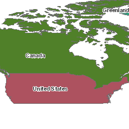
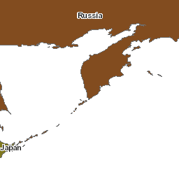
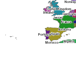
Arctic Countries represents the boundaries for the Arctic countries of the world as they existed in January 2006 north of 35 degrees Latitude.
Available map layers (1)
Arctic Research Mapping Application (ARMAP) Countries, 35N (0)
Arctic Research Mapping Application (ARMAP) Countries, 35N
There are currently no notifications for the service, click the feed icon to subscribe.