[unknown data provider] |
|
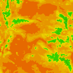
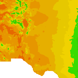
US_Average_Annual_Precipitation_1961_to_1990

| Service health Now: |
|---|
- Interface
- Web Service, OGC Web Map Service 1.3.0
- Keywords
- Fees
- unknown
- Access constraints
- unknown
- Supported languages
- No INSPIRE Extended Capabilities (including service language support) given. See INSPIRE Technical Guidance - View Services for more information.
- Data provider
-
unknown (unverified)
Contact information:
- Service metadata
- No INSPIRE Extended Capabilities (including service metadata) given. See INSPIRE Technical Guidance - View Services for more information.
Ads by Google
WMS
Available map layers (1)
Average Annual Precipitation (in inches) 1961 - 1990 (0)
Each polygon represents an area with a constant value for the average annual precipitation, as determined by the PRISM model. The Range attribute is the average annual precipitation in inches for years 1961-1990.
There are currently no notifications for the service, click the feed icon to subscribe.