[unknown data provider] |
|
CPC Global cloud-cover composite imagery WMS
| Service health Now: |
|---|
- Interface
- Web Service, OGC Web Map Service 1.3.0
- Keywords
- Fees
- unknown
- Access constraints
- unknown
- Supported languages
- No INSPIRE Extended Capabilities (including service language support) given. See INSPIRE Technical Guidance - View Services for more information.
- Data provider
-
unknown (unverified)
Contact information:
- Service metadata
- No INSPIRE Extended Capabilities (including service metadata) given. See INSPIRE Technical Guidance - View Services for more information.
Ads by Google
This Web Map Service (WMS) offers a global cloud-cover composite of infrared imagery from several satellites (currently GOES-8/10, METEOSAT-7/5 & GMS). The composites are assembled and provided by the NOAA/NWS/NCEP Climate Prediction Center (http://www.cpc.ncep.noaa.gov/). Ancillary datasets are also provided for reference. This WMS is supported by the NASA Geosciences Interoperability Office (http://gio.gsfc.nasa.gov/) and the NASA GSFC Software Integration and Visualization Office (http://sivo.gsfc.nasa.gov/).
Available map layers (8)
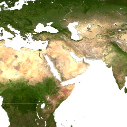
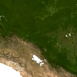
Blue Marble 2002 - MODIS composite land image (land)
The Blue Marble 2002 dataset is a composite of cloud-free land images from the Moderate Resolution Imaging Spectroradiometer (MODIS) instrument aboard NASA's Terra satellite. The spatial resolution is approximately 1km. The image was produced by NASA Goddard Space Flight Center. For more information see NASA Earth Observatory (http://earthobservatory.nasa.gov/).
Lat/Lon Grid (grid)
The spacing of the lines in this latitude/longitude graticule depend on the map bounding box.
Lat/Lon Grid - 10deg (grid10)
This latitude/longitude graticule has a fixed 10-degree spacing.
National Boundaries (countries)
The country boundary dataset is provided by the Interactive Data Language (IDL - http://www.rsinc.com/idl/) package based on data available from the ESRI ArcWeb Services World Basemap Service (http://www.esri.com/).
USA State Boundaries 1:20M scale (states20m)
The USA State Boundaries 1:20M scale layer is provided by the USGS National Atlas (http://www.nationalatlas.gov/mld/statesp.html).
Blank layer (no data) (blank)
NWS/NCEP/CPC Global IR composite (cpc)
The CPC global cloud-cover layer is a composite of infrared imagery from several satellites (currently GOES-8/10, METEOSAT-7/5 & GMS). The composites are assembled and provided by the NOAA/NWS/NCEP Climate Prediction Center (http://www.cpc.ncep.noaa.gov/).
nodata (nodata)
There are currently no notifications for the service, click the feed icon to subscribe.