Geological Survey of Victoria - Earth … |
|
Geology Web Mapping

| Service health Now: |
|---|
- Interface
- Web Service, OGC Web Map Service 1.3.0
- Keywords
- WFS, WMS, GEOSERVER
- Fees
- NONE
- Access constraints
- Copyright © The State of Victoria, 2002 - 2012
- Supported languages
- No INSPIRE Extended Capabilities (including service language support) given. See INSPIRE Technical Guidance - View Services for more information.
- Data provider
-
Geological Survey of Victoria - Earth Resource Development Division (unverified)
Contact information:
Cameron Cairns
Geological Survey of Victoria - Earth Resource Development Division
Work:
Melbourne, AUSTRALIAEmail:
- Service metadata
- No INSPIRE Extended Capabilities (including service metadata) given. See INSPIRE Technical Guidance - View Services for more information.
Ads by Google
Geology Web Map Service Maintained by the Victorian Department of Primary Industries - Earth Resource Development Division.
Available map layers (10)
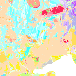
GSV Geological Unit (250K) (erdd:GSV_SG_250K_GEOLUNIT)
Geological units represented as two dimensional polygons, designed for portrayal at 1:250 000 scale. The polygon edges are constructed from the corresponding geological contacts and faults layer. Default theme based on GSV geological units.
GSV Geological Unit Contact (250K) (erdd:GSV_SG_250K_GEOLUNITCONTACT)
Geological boundaries represented as two dimensional lines, designed for portrayal at 1:250 000 scale.
GSV Geological Unit (250K) - Age (erdd:GSV_SG_250K_GEOLUNIT_AGE)
Geological units represented as two dimensional polygons, designed for portrayal at 1:250 000 scale. The polygon edges are constructed from the corresponding geological contacts and faults layer. Theme based on the 2008 version of the IUGS International stratigraphic chart (International Commission on Stratigraphy : http://www.stratigraphy.org/).
GSV Geological Unit (250K) - Lithology (erdd:GSV_SG_250K_GEOLUNIT_LITHOLOGY)
Geological units represented as two dimensional polygons, designed for portrayal at 1:250 000 scale. The polygon edges are constructed from the corresponding geological contacts and faults layer. Theme adapted from Moyer,Hasting and Raines, 2005 (http://pubs.usgs.gov/of/2005/1314/of2005-1314.pdf) for GeoSciML testbeds.
GSV Shear Displacement Structure (250K) (erdd:GSV_SG_250K_SHEARDISPSTRUCTURE)
Shear displacement structures (faults) represented as two dimensional lines, designed for portrayal at 1:250 000 scale.
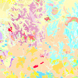
GSV Geological Unit (50K) (erdd:GSV_SG_50K_GEOLUNIT)
Geological units represented as two dimensional polygons, designed for portrayal at 1:50 000 scale. The polygon edges are constructed from the corresponding geological contacts and faults layer. Default theme based on GSV geological units.
GSV Geological Unit Contact (50K) (erdd:GSV_SG_50K_GEOLUNITCONTACT)
Geological boundaries represented as two dimensional lines, designed for portrayal at 1:50 000 scale.
GSV Geological Unit (50K) - Age (erdd:GSV_SG_50K_GEOLUNIT_AGE)
Geological units represented as two dimensional polygons, designed for portrayal at 1:50 000 scale. The polygon edges are constructed from the corresponding geological contacts and faults layer. Theme based on the 2008 version of the IUGS International stratigraphic chart (International Commission on Stratigraphy : http://www.stratigraphy.org/).
GSV Geological Unit (50K) - Lithology (erdd:GSV_SG_50K_GEOLUNIT_LITHOLOGY)
Geological units represented as two dimensional polygons, designed for portrayal at 1:50 000 scale. The polygon edges are constructed from the corresponding geological contacts and faults layer. Theme adapted from Moyer,Hasting and Raines, 2005 (http://pubs.usgs.gov/of/2005/1314/of2005-1314.pdf) for GeoSciML testbeds.
GSV Shear Displacement Structure (50K) (erdd:GSV_SG_50K_SHEARDISPSTRUCTURE)
Shear displacement structures (faults) represented as two dimensional lines, designed for portrayal at 1:50 000 scale.
There are currently no notifications for the service, click the feed icon to subscribe.