Geological Survey of Norway |
|
NGU Bedrock and Superficial Geology
http://geo.ngu.no/mapserver/NGU_Bedrock_and_Superficial_Geology/wms

| Service health Now: |
|---|
- Interface
- Web Service, OGC Web Map Service 1.3.0
- Keywords
- Fees
- none
- Access constraints
- Copyright Geological Survey of Norway 2008
- Supported languages
- No INSPIRE Extended Capabilities (including service language support) given. See INSPIRE Technical Guidance - View Services for more information.
- Data provider
-
Geological Survey of Norway (unverified)
Contact information:
Sverre Iversen
Geological Survey of Norway
Postal address:
-, 7491 Trondheim, NorwayEmail:
- Service metadata
- No INSPIRE Extended Capabilities (including service metadata) given. See INSPIRE Technical Guidance - View Services for more information.
Ads by Google
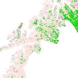
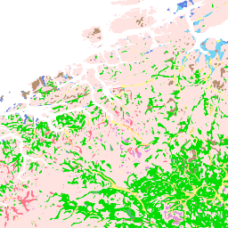
Superficial Deposits WMS service. Mapscale 1:1 Mill
Available map layers (9)
NGU Bedrock and Superficial Geology (NGU_Bedrock_and_Superficial_Geology)
Superficial Deposits WMS service. Mapscale 1:1 Mill
NOR NGU 1:1M SUPERFICIAL DEPOSIT POLYGON (NOR_NGU_1M_SDP)
The superficial deposit polygons have been compiled, generalised and harmonised from all available quaternary maps published by the Geological Survey of Norway. The superficial deposits are classified according to their genesis and thickness. In unmapped areas the deposits have been interpreted from aerial photos in combination with field controls. Due to variation of quality and scales of different mapping eras, the level of accuracy in the resulting dataset is variable.
NOR NGU 1:1M LØSMASSEPOLYGON (NOR_NGU_1M_SDP_NO)
Løsmassepolygoner har vært samlet, generalisert og harmonisert fra alle tilgjengelige kvartære kart utgitt av Norges Geologiske Undersøkelse i Norge. Løsmassene er klassifisert i henhold til dannelsesmåte og tykkelse. I ikke-kartlagte områder har forekomstene blitt tolket fra flyfoto i kombinasjon med feltkontroller. På grunn av variasjon i kvalitet og målestokk fra ulike kartleggingsepoker, er kvaliteten i det resulterende datasettet variabel.
NOR NGU 1:1M SUPERFICIAL DEPOSIT POLYGON AGE (NOR_NGU_1M_SDP_AGE)
The superficial deposit polygons have been compiled, generalised and harmonised from all available quaternary maps published by the Geological Survey of Norway. The superficial deposits are classified according to their genesis and thickness. In unmapped areas the deposits have been interpreted from aerial photos in combination with field controls. Due to variation of quality and scales of different mapping eras, the level of accuracy in the resulting dataset is variable.
NOR NGU 1:1M LØSMASSEPOLYGON ALDER (NOR_NGU_1M_SDP_AGE_NO)
Løsmassepolygoner har vært samlet, generalisert og harmonisert fra alle tilgjengelige kvartære kart utgitt av Norges Geologiske Undersøkelse i Norge. Løsmassene er klassifisert i henhold til dannelsesmåte og tykkelse. I ikke-kartlagte områder har forekomstene blitt tolket fra flyfoto i kombinasjon med feltkontroller. På grunn av variasjon i kvalitet og målestokk fra ulike kartleggingsepoker, er kvaliteten i det resulterende datasettet variabel.
NOR NGU 1:1M SUPERFICIAL DEPOSIT LANDFORM (NOR_NGU_1M_SDF)
The superficial deposit landforms have been compiled, generalised and harmonised from all available quaternary maps published by the Geological Survey of Norway. In unmapped areas the deposits have been interpreted from aerial photos in combination with field controls. Due to variation of quality and scales of different mapping eras, the level of accuracy in the resulting dataset is variable. The landforms currently included in the map are eskers and marginal moraines.
NOR NGU 1:1M LØSMASSEFORMELEMENT (NOR_NGU_1M_SDF_NO)
Løsmassepolygoner har vært samlet, generalisert og harmonisert fra alle tilgjengelige kvartære kart utgitt av Norges Geologiske Undersøkelse i Norge. Løsmassene er klassifisert i henhold til dannelsesmåte og tykkelse. I ikke-kartlagte områder har forekomstene blitt tolket fra flyfoto i kombinasjon med feltkontroller. På grunn av variasjon i kvalitet og målestokk fra ulike kartleggingsepoker, er kvaliteten i det resulterende datasettet variabel. Landformene som nå er inkludert i kartet er eskere og endemorener.
NOR NGU 1:1M BEDROCK LITHOLOGY (NOR_NGU_1M_BLT)
This dataset shows bedrock areas defined by rock types and ages. The bedrock areas are also assigned to tectonic units. The map is composed of data resulting from several mapping campaigns, performed over decades, compiled and archived in digital format, published or prepared in manuscript format between 1989 and 2001. Due to the variation of quality and scales of different mapping campaigns the level of accuracy in the underlying national database is variable. The database is designed for presentation in the 1:1M scale.
NOR NGU 1:1M BEDROCK LITHOLOGY AGE (NOR_NGU_1M_BLT_AGE)
This dataset shows bedrock areas defined by rock types and ages. The bedrock areas are also assigned to tectonic units. The map is composed of data resulting from several mapping campaigns, performed over decades, compiled and archived in digital format, published or prepared in manuscript format between 1989 and 2001. Due to the variation of quality and scales of different mapping campaigns the level of accuracy in the underlying national database is variable. The database is designed for presentation in the 1:1M scale.
There are currently no notifications for the service, click the feed icon to subscribe.