MINES ParisTech |
|
Webservice-Energy (WMS)
| Service health Now: |
|---|
- Interface
- Web Service, OGC Web Map Service 1.3.0
- Keywords
- WFS, WMS, GEOSERVER
- Fees
- NONE
- Access constraints
- NONE
- Supported languages
- No INSPIRE Extended Capabilities (including service language support) given. See INSPIRE Technical Guidance - View Services for more information.
- Data provider
-
MINES ParisTech (unverified)
Contact information:
Lionel MENARD
MINES ParisTech
Work:
1, rue Claude Daunesse - CS 10207, 06904 SOPHIA ANTIPOLIS, FRANCEEmail:
- Service metadata
- No INSPIRE Extended Capabilities (including service metadata) given. See INSPIRE Technical Guidance - View Services for more information.
Ads by Google
A compliant implementation of WMS plus most of the SLD extension (dynamic styling). Can also generate PDF, SVG, KML, GeoRSS
Available map layers (85)
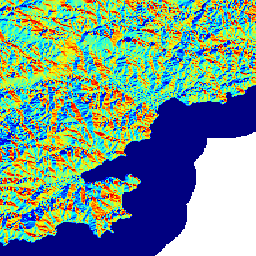
PACA Maps Aggregation (PACA-Aggregate)
This is an aggregated map of the PACA region layers.
ATLAS_PACA_BTI_05 (ATLAS_PACA_BTI_05)
Solar Atlas of Provence-Alpes-Cte d'Azur: mean of yearly sum of Beam Irradiation on Tilted plan (slope = 16.7 deg, azimuth = 225.0 deg) in kWh/m^2 (2004-2010)
ATLAS_PACA_DISTRICT_DIVISION_EPSG_4326_SHP (ATLAS_PACA_DISTRICT_DIVISION_EPSG_4326_SHP)
Shapefile of the districts in the region Provence-Alpes-Cote d'Azur (PACA) Extracted from the GEOFLA products of IGN, the Frence institute of geography
ATLAS_PACA_ASPECT_SRTM_EPSG_4326_r32 (ATLAS_PACA_ASPECT_SRTM_EPSG_4326_r32)
Local azimuth (degree) of the Digital Elevation Model extracted from SRTMv4 (http://www.cgiar-csi.org/category/elevation/)
ATLAS_PACA_BTI_01 (ATLAS_PACA_BTI_01)
Solar Atlas of Provence-Alpes-Cte d'Azur: mean of yearly sum of Beam Irradiation on Tilted plan (slope = 0.0 deg, azimuth = 180.0 deg) in kWh/m^2 (2004-2010)
ATLAS_PACA_BTI_02 (ATLAS_PACA_BTI_02)
Solar Atlas of Provence-Alpes-Cte d'Azur: mean of yearly sum of Beam Irradiation on Tilted plan (slope = 16.7 deg, azimuth = 180.0 deg) in kWh/m^2 (2004-2010)
ATLAS_PACA_BTI_03 (ATLAS_PACA_BTI_03)
Solar Atlas of Provence-Alpes-Cte d'Azur: mean of yearly sum of Beam Irradiation on Tilted plan (slope = 16.7 deg, azimuth = 135.0 deg) in kWh/m^2 (2004-2010)
ATLAS_PACA_BTI_04 (ATLAS_PACA_BTI_04)
Solar Atlas of Provence-Alpes-Cte d'Azur: mean of yearly sum of Beam Irradiation on Tilted plan (slope = 16.7 deg, azimuth = 90.0 deg) in kWh/m^2 (2004-2010)
ATLAS_PACA_BTI_06 (ATLAS_PACA_BTI_06)
Solar Atlas of Provence-Alpes-Cte d'Azur: mean of yearly sum of Beam Irradiation on Tilted plan (slope = 16.7 deg, azimuth = 270.0 deg) in kWh/m^2 (2004-2010)
ATLAS_PACA_BTI_07 (ATLAS_PACA_BTI_07)
Solar Atlas of Provence-Alpes-Cte d'Azur: mean of yearly sum of Beam Irradiation on Tilted plan (slope = 16.7 deg, azimuth = 0.0 deg) in kWh/m^2 (2004-2010)
ATLAS_PACA_BTI_08 (ATLAS_PACA_BTI_08)
Solar Atlas of Provence-Alpes-Cte d'Azur: mean of yearly sum of Beam Irradiation on Tilted plan (slope = 35.0 deg, azimuth = 180.0 deg) in kWh/m^2 (2004-2010)
ATLAS_PACA_BTI_12 (ATLAS_PACA_BTI_12)
Solar Atlas of Provence-Alpes-Cte d'Azur: mean of yearly sum of Beam Irradiation on Tilted plan (slope = 45.0 deg, azimuth = 135.0 deg) in kWh/m^2 (2004-2010)
ATLAS_PACA_DEM_SRTM_EPSG_4326_r32 (ATLAS_PACA_DEM_SRTM_EPSG_4326_r32)
Digital Elevation Model extracted from SRTMv4 (http://www.cgiar-csi.org/data/elevation/item/45-srtm-90m-digital-elevation-database-v41)
ATLAS_PACA_DISTRICT_DIVISION_EPSG_4326_16b (ATLAS_PACA_DISTRICT_DIVISION_EPSG_4326_16b)
Map of the district divisions for the solar atlas of Provence-Alpes-Cote d''Azur (PACA) It comprises the 964 districts of PACA with a surrounding margin of 4 km. It has been created from the product GEOFLA of IGN, the french institute of geography (http://professionnels.ign.fr/ficheProduitCMS.do?idDoc=5323861)
ATLAS_PACA_DNI (ATLAS_PACA_DNI)
Solar Atlas of Provence-Alpes-Cte d'Azur: mean of yearly sum of Beam Normal Irradiation in kWh/m^2 (2004-2010)
ATLAS_PACA_DNI_EPSG_4326_8b (ATLAS_PACA_DNI_EPSG_4326_8b)
ATLAS_PACA_DTI_01 (ATLAS_PACA_DTI_01)
Solar Atlas of Provence-Alpes-Cte d'Azur: mean of yearly sum of Diffuse Irradiation on Tilted plan (slope = 0.0 deg, azimuth = 180.0 deg) in kWh/m^2 (2004-2010)
ATLAS_PACA_DTI_02 (ATLAS_PACA_DTI_02)
Solar Atlas of Provence-Alpes-Cte d'Azur: mean of yearly sum of Diffuse Irradiation on Tilted plan (slope = 16.7 deg, azimuth = 180.0 deg) in kWh/m^2 (2004-2010)
ATLAS_PACA_DTI_03 (ATLAS_PACA_DTI_03)
Solar Atlas of Provence-Alpes-Cte d'Azur: mean of yearly sum of Diffuse Irradiation on Tilted plan (slope = 16.7 deg, azimuth = 135.0 deg) in kWh/m^2 (2004-2010)
ATLAS_PACA_DTI_04 (ATLAS_PACA_DTI_04)
Solar Atlas of Provence-Alpes-Cte d'Azur: mean of yearly sum of Diffuse Irradiation on Tilted plan (slope = 16.7 deg, azimuth = 90.0 deg) in kWh/m^2 (2004-2010)
ATLAS_PACA_DTI_05 (ATLAS_PACA_DTI_05)
Solar Atlas of Provence-Alpes-Cte d'Azur: mean of yearly sum of Diffuse Irradiation on Tilted plan (slope = 16.7 deg, azimuth = 225.0 deg) in kWh/m^2 (2004-2010)
ATLAS_PACA_DTI_06 (ATLAS_PACA_DTI_06)
Solar Atlas of Provence-Alpes-Cte d'Azur: mean of yearly sum of Diffuse Irradiation on Tilted plan (slope = 16.7 deg, azimuth = 270.0 deg) in kWh/m^2 (2004-2010)
ATLAS_PACA_DTI_07 (ATLAS_PACA_DTI_07)
Solar Atlas of Provence-Alpes-Cte d'Azur: mean of yearly sum of Diffuse Irradiation on Tilted plan (slope = 16.7 deg, azimuth = 0.0 deg) in kWh/m^2 (2004-2010)
ATLAS_PACA_DTI_08 (ATLAS_PACA_DTI_08)
Solar Atlas of Provence-Alpes-Cte d'Azur: mean of yearly sum of Diffuse Irradiation on Tilted plan (slope = 35.0 deg, azimuth = 180.0 deg) in kWh/m^2 (2004-2010)
ATLAS_PACA_DTI_12 (ATLAS_PACA_DTI_12)
Solar Atlas of Provence-Alpes-Cte d'Azur: mean of yearly sum of Diffuse Irradiation on Tilted plan (slope = 45.0 deg, azimuth = 135.0 deg) in kWh/m^2 (2004-2010)
ATLAS_PACA_GTI_01 (ATLAS_PACA_GTI_01)
Solar Atlas of Provence-Alpes-Cte d'Azur: mean of yearly sum of Global Irradiation on Tilted plan (slope = 0.0 deg, azimuth = 180.0 deg) in kWh/m^2 (2004-2010)
ATLAS_PACA_GTI_02 (ATLAS_PACA_GTI_02)
Solar Atlas of Provence-Alpes-Cte d'Azur: mean of yearly sum of Global Irradiation on Tilted plan (slope = 16.7 deg, azimuth = 180.0 deg) in kWh/m^2 (2004-2010)
ATLAS_PACA_GTI_03 (ATLAS_PACA_GTI_03)
Solar Atlas of Provence-Alpes-Cte d'Azur: mean of yearly sum of Global Irradiation on Tilted plan (slope = 16.7 deg, azimuth = 135.0 deg) in kWh/m^2 (2004-2010)
ATLAS_PACA_GTI_04 (ATLAS_PACA_GTI_04)
Solar Atlas of Provence-Alpes-Cte d'Azur: mean of yearly sum of Global Irradiation on Tilted plan (slope = 16.7 deg, azimuth = 90.0 deg) in kWh/m^2 (2004-2010)
ATLAS_PACA_GTI_05 (ATLAS_PACA_GTI_05)
Solar Atlas of Provence-Alpes-Cte d'Azur: mean of yearly sum of Global Irradiation on Tilted plan (slope = 16.7 deg, azimuth = 225.0 deg) in kWh/m^2 (2004-2010)
ATLAS_PACA_GTI_06 (ATLAS_PACA_GTI_06)
Solar Atlas of Provence-Alpes-Cte d'Azur: mean of yearly sum of Global Irradiation on Tilted plan (slope = 16.7 deg, azimuth = 270.0 deg) in kWh/m^2 (2004-2010)
ATLAS_PACA_GTI_07 (ATLAS_PACA_GTI_07)
Solar Atlas of Provence-Alpes-Cte d'Azur: mean of yearly sum of Global Irradiation on Tilted plan (slope = 16.7 deg, azimuth = 0.0 deg) in kWh/m^2 (2004-2010)
ATLAS_PACA_GTI_08 (ATLAS_PACA_GTI_08)
Solar Atlas of Provence-Alpes-Cte d'Azur: mean of yearly sum of Global Irradiation on Tilted plan (slope = 35.0 deg, azimuth = 180.0 deg) in kWh/m^2 (2004-2010)
ATLAS_PACA_GTI_12 (ATLAS_PACA_GTI_12)
Solar Atlas of Provence-Alpes-Cte d'Azur: mean of yearly sum of Global Irradiation on Tilted plan (slope = 45.0 deg, azimuth = 135.0 deg) in kWh/m^2 (2004-2010)
ATLAS_PACA_LAND_USE_CLC2006_EPSG_4326_8b (ATLAS_PACA_LAND_USE_CLC2006_EPSG_4326_8b)
Raster data on land cover from the CLC2006 inventory, extracted for Provence-Alpes-Cote d'Azur. Data categorized using the 44 classes of the 3-level Corine nomenclature Extracted with the wms request: http://sd1878-2.sivit.org/geoserver/wms?SERVICE=WMS&VERSION=1.3.0&REQUEST=GetMap&BBOX=3.91625,42.916667,8.01625,45.416667&LAYERS=topp:RCLC06_WGS&CRS=EPSG:4326&FORMAT=image/geotiff 8&WIDTH=1640&HEIGHT=1500
ATLAS_PACA_MASK_EPSG_4326_8b (ATLAS_PACA_MASK_EPSG_4326_8b)
Binary mask for the solar atlas of Provence-Alpes-Cote d'Azur (PACA) It comprises the five territorial regions of PACA with a surrounding margin of 4 km
ATLAS_PACA_MAX_TEMPERATURE_MODIS_UNIGE_EPSG_4326_r32 (ATLAS_PACA_MAX_TEMPERATURE_MODIS_UNIGE_EPSG_4326_r32)
Description: Map of estimated monthly maximum daytime air temperature at 2-m height [°C], March 2009, PACA Region. The layer was generated from input satellite MODIS images (provided by NASA) and in-situ temperature measurements (collected by Meteo France and provided by ARMINES) through the application of a supervised regression techique based on support vector machines (SVM). Daytime MODIS acquisitions are daily. For each pixel, first air temperature was separately estimated from each daily MODIS observation not affected by cloud cover, and, then, the maximum of the resulting estimates was displayed in the present layer. Pixels in which cloud cover was present at all observation times and sea areas were masked out. Scientific reference: G. Moser and S. B. Serpico,
ATLAS_PACA_MAX_TEMPERATURE_MONTH01_NCEP_EPSG_4326_r32 (ATLAS_PACA_MAX_TEMPERATURE_MONTH01_NCEP_EPSG_4326_r32)
Max temperature of the month 01 extracted from the webservice EMPClimate (http://www.webservice-energy.org/web-services/w3c-web-services/emp-climate-w3c)
ATLAS_PACA_MAX_TEMPERATURE_MONTH02_NCEP_EPSG_4326_r32 (ATLAS_PACA_MAX_TEMPERATURE_MONTH02_NCEP_EPSG_4326_r32)
Max temperature of the month 02 extracted from the webservice EMPClimate (http://www.webservice-energy.org/web-services/w3c-web-services/emp-climate-w3c)
ATLAS_PACA_MAX_TEMPERATURE_MONTH03_NCEP_EPSG_4326_r32 (ATLAS_PACA_MAX_TEMPERATURE_MONTH03_NCEP_EPSG_4326_r32)
Max temperature of the month 03 extracted from the webservice EMPClimate (http://www.webservice-energy.org/web-services/w3c-web-services/emp-climate-w3c)
ATLAS_PACA_MAX_TEMPERATURE_MONTH04_NCEP_EPSG_4326_r32 (ATLAS_PACA_MAX_TEMPERATURE_MONTH04_NCEP_EPSG_4326_r32)
Max temperature of the month 04 extracted from the webservice EMPClimate (http://www.webservice-energy.org/web-services/w3c-web-services/emp-climate-w3c)
ATLAS_PACA_MAX_TEMPERATURE_MONTH05_NCEP_EPSG_4326_r32 (ATLAS_PACA_MAX_TEMPERATURE_MONTH05_NCEP_EPSG_4326_r32)
Max temperature of the month 05 extracted from the webservice EMPClimate (http://www.webservice-energy.org/web-services/w3c-web-services/emp-climate-w3c)
ATLAS_PACA_MAX_TEMPERATURE_MONTH06_NCEP_EPSG_4326_r32 (ATLAS_PACA_MAX_TEMPERATURE_MONTH06_NCEP_EPSG_4326_r32)
Max temperature of the month 06 extracted from the webservice EMPClimate (http://www.webservice-energy.org/web-services/w3c-web-services/emp-climate-w3c)
ATLAS_PACA_MAX_TEMPERATURE_MONTH07_NCEP_EPSG_4326_r32 (ATLAS_PACA_MAX_TEMPERATURE_MONTH07_NCEP_EPSG_4326_r32)
Max temperature of the month 07 extracted from the webservice EMPClimate (http://www.webservice-energy.org/web-services/w3c-web-services/emp-climate-w3c)
ATLAS_PACA_MAX_TEMPERATURE_MONTH08_NCEP_EPSG_4326_r32 (ATLAS_PACA_MAX_TEMPERATURE_MONTH08_NCEP_EPSG_4326_r32)
Max temperature of the month 08 extracted from the webservice EMPClimate (http://www.webservice-energy.org/web-services/w3c-web-services/emp-climate-w3c)
ATLAS_PACA_MAX_TEMPERATURE_MONTH09_NCEP_EPSG_4326_r32 (ATLAS_PACA_MAX_TEMPERATURE_MONTH09_NCEP_EPSG_4326_r32)
Max temperature of the month 09 extracted from the webservice EMPClimate (http://www.webservice-energy.org/web-services/w3c-web-services/emp-climate-w3c)
ATLAS_PACA_MAX_TEMPERATURE_MONTH10_NCEP_EPSG_4326_r32 (ATLAS_PACA_MAX_TEMPERATURE_MONTH10_NCEP_EPSG_4326_r32)
Max temperature of the month 10 extracted from the webservice EMPClimate (http://www.webservice-energy.org/web-services/w3c-web-services/emp-climate-w3c)
ATLAS_PACA_MAX_TEMPERATURE_MONTH11_NCEP_EPSG_4326_r32 (ATLAS_PACA_MAX_TEMPERATURE_MONTH11_NCEP_EPSG_4326_r32)
Max temperature of the month 11 extracted from the webservice EMPClimate (http://www.webservice-energy.org/web-services/w3c-web-services/emp-climate-w3c)
ATLAS_PACA_MAX_TEMPERATURE_MONTH12_NCEP_EPSG_4326_r32 (ATLAS_PACA_MAX_TEMPERATURE_MONTH12_NCEP_EPSG_4326_r32)
Max temperature of the month 12 extracted from the webservice EMPClimate (http://www.webservice-energy.org/web-services/w3c-web-services/emp-climate-w3c)
ATLAS_PACA_MEAN_TEMPERATURE_MODIS_UNIGE_EPSG_4326_r32 (ATLAS_PACA_MEAN_TEMPERATURE_MODIS_UNIGE_EPSG_4326_r32)
Map of estimated monthly mean daytime air temperature at 2-m height [°C], March 2009, PACA Region. The layer was generated from input satellite MODIS images (provided by NASA) and in-situ temperature measurements (collected by Meteo France and provided by ARMINES) through the application of a supervised regression techique based on support vector machines (SVM). Daytime MODIS acquisitions are daily. For each pixel, first air temperature was separately estimated from each daily MODIS observation not affected by cloud cover, and, then, the mean of the resulting estimates was displayed in the present layer. Pixels in which cloud cover was present at all observation times and sea areas were masked out. Scientific reference: G. Moser and S. B. Serpico,
ATLAS_PACA_MEAN_TEMPERATURE_MONTH01_NCEP_EPSG_4326_r32 (ATLAS_PACA_MEAN_TEMPERATURE_MONTH01_NCEP_EPSG_4326_r32)
Mean temperature of the month 01 extracted from the webservice EMPClimate (http://www.webservice-energy.org/web-services/w3c-web-services/emp-climate-w3c)
ATLAS_PACA_MEAN_TEMPERATURE_MONTH02_NCEP_EPSG_4326_r32 (ATLAS_PACA_MEAN_TEMPERATURE_MONTH02_NCEP_EPSG_4326_r32)
Mean temperature of the month 02 extracted from the webservice EMPClimate (http://www.webservice-energy.org/web-services/w3c-web-services/emp-climate-w3c)
ATLAS_PACA_MEAN_TEMPERATURE_MONTH03_NCEP_EPSG_4326_r32 (ATLAS_PACA_MEAN_TEMPERATURE_MONTH03_NCEP_EPSG_4326_r32)
Mean temperature of the month 03 extracted from the webservice EMPClimate (http://www.webservice-energy.org/web-services/w3c-web-services/emp-climate-w3c)
ATLAS_PACA_MEAN_TEMPERATURE_MONTH04_NCEP_EPSG_4326_r32 (ATLAS_PACA_MEAN_TEMPERATURE_MONTH04_NCEP_EPSG_4326_r32)
Mean temperature of the month 04 extracted from the webservice EMPClimate (http://www.webservice-energy.org/web-services/w3c-web-services/emp-climate-w3c)
ATLAS_PACA_MEAN_TEMPERATURE_MONTH05_NCEP_EPSG_4326_r32 (ATLAS_PACA_MEAN_TEMPERATURE_MONTH05_NCEP_EPSG_4326_r32)
Mean temperature of the month 05 extracted from the webservice EMPClimate (http://www.webservice-energy.org/web-services/w3c-web-services/emp-climate-w3c)
ATLAS_PACA_MEAN_TEMPERATURE_MONTH06_NCEP_EPSG_4326_r32 (ATLAS_PACA_MEAN_TEMPERATURE_MONTH06_NCEP_EPSG_4326_r32)
Mean temperature of the month 06 extracted from the webservice EMPClimate (http://www.webservice-energy.org/web-services/w3c-web-services/emp-climate-w3c)
ATLAS_PACA_MEAN_TEMPERATURE_MONTH07_NCEP_EPSG_4326_r32 (ATLAS_PACA_MEAN_TEMPERATURE_MONTH07_NCEP_EPSG_4326_r32)
Mean temperature of the month 07 extracted from the webservice EMPClimate (http://www.webservice-energy.org/web-services/w3c-web-services/emp-climate-w3c)
ATLAS_PACA_MEAN_TEMPERATURE_MONTH08_NCEP_EPSG_4326_r32 (ATLAS_PACA_MEAN_TEMPERATURE_MONTH08_NCEP_EPSG_4326_r32)
Mean temperature of the month 08 extracted from the webservice EMPClimate (http://www.webservice-energy.org/web-services/w3c-web-services/emp-climate-w3c)
ATLAS_PACA_MEAN_TEMPERATURE_MONTH09_NCEP_EPSG_4326_r32 (ATLAS_PACA_MEAN_TEMPERATURE_MONTH09_NCEP_EPSG_4326_r32)
Mean temperature of the month 09 extracted from the webservice EMPClimate (http://www.webservice-energy.org/web-services/w3c-web-services/emp-climate-w3c)
ATLAS_PACA_MEAN_TEMPERATURE_MONTH10_NCEP_EPSG_4326_r32 (ATLAS_PACA_MEAN_TEMPERATURE_MONTH10_NCEP_EPSG_4326_r32)
Mean temperature of the month 10 extracted from the webservice EMPClimate (http://www.webservice-energy.org/web-services/w3c-web-services/emp-climate-w3c)
ATLAS_PACA_MEAN_TEMPERATURE_MONTH11_NCEP_EPSG_4326_r32 (ATLAS_PACA_MEAN_TEMPERATURE_MONTH11_NCEP_EPSG_4326_r32)
Mean temperature of the month 11 extracted from the webservice EMPClimate (http://www.webservice-energy.org/web-services/w3c-web-services/emp-climate-w3c)
ATLAS_PACA_MEAN_TEMPERATURE_MONTH12_NCEP_EPSG_4326_r32 (ATLAS_PACA_MEAN_TEMPERATURE_MONTH12_NCEP_EPSG_4326_r32)
Mean temperature of the month 12 extracted from the webservice EMPClimate (http://www.webservice-energy.org/web-services/w3c-web-services/emp-climate-w3c)
ATLAS_PACA_MEAN_TEMPERATURE_MSG_UNIGE_EPSG_4326_r32 (ATLAS_PACA_MEAN_TEMPERATURE_MSG_UNIGE_EPSG_4326_r32)
Description: Map of estimated mean daytime air temperature at 2-m height [Degree C], August 30, 2009, PACA Region. The layer was generated from input satellite MSG-SEVIRI images (provided by EUMETSAT) and in-situ temperature measurements (collected by Meteo France and provided by ARMINES) through the application of a supervised regression techique based on support vector machines (SVM). Hourly MSG-SEVIRI images acquired between 8 am and 5 pm were used. For each pixel, first air temperature was separately estimated from each hourly MSG-SEVIRI observation not affected by cloud cover, and, then, the mean of the resulting estimates was displayed in the present layer. Pixels in which cloud cover was present at all observation times and sea areas were masked out. Scientific reference: G. Moser and S. B. Serpico.
ATLAS_PACA_MIN_TEMPERATURE_MODIS_UNIGE_EPSG_4326_r32 (ATLAS_PACA_MIN_TEMPERATURE_MODIS_UNIGE_EPSG_4326_r32)
Description: Map of estimated monthly minimum daytime air temperature at 2-m height [°C], March 2009, PACA Region. The layer was generated from input satellite MODIS images (provided by NASA) and in-situ temperature measurements (collected by Meteo France and provided by ARMINES) through the application of a supervised regression techique based on support vector machines (SVM). Daytime MODIS acquisitions are daily. For each pixel, first air temperature was separately estimated from each daily MODIS observation not affected by cloud cover, and, then, the minimum of the resulting estimates was displayed in the present layer. Pixels in which cloud cover was present at all observation times and sea areas were masked out. Scientific reference: G. Moser and S. B. Serpico,
ATLAS_PACA_MIN_TEMPERATURE_MONTH01_NCEP_EPSG_4326_r32 (ATLAS_PACA_MIN_TEMPERATURE_MONTH01_NCEP_EPSG_4326_r32)
Min temperature of the month 01 extracted from the webservice EMPClimate (http://www.webservice-energy.org/web-services/w3c-web-services/emp-climate-w3c)
ATLAS_PACA_MIN_TEMPERATURE_MONTH02_NCEP_EPSG_4326_r32 (ATLAS_PACA_MIN_TEMPERATURE_MONTH02_NCEP_EPSG_4326_r32)
Min temperature of the month 02 extracted from the webservice EMPClimate (http://www.webservice-energy.org/web-services/w3c-web-services/emp-climate-w3c)
ATLAS_PACA_MIN_TEMPERATURE_MONTH03_NCEP_EPSG_4326_r32 (ATLAS_PACA_MIN_TEMPERATURE_MONTH03_NCEP_EPSG_4326_r32)
Min temperature of the month 03 extracted from the webservice EMPClimate (http://www.webservice-energy.org/web-services/w3c-web-services/emp-climate-w3c)
ATLAS_PACA_MIN_TEMPERATURE_MONTH04_NCEP_EPSG_4326_r32 (ATLAS_PACA_MIN_TEMPERATURE_MONTH04_NCEP_EPSG_4326_r32)
Min temperature of the month 04 extracted from the webservice EMPClimate (http://www.webservice-energy.org/web-services/w3c-web-services/emp-climate-w3c)
ATLAS_PACA_MIN_TEMPERATURE_MONTH05_NCEP_EPSG_4326_r32 (ATLAS_PACA_MIN_TEMPERATURE_MONTH05_NCEP_EPSG_4326_r32)
Min temperature of the month 05 extracted from the webservice EMPClimate (http://www.webservice-energy.org/web-services/w3c-web-services/emp-climate-w3c)
ATLAS_PACA_MIN_TEMPERATURE_MONTH06_NCEP_EPSG_4326_r32 (ATLAS_PACA_MIN_TEMPERATURE_MONTH06_NCEP_EPSG_4326_r32)
Min temperature of the month 06 extracted from the webservice EMPClimate (http://www.webservice-energy.org/web-services/w3c-web-services/emp-climate-w3c)
ATLAS_PACA_MIN_TEMPERATURE_MONTH07_NCEP_EPSG_4326_r32 (ATLAS_PACA_MIN_TEMPERATURE_MONTH07_NCEP_EPSG_4326_r32)
Min temperature of the month 07 extracted from the webservice EMPClimate (http://www.webservice-energy.org/web-services/w3c-web-services/emp-climate-w3c)
ATLAS_PACA_MIN_TEMPERATURE_MONTH08_NCEP_EPSG_4326_r32 (ATLAS_PACA_MIN_TEMPERATURE_MONTH08_NCEP_EPSG_4326_r32)
Min temperature of the month 08 extracted from the webservice EMPClimate (http://www.webservice-energy.org/web-services/w3c-web-services/emp-climate-w3c)
ATLAS_PACA_MIN_TEMPERATURE_MONTH09_NCEP_EPSG_4326_r32 (ATLAS_PACA_MIN_TEMPERATURE_MONTH09_NCEP_EPSG_4326_r32)
Min temperature of the month 09 extracted from the webservice EMPClimate (http://www.webservice-energy.org/web-services/w3c-web-services/emp-climate-w3c)
ATLAS_PACA_MIN_TEMPERATURE_MONTH10_NCEP_EPSG_4326_r32 (ATLAS_PACA_MIN_TEMPERATURE_MONTH10_NCEP_EPSG_4326_r32)
Min temperature of the month 10 extracted from the webservice EMPClimate (http://www.webservice-energy.org/web-services/w3c-web-services/emp-climate-w3c)
ATLAS_PACA_MIN_TEMPERATURE_MONTH11_NCEP_EPSG_4326_r32 (ATLAS_PACA_MIN_TEMPERATURE_MONTH11_NCEP_EPSG_4326_r32)
Min temperature of the month 11 extracted from the webservice EMPClimate (http://www.webservice-energy.org/web-services/w3c-web-services/emp-climate-w3c)
ATLAS_PACA_MIN_TEMPERATURE_MONTH12_NCEP_EPSG_4326_r32 (ATLAS_PACA_MIN_TEMPERATURE_MONTH12_NCEP_EPSG_4326_r32)
Min temperature of the month 12 extracted from the webservice EMPClimate (http://www.webservice-energy.org/web-services/w3c-web-services/emp-climate-w3c)
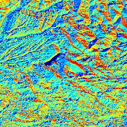
ATLAS_PACA_SLOPE_SRTM_EPSG_4326_r32 (ATLAS_PACA_SLOPE_SRTM_EPSG_4326_r32)
Local slope in % (atan of the slope angle) of the Digital Elevation Model extracted from SRTMv4 (http://www.cgiar-csi.org/data/elevation/item/45-srtm-90m-digital-elevation-database-v41)
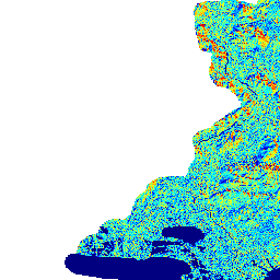
ATLAS_PACA_SOURCE_POINTS_DISTKM_EPSG_4326_r32 (ATLAS_PACA_SOURCE_POINTS_DISTKM_EPSG_4326_r32)
Distance to the nearest electric source point (km) (from scanned map of ErDF)
ATLAS_PACA_SOURCE_POINTS_DISTKM_EPSG_4326_shp (ATLAS_PACA_SOURCE_POINTS_DISTKM_EPSG_4326_shp)
ATLAS_PACA_STD_TEMPERATURE_MODIS_UNIGE_EPSG_4326_r32 (ATLAS_PACA_STD_TEMPERATURE_MODIS_UNIGE_EPSG_4326_r32)
Description: Map of the standard deviation of the regression error in the estimated monthly mean daytime air temperature at 2-m height [°C], March 2009, PACA Region. The layer was generated from input satellite MODIS images (provided by NASA) and in-situ temperature measurements (collected by Meteo France and provided by ARMINES) through the application of a nonstationary probabilistic model based on support vector machines (SVM). Daytime MODIS acquisitions are daily. For each pixel, first the regression error statistics was separately modeled from each daily MODIS observation not affected by cloud cover, and, then, the standard deviation of the mean temperature estimate was derived and displayed in the present layer. Pixels in which cloud cover was present at all observation times and sea areas were masked out. Scientific reference: G. Moser and S. B. Serpico,
ATLAS_PACA_TERRITORIAL_DIVISION_EPSG_4326_8b (ATLAS_PACA_TERRITORIAL_DIVISION_EPSG_4326_8b)
Map of the territorial divisions for the solar atlas of Provence-Alpes-Cote d'Azur (PACA) It comprises the six territorial regions of PACA with a surrounding margin of 4 km It has been created from the product GEOFLA of IGN, the French institute of geography (http://professionnels.ign.fr/ficheProduitCMS.do?idDoc=5323861)
ATLAS_PACA_TERRITORIAL_DIVISION_EPSG_4326_SHP (ATLAS_PACA_TERRITORIAL_DIVISION_EPSG_4326_SHP)
Shapefile of the territorial divisions for the solar atlas of Provence-Alpes-Cote d'Azur (PACA). It comprises the six territorial regions of PACA with a surrounding margin of 4 km
ATLAS_PACA_WINDSPEED_10M_CLASSES_EPSG_4326_8b (ATLAS_PACA_WINDSPEED_10M_CLASSES_EPSG_4326_8b)
ATLAS_PACA_ZONE_FLOOD_RISK_EPSG_4326_8b (ATLAS_PACA_ZONE_FLOOD_RISK_EPSG_4326_8b)
Map of flood risks (Atlas Zone Inondable validé) extracted from the GIS CARMEN (DREAL - PACA). (http://carmen.developpement-durable.gouv.fr/25/environnement.map)
ATLAS_PACA_ZONE_NATURE_RESERVES_EPSG_4326_8b (ATLAS_PACA_ZONE_NATURE_RESERVES_EPSG_4326_8b)
Map of natural reserves (Parc National" + "Réserve naturelle nationale" + "Réserve naturelle régionale" + "Parc naturel régional") extracted from the GIS CARMEN (DREAL - PACA). (http://carmen.developpement-durable.gouv.fr/25/environnement.map)
There are currently no notifications for the service, click the feed icon to subscribe.