US Geological Survey |
|
USGS Coastal Marine Geology Program Web Map Service

| Service health Now: |
|---|
- Interface
- Web Service, OGC Web Map Service 1.3.0
- Keywords
- WFS, WMS, GEOSERVER, USGS, Coastal Marine Geology, Oceans
- Fees
- NONE
- Access constraints
- NONE
- Supported languages
- No INSPIRE Extended Capabilities (including service language support) given. See INSPIRE Technical Guidance - View Services for more information.
- Data provider
-
US Geological Survey (unverified)
Contact information:
Greg Miller
US Geological Survey
Work:
600 Fourth St. South, 33701 Saint Petersburg, USAEmail:
Phone: 727 803-8747
- Service metadata
- No INSPIRE Extended Capabilities (including service metadata) given. See INSPIRE Technical Guidance - View Services for more information.
A compliant implementation of WMS plus most of the SLD extension (dynamic styling). Can also generate PDF, SVG, KML, GeoRSS
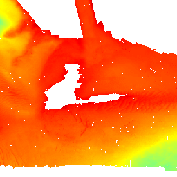
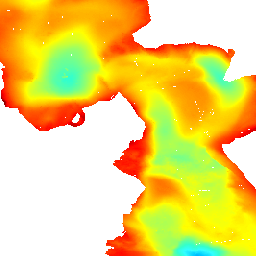
Available map layers (18)
Bathy - 2008-1004 (153 Mb) Arcgrid (2008-1004_bathy)
The U.S. Geological Survey (USGS), in cooperation with the National Oceanic and Atmospheric Administration (NOAA) and the Massachusetts Office of Coastal Zone Management (MA CZM), is producing detailed geologic maps of the coastal sea floor. Imagery, originally collected by NOAA for charting purposes, provides a fundamental framework for research and management activities along this part of the Massachusetts coastline, shows the composition and terrain of the seabed, and provides information on sediment transport and benthic habitat. Interpretive data layers were derived from multibeam echo-sounder and sidescan-sonar data collected in the vicinity of Woods Hole, a passage between the Elizabeth Islands and Cape Cod, Massachusetts. In November 2007, bottom photographs, seismic-reflection profiles, and surficial sediment data were acquired as part of a ground-truth reconnaissance survey.
Bathy - 2008-1195 (13.5Mb) Arcgrid (2008-1195_bathy)
In 2006 and 2007, the U.S. Geological Survey, in partnership with Louisiana Department of Natural Resources and the University of New Orleans, conducted geologic mapping to characterize the sea floor and shallow subsurface stratigraphy offshore of the Chandeleur Islands in Eastern Louisiana. The mapping was carried out during two cruises on the R/V Acadiana. Data were acquired with the following equipment: an SEA Ltd SwathPlus interferometric sonar (234 kHz), Klein 3000 dual frequency sidescan sonar, and an Edgetech 512i chirp subbottom profiling system. The long-term goal of this mapping effort is to produce high-quality geologic maps and geophysical interpretations that can be utilized to investigate the impact of Hurricane Katrina in 2005 and to identify sand resources within the region.
Bathy - 2008-1195 contours (2008-1195_bathy_contours_1m)
In 2006 and 2007, the U.S. Geological Survey, in partnership with Louisiana Department of Natural Resources and the University of New Orleans, conducted geologic mapping to characterize the sea floor and shallow subsurface stratigraphy offshore of the Chandeleur Islands in Eastern Louisiana. The mapping was carried out during two cruises on the R/V Acadiana. Data were acquired with the following equipment: an SEA Ltd SwathPlus interferometric sonar (234 kHz), Klein 3000 dual frequency sidescan sonar, and an Edgetech 512i chirp subbottom profiling system. The long-term goal of this mapping effort is to produce high-quality geologic maps and geophysical interpretations that can be utilized to investigate the impact of Hurricane Katrina in 2005 and to identify sand resources within the region.
Bathy - 2008-1195 geotiff (2008-1195_bathy_geotiff)
In 2006 and 2007, the U.S. Geological Survey, in partnership with Louisiana Department of Natural Resources and the University of New Orleans, conducted geologic mapping to characterize the sea floor and shallow subsurface stratigraphy offshore of the Chandeleur Islands in Eastern Louisiana. The mapping was carried out during two cruises on the R/V Acadiana. Data were acquired with the following equipment: an SEA Ltd SwathPlus interferometric sonar (234 kHz), Klein 3000 dual frequency sidescan sonar, and an Edgetech 512i chirp subbottom profiling system. The long-term goal of this mapping effort is to produce high-quality geologic maps and geophysical interpretations that can be utilized to investigate the impact of Hurricane Katrina in 2005 and to identify sand resources within the region.
Bathy - 2008-1195 hillshade (12.9 Mb) Arcgrid (2008-1195_hillshade)
In 2006 and 2007, the U.S. Geological Survey, in partnership with Louisiana Department of Natural Resources and the University of New Orleans, conducted geologic mapping to characterize the sea floor and shallow subsurface stratigraphy offshore of the Chandeleur Islands in Eastern Louisiana. The mapping was carried out during two cruises on the R/V Acadiana. Data were acquired with the following equipment: an SEA Ltd SwathPlus interferometric sonar (234 kHz), Klein 3000 dual frequency sidescan sonar, and an Edgetech 512i chirp subbottom profiling system. The long-term goal of this mapping effort is to produce high-quality geologic maps and geophysical interpretations that can be utilized to investigate the impact of Hurricane Katrina in 2005 and to identify sand resources within the region.
Bathy - 2008-1288 (75.6Mb) Arcgrid (2008-1288_bathy)
The USGS Woods Hole Science Center conducted a nearshore geophysical survey offshore of the southern coast of Martha's Vineyard, in the vicinity of the Martha's Vineyard Coastal Observatory (MVCO) in August 2007. This mapping program was part of a larger research effort supporting the Office of Naval Research (ONR) Ripples Directed-Research Initiative (DRI) studies at MVCO by providing data collection and modeling. The geophysical data will be used to provide initial conditions for wave and circulation models for the study area. Ultimately, geophysical mapping, oceanographic measurements and modeling will help to improve our understanding of coastal sediment-transport processes. The geophysical mapping utilized a suite of high-resolution instrumentation to map the surficial sediment distribution, depth and sub-surface geology: dual-frequency 100/500 KHz sidescan-sonar system, 234-KHz interferometric sonar, and 500 Hz -12 KHz chirp sub-bottom profiler. The survey was conducted aboard the M/V Megan Miller August 9-13, 2007. The study area covers 35 square kilometers from about 0.2 km to 5-km offshore of the south shore of Martha's Vineyard, and ranges in depth from ~ 5 to 20 meters.
Bathy - 2008-1288 Geotiff (2008-1288_bathy_2m_chs)
The USGS Woods Hole Science Center conducted a nearshore geophysical survey offshore of the southern coast of Martha's Vineyard, in the vicinity of the Martha's Vineyard Coastal Observatory (MVCO) in August 2007. This mapping program was part of a larger research effort supporting the Office of Naval Research (ONR) Ripples Directed-Research Initiative (DRI) studies at MVCO by providing data collection and modeling. The geophysical data will be used to provide initial conditions for wave and circulation models for the study area. Ultimately, geophysical mapping, oceanographic measurements and modeling will help to improve our understanding of coastal sediment-transport processes. The geophysical mapping utilized a suite of high-resolution instrumentation to map the surficial sediment distribution, depth and sub-surface geology: dual-frequency 100/500 KHz sidescan-sonar system, 234-KHz interferometric sonar, and 500 Hz -12 KHz chirp sub-bottom profiler. The survey was conducted aboard the M/V Megan Miller August 9-13, 2007. The study area covers 35 square kilometers from about 0.2 km to 5-km offshore of the south shore of Martha's Vineyard, and ranges in depth from ~ 5 to 20 meters.
Bathy - 2008-1288 contours (2008-1288_bathy_cont)
The USGS Woods Hole Science Center conducted a nearshore geophysical survey offshore of the southern coast of Martha's Vineyard, in the vicinity of the Martha's Vineyard Coastal Observatory (MVCO) in August 2007. This mapping program was part of a larger research effort supporting the Office of Naval Research (ONR) Ripples Directed-Research Initiative (DRI) studies at MVCO by providing data collection and modeling. The geophysical data will be used to provide initial conditions for wave and circulation models for the study area. Ultimately, geophysical mapping, oceanographic measurements and modeling will help to improve our understanding of coastal sediment-transport processes. The geophysical mapping utilized a suite of high-resolution instrumentation to map the surficial sediment distribution, depth and sub-surface geology: dual-frequency 100/500 KHz sidescan-sonar system, 234-KHz interferometric sonar, and 500 Hz -12 KHz chirp sub-bottom profiler. The survey was conducted aboard the M/V Megan Miller August 9-13, 2007. The study area covers 35 square kilometers from about 0.2 km to 5-km offshore of the south shore of Martha's Vineyard, and ranges in depth from ~ 5 to 20 meters.
Bathy - 2008-1288 hillshade (44Mb) Arcgrid (2008-1288_bathy_hillshade)
The USGS Woods Hole Science Center conducted a nearshore geophysical survey offshore of the southern coast of Martha's Vineyard, in the vicinity of the Martha's Vineyard Coastal Observatory (MVCO) in August 2007. This mapping program was part of a larger research effort supporting the Office of Naval Research (ONR) Ripples Directed-Research Initiative (DRI) studies at MVCO by providing data collection and modeling. The geophysical data will be used to provide initial conditions for wave and circulation models for the study area. Ultimately, geophysical mapping, oceanographic measurements and modeling will help to improve our understanding of coastal sediment-transport processes. The geophysical mapping utilized a suite of high-resolution instrumentation to map the surficial sediment distribution, depth and sub-surface geology: dual-frequency 100/500 KHz sidescan-sonar system, 234-KHz interferometric sonar, and 500 Hz -12 KHz chirp sub-bottom profiler. The survey was conducted aboard the M/V Megan Miller August 9-13, 2007. The study area covers 35 square kilometers from about 0.2 km to 5-km offshore of the south shore of Martha's Vineyard, and ranges in depth from ~ 5 to 20 meters.
Bathy - 2009-1001 (692Kb) Arcgrid (2009-1001_bathy)
The U.S. Geological Survey (USGS), in cooperation with the National Oceanic and Atmospheric Administration (NOAA) and the Massachusetts Office of Coastal Zone Management (MA CZM), is producing detailed geologic maps of the coastal sea floor. Imagery, originally collected by NOAA for charting purposes, provides a fundamental framework for research and management activities along this part of the Massachusetts coastline, shows the composition and terrain of the seabed, and provides information on sediment transport and benthic habitat. Interpretive data layers were derived from the combined single-beam and multibeam echo-sounder data and sidescan-sonar data collected in the vicinity of Edgartown Harbor, Massachusetts. During August 2008 seismic-reflection profiles (Boomer and Chirp) were acquired, and during September 2008 bottom photographs and surficial sediment data were acquired as part of two ground-truth reconnaissance surveys.
Bathy - 2009-1231 combined (135Mb) Arcgrid (2009-1231_combined_geo)
Nearshore areas within Long Island Sound are of great interest to the Connecticut and New York research and management communities because of their ecological, recreational, and commercial importance. However, although advances in multibeam echosounder technology permit the construction of detailed digital terrain models of seafloor topography within deeper waters, limitations inherent with collecting multibeam data make using this technology in shallower waters (<10-m deep) more difficult and expensive. These limitations have often resulted in gaps of no data between multibeam bathymetric datasets and the adjacent shoreline. To address this problem, complete-coverage multibeam bathymetry acquired offshore of New London and Niantic Bay, Connecticut, has been integrated with hydrographic LIDAR acquired along the nearshore. The result is a more continuous seafloor perspective and a much smaller gap between the digital bathymetric data and the shoreline. These datasets are provided as ESRI grid and GeoTIFF formats in order to facilitate access, compatibility, and utility.
Bathy - 2009-1231 combined geotiff (2009-1231_combined_geotiff)
Abstract: Nearshore areas within Long Island Sound are of great interest to the Connecticut and New York research and management communities because of their ecological, recreational, and commercial importance. However, although advances in multibeam echosounder technology permit the construction of detailed digital terrain models of seafloor topography within deeper waters, limitations inherent with collecting multibeam data make using this technology in shallower waters (<10-m deep) more difficult and expensive. These limitations have often resulted in gaps of no data between multibeam bathymetric datasets and the adjacent shoreline. To address this problem, complete-coverage multibeam bathymetry acquired offshore of New London and Niantic Bay, Connecticut, has been integrated with hydrographic LIDAR acquired along the nearshore. The result is a more continuous seafloor perspective and a much smaller gap between the digital bathymetric data and the shoreline. These datasets are provided as ESRI grid and GeoTIFF formats in order to facilitate access, compatibility, and utility.
Bathy - 2009-1231 Niantic (44.5Mb) Arcgrid (2009-1231_niantic_geo)
Abstract: Nearshore areas within Long Island Sound are of great interest to the Connecticut and New York research and management communities because of their ecological, recreational, and commercial importance. However, although advances in multibeam echosounder technology permit the construction of detailed digital terrain models of seafloor topography within deeper waters, limitations inherent with collecting multibeam data make using this technology in shallower waters (<10-m deep) more difficult and expensive. These limitations have often resulted in gaps of no data between multibeam bathymetric datasets and the adjacent shoreline. To address this problem, complete-coverage multibeam bathymetry acquired offshore of New London and Niantic Bay, Connecticut, has been integrated with hydrographic LIDAR acquired along the nearshore. The result is a more continuous seafloor perspective and a much smaller gap between the digital bathymetric data and the shoreline. These datasets are provided as ESRI grid and GeoTIFF formats in order to facilitate access, compatibility, and utility.
Bathy - 2009-1231 Niantic geotiff (2009-1231_niantic_mblidar_geo)
Abstract: Nearshore areas within Long Island Sound are of great interest to the Connecticut and New York research and management communities because of their ecological, recreational, and commercial importance. However, although advances in multibeam echosounder technology permit the construction of detailed digital terrain models of seafloor topography within deeper waters, limitations inherent with collecting multibeam data make using this technology in shallower waters (<10-m deep) more difficult and expensive. These limitations have often resulted in gaps of no data between multibeam bathymetric datasets and the adjacent shoreline. To address this problem, complete-coverage multibeam bathymetry acquired offshore of New London and Niantic Bay, Connecticut, has been integrated with hydrographic LIDAR acquired along the nearshore. The result is a more continuous seafloor perspective and a much smaller gap between the digital bathymetric data and the shoreline. These datasets are provided as ESRI grid and GeoTIFF formats in order to facilitate access, compatibility, and utility.
Bathy - 2009-1231 New London (63Mb) Arcgrid (2009-1231_nlondon_geo)
Abstract: Nearshore areas within Long Island Sound are of great interest to the Connecticut and New York research and management communities because of their ecological, recreational, and commercial importance. However, although advances in multibeam echosounder technology permit the construction of detailed digital terrain models of seafloor topography within deeper waters, limitations inherent with collecting multibeam data make using this technology in shallower waters (<10-m deep) more difficult and expensive. These limitations have often resulted in gaps of no data between multibeam bathymetric datasets and the adjacent shoreline. To address this problem, complete-coverage multibeam bathymetry acquired offshore of New London and Niantic Bay, Connecticut, has been integrated with hydrographic LIDAR acquired along the nearshore. The result is a more continuous seafloor perspective and a much smaller gap between the digital bathymetric data and the shoreline. These datasets are provided as ESRI grid and GeoTIFF formats in order to facilitate access, compatibility, and utility.
Bathy - 2009-1231 New London geotiff (2009-1231_nlondon_geotiff)
Abstract: Nearshore areas within Long Island Sound are of great interest to the Connecticut and New York research and management communities because of their ecological, recreational, and commercial importance. However, although advances in multibeam echosounder technology permit the construction of detailed digital terrain models of seafloor topography within deeper waters, limitations inherent with collecting multibeam data make using this technology in shallower waters (<10-m deep) more difficult and expensive. These limitations have often resulted in gaps of no data between multibeam bathymetric datasets and the adjacent shoreline. To address this problem, complete-coverage multibeam bathymetry acquired offshore of New London and Niantic Bay, Connecticut, has been integrated with hydrographic LIDAR acquired along the nearshore. The result is a more continuous seafloor perspective and a much smaller gap between the digital bathymetric data and the shoreline. These datasets are provided as ESRI grid and GeoTIFF formats in order to facilitate access, compatibility, and utility.
Bathy - 2010-1035 contours (2010-1035_bathy_contours)
In 2008, the U.S. Geological Survey (USGS), Woods Hole Coastal and Marine Science Center (WHCMSC), in cooperation with the U.S. Army Corps of Engineers conducted a geophysical and sampling survey of the riverbed of the Upper St. Clair River between Port Huron, MI, and Sarnia, Ontario, Canada. The objectives were to define the Quaternary geologic framework of the St. Clair River to evaluate the relationship between morphologic change of the riverbed and underlying stratigraphy. This report presents the geophysical and sample data collected from the St. Clair River, May 29-June 6, 2008 as part of the International Upper Great Lakes Study, a 5-year project funded by the International Joint Commission of the United States and Canada to examine whether physical changes in the St. Clair River are affecting water levels within the upper Great Lakes, to assess regulation plans for outflows from Lake Superior, and to examine the potential effect of climate change on the Great Lakes water levels ( ). This document makes available the data that were used in a separate report, U.S. Geological Survey Open-File Report 2009-1137, which detailed the interpretations of the Quaternary geologic framework of the region. This report includes a description of the suite of high-resolution acoustic and sediment-sampling systems that were used to map the morphology, surficial sediment distribution, and underlying geology of the Upper St. Clair River during USGS field activity 2008-016-FA . Video and photographs of the riverbed were also collected and are included in this data release. Future analyses will be focused on substrate erosion and its effects on river-channel morphology and geometry. Ultimately, the International Upper Great Lakes Study will attempt to determine where physical changes in the St. Clair River affect water flow and, subsequently, water levels in the Upper Great Lakes.
Bathy - 2010-1035 geotiff (Arcgrid data available as a direct download from publication) (2010-1035_bathy_geotiff)
In 2008, the U.S. Geological Survey (USGS), Woods Hole Coastal and Marine Science Center (WHCMSC), in cooperation with the U.S. Army Corps of Engineers conducted a geophysical and sampling survey of the riverbed of the Upper St. Clair River between Port Huron, MI, and Sarnia, Ontario, Canada. The objectives were to define the Quaternary geologic framework of the St. Clair River to evaluate the relationship between morphologic change of the riverbed and underlying stratigraphy. This report presents the geophysical and sample data collected from the St. Clair River, May 29-June 6, 2008 as part of the International Upper Great Lakes Study, a 5-year project funded by the International Joint Commission of the United States and Canada to examine whether physical changes in the St. Clair River are affecting water levels within the upper Great Lakes, to assess regulation plans for outflows from Lake Superior, and to examine the potential effect of climate change on the Great Lakes water levels ( ). This document makes available the data that were used in a separate report, U.S. Geological Survey Open-File Report 2009-1137, which detailed the interpretations of the Quaternary geologic framework of the region. This report includes a description of the suite of high-resolution acoustic and sediment-sampling systems that were used to map the morphology, surficial sediment distribution, and underlying geology of the Upper St. Clair River during USGS field activity 2008-016-FA . Video and photographs of the riverbed were also collected and are included in this data release. Future analyses will be focused on substrate erosion and its effects on river-channel morphology and geometry. Ultimately, the International Upper Great Lakes Study will attempt to determine where physical changes in the St. Clair River affect water flow and, subsequently, water levels in the Upper Great Lakes.