Pacific Islands Ocean Observing System… |
|
WMS for HYbrid Coordinate Ocean Model (HYCOM): Global: 3-D Variables
http://oos.soest.hawaii.edu/erddap/wms/HYCOM_Global_3D/request

| Service health Now: |
|---|
- Interface
- Web Service, OGC Web Map Service 1.3.0
- Keywords
- Earth Science > Atmosphere > Atmospheric Radiation > Heat Flux, Earth Science > Oceans > Ocean Circulation > Fresh Water Flux, Earth Science > Oceans > Ocean Circulation > Ocean Currents, Earth Science > Oceans > Ocean Circulation > Ocean Mixed Layer, Earth Science > Oceans > Ocean Temperature > Ocean Mixed Layer, Earth Science > Oceans > Ocean Temperature > Sea Surface Temperature, Earth Science > Oceans > Salinity/Density > Salinity, Earth Science > Oceans > Sea Surface Topography > Sea Surface Height, Earth Science Services > Models > Ocean General Circulation Models (OGCM)/Regional Ocean Models, Earth Science Services > Models > Weather Research/Forecast Models
- Fees
- NONE
- Access constraints
- NONE
- Supported languages
- No INSPIRE Extended Capabilities (including service language support) given. See INSPIRE Technical Guidance - View Services for more information.
- Data provider
-
Pacific Islands Ocean Observing System (PacIOOS) (unverified)
Contact information:
Jim Potemra
Pacific Islands Ocean Observing System (PacIOOS)
postal:
1680 East West Road, POST-815, 96822 Honolulu, USAEmail:
Phone: 808-956-2737
- Service metadata
- No INSPIRE Extended Capabilities (including service metadata) given. See INSPIRE Technical Guidance - View Services for more information.
Ads by Google
Global HYbrid Coordinate Ocean Model (HYCOM) and U.S. Navy Coupled Ocean Data Assimilation (NCODA) 3-day, daily forecast at approximately 9-km (1/12-degree) resolution. This is a demonstration product from the HYCOM Consortium and is provided as is. While considerable effort has been made to implement all model components in a thorough, correct, and accurate manner, numerous sources of error are possible. As such, please use these data with the caution appropriate for any ocean related activity.
Available map layers (10)
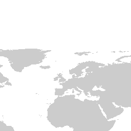
Land (Land)
HYbrid Coordinate Ocean Model (HYCOM): Global: 3-D Variables - sea_water_potential_temperature (HYCOM_Global_3D:sea_water_potential_temperature)
HYbrid Coordinate Ocean Model (HYCOM): Global: 3-D Variables - sea_water_salinity (HYCOM_Global_3D:sea_water_salinity)
HYbrid Coordinate Ocean Model (HYCOM): Global: 3-D Variables - eastward_sea_water_velocity (HYCOM_Global_3D:eastward_sea_water_velocity)
HYbrid Coordinate Ocean Model (HYCOM): Global: 3-D Variables - northward_sea_water_velocity (HYCOM_Global_3D:northward_sea_water_velocity)
LandMask (LandMask)
Coastlines (Coastlines)
Lakes and Rivers (LakesAndRivers)
National Boundaries (Nations)
State Boundaries (States)
There are currently no notifications for the service, click the feed icon to subscribe.