US Geological Survey |
|
USGS Coastal Marine Geology Program Web Map Service

| Service health Now: |
|---|
- Interface
- Web Service, OGC Web Map Service 1.3.0
- Keywords
- WFS, WMS, GEOSERVER, USGS, Coastal Marine Geology, Oceans
- Fees
- NONE
- Access constraints
- NONE
- Supported languages
- No INSPIRE Extended Capabilities (including service language support) given. See INSPIRE Technical Guidance - View Services for more information.
- Data provider
-
US Geological Survey (unverified)
Contact information:
Greg Miller
US Geological Survey
Work:
600 Fourth St. South, 33701 Saint Petersburg, USAEmail:
Phone: 727 803-8747
- Service metadata
- No INSPIRE Extended Capabilities (including service metadata) given. See INSPIRE Technical Guidance - View Services for more information.
Ads by Google
A compliant implementation of WMS plus most of the SLD extension (dynamic styling). Can also generate PDF, SVG, KML, GeoRSS
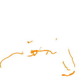
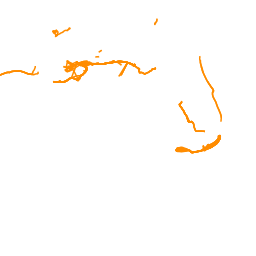
Available map layers (4)
Tracklines - lidar (lidar)
Navigation information of operations that acquired lidar data
Tracklines - multichannel seismic (mcs)
Navigation information of field activities that acquired Multichannel seismic data
Tracklines - singlechannel seismic (scs)
Navigation information of field activities that acquired single channel seismic data
Tracklines - sidescan (sss)
There are currently no notifications for the service, click the feed icon to subscribe.