The ancient geographes INC |
|
GeoServer Web Map Service

| Service health Now: |
|---|
- Interface
- Web Service, OGC Web Map Service 1.1.1
- Keywords
- WFS, WMS, GEOSERVER
- Fees
- NONE
- Access constraints
- NONE
- Data provider
-
The ancient geographes INC (unverified)
Contact information:
Claudius Ptolomaeus
The ancient geographes INC
Work:
Alexandria, EgyptEmail:
Ads by Google
A compliant implementation of WMS 1.1.1 plus most of the SLD 1.0 extension (dynamic styling). Can also generate PDF, SVG, KML, GeoRSS
Available map layers (51)
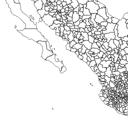
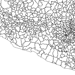
MUNICIPIOS_2010_Type (acdm:MUNICIPIOS_2010)
Generated from MUNICIPIOS_2010
RIOS_Type (acdm:RIOS)
Generated from rios_centroa
VelGeo_01_Type (acdm:VelGeo_01)
Generated from vg_01
VelGeo_02_Type (acdm:VelGeo_02)
Generated from vg_02
VelGeo_03_Type (acdm:VelGeo_03)
Generated from vg_03
VelGeo_04_Type (acdm:VelGeo_04)
Generated from vg_04
VelGeo_05_Type (acdm:VelGeo_05)
Generated from vg_05
VelGeo_06_Type (acdm:VelGeo_06)
Generated from vg_06
VelGeo_07_Type (acdm:VelGeo_07)
Generated from vg_07
VelGeo_08_Type (acdm:VelGeo_08)
Generated from vg_08
VelGeo_09_Type (acdm:VelGeo_09)
Generated from vg_09
VelGeo_10_Type (acdm:VelGeo_10)
Generated from vg_10
VelGeo_11_Type (acdm:VelGeo_11)
Generated from vg_11
VelGeo_12_Type (acdm:VelGeo_12)
Generated from vg_12
Logos is a Tagged Image File Format with Geographic information (acdm:Logos)
/usr/local/geoserverdata/data12/coverages/ACDM/LOGOS/Logos.tif
anm_1 is a Tagged Image File Format with Geographic information (acdm:anm_1)
/usr/local/geoserverdata/data12/coverages/ACDM/ANOMALIA_NIVEL_MAR/anm_1.tif
anm_10 is a Tagged Image File Format with Geographic information (acdm:anm_10)
/usr/local/geoserverdata/data12/coverages/ACDM/ANOMALIA_NIVEL_MAR/anm_10.tif
anm_11 is a Tagged Image File Format with Geographic information (acdm:anm_11)
/usr/local/geoserverdata/data12/coverages/ACDM/ANOMALIA_NIVEL_MAR/anm_11.tif
anm_12 is a Tagged Image File Format with Geographic information (acdm:anm_12)
/usr/local/geoserverdata/data12/coverages/ACDM/ANOMALIA_NIVEL_MAR/anm_12.tif
anm_1992_2011_10 is a Tagged Image File Format with Geographic information (acdm:anm_1992_2011_10)
/usr/local/geoserverdata/data12/coverages/ACDM/AnomNivelMar_1992_2012/anm_1992_2011_10.tif
anm_1992_2011_11 is a Tagged Image File Format with Geographic information (acdm:anm_1992_2011_11)
/usr/local/geoserverdata/data12/coverages/ACDM/AnomNivelMar_1992_2012/anm_1992_2011_11.tif
anm_1992_2011_12 is a Tagged Image File Format with Geographic information (acdm:anm_1992_2011_12)
/usr/local/geoserverdata/data12/coverages/ACDM/AnomNivelMar_1992_2012/anm_1992_2011_12.tif
anm_1993_2011_08 is a Tagged Image File Format with Geographic information (acdm:anm_1993_2011_08)
/usr/local/geoserverdata/data12/coverages/ACDM/AnomNivelMar_1992_2012/anm_1993_2011_08.tif
anm_1993_2011_09 is a Tagged Image File Format with Geographic information (acdm:anm_1993_2011_09)
/usr/local/geoserverdata/data12/coverages/ACDM/AnomNivelMar_1992_2012/anm_1993_2011_09.tif
anm_1993_2012_01 is a Tagged Image File Format with Geographic information (acdm:anm_1993_2012_01)
/usr/local/geoserverdata/data12/coverages/ACDM/AnomNivelMar_1992_2012/anm_1993_2012_01.tif
anm_1993_2012_02 is a Tagged Image File Format with Geographic information (acdm:anm_1993_2012_02)
/usr/local/geoserverdata/data12/coverages/ACDM/AnomNivelMar_1992_2012/anm_1993_2012_02.tif
anm_1993_2012_03 is a Tagged Image File Format with Geographic information (acdm:anm_1993_2012_03)
/usr/local/geoserverdata/data12/coverages/ACDM/AnomNivelMar_1992_2012/anm_1993_2012_03.tif
anm_1993_2012_04 is a Tagged Image File Format with Geographic information (acdm:anm_1993_2012_04)
/usr/local/geoserverdata/data12/coverages/ACDM/AnomNivelMar_1992_2012/anm_1993_2012_04.tif
anm_1993_2012_05 is a Tagged Image File Format with Geographic information (acdm:anm_1993_2012_05)
/usr/local/geoserverdata/data12/coverages/ACDM/AnomNivelMar_1992_2012/anm_1993_2012_05.tif
anm_1993_2012_06 is a Tagged Image File Format with Geographic information (acdm:anm_1993_2012_06)
/usr/local/geoserverdata/data12/coverages/ACDM/AnomNivelMar_1992_2012/anm_1993_2012_06.tif
anm_1993_2012_07 is a Tagged Image File Format with Geographic information (acdm:anm_1993_2012_07)
/usr/local/geoserverdata/data12/coverages/ACDM/AnomNivelMar_1992_2012/anm_1993_2012_07.tif
anm_2 is a Tagged Image File Format with Geographic information (acdm:anm_2)
/usr/local/geoserverdata/data12/coverages/ACDM/ANOMALIA_NIVEL_MAR/anm_2.tif
anm_3 is a Tagged Image File Format with Geographic information (acdm:anm_3)
/usr/local/geoserverdata/data12/coverages/ACDM/ANOMALIA_NIVEL_MAR/anm_3.tif
anm_4 is a Tagged Image File Format with Geographic information (acdm:anm_4)
/usr/local/geoserverdata/data12/coverages/ACDM/ANOMALIA_NIVEL_MAR/anm_4.tif
anm_5 is a Tagged Image File Format with Geographic information (acdm:anm_5)
/usr/local/geoserverdata/data12/coverages/ACDM/ANOMALIA_NIVEL_MAR/anm_5.tif
anm_6 is a Tagged Image File Format with Geographic information (acdm:anm_6)
/usr/local/geoserverdata/data12/coverages/ACDM/ANOMALIA_NIVEL_MAR/anm_6.tif
anm_7 is a Tagged Image File Format with Geographic information (acdm:anm_7)
/usr/local/geoserverdata/data12/coverages/ACDM/ANOMALIA_NIVEL_MAR/anm_7.tif
anm_8 is a Tagged Image File Format with Geographic information (acdm:anm_8)
/usr/local/geoserverdata/data12/coverages/ACDM/ANOMALIA_NIVEL_MAR/anm_8.tif
anm_9 is a Tagged Image File Format with Geographic information (acdm:anm_9)
/usr/local/geoserverdata/data12/coverages/ACDM/ANOMALIA_NIVEL_MAR/anm_9.tif
tda_1 is a Tagged Image File Format with Geographic information (acdm:tda_1)
/usr/local/geoserverdata/data12/coverages/ACDM/TOPOGRAFIA_DINAMICA_ABS/tda_1.tif
tda_10 is a Tagged Image File Format with Geographic information (acdm:tda_10)
/usr/local/geoserverdata/data12/coverages/ACDM/TOPOGRAFIA_DINAMICA_ABS/tda_10.tif
tda_11 is a Tagged Image File Format with Geographic information (acdm:tda_11)
/usr/local/geoserverdata/data12/coverages/ACDM/TOPOGRAFIA_DINAMICA_ABS/tda_11.tif
tda_12_p is a Tagged Image File Format with Geographic information (acdm:tda_12_p)
/usr/local/geoserverdata/data12/coverages/ACDM/TOPOGRAFIA_DINAMICA_ABS/tda_12_p.tif
tda_2 is a Tagged Image File Format with Geographic information (acdm:tda_2)
/usr/local/geoserverdata/data12/coverages/ACDM/TOPOGRAFIA_DINAMICA_ABS/tda_2.tif
tda_3 is a Tagged Image File Format with Geographic information (acdm:tda_3)
/usr/local/geoserverdata/data12/coverages/ACDM/TOPOGRAFIA_DINAMICA_ABS/tda_3.tif
tda_4 is a Tagged Image File Format with Geographic information (acdm:tda_4)
/usr/local/geoserverdata/data12/coverages/ACDM/TOPOGRAFIA_DINAMICA_ABS/tda_4.tif
tda_5 is a Tagged Image File Format with Geographic information (acdm:tda_5)
/usr/local/geoserverdata/data12/coverages/ACDM/TOPOGRAFIA_DINAMICA_ABS/tda_5.tif
tda_6 is a Tagged Image File Format with Geographic information (acdm:tda_6)
/usr/local/geoserverdata/data12/coverages/ACDM/TOPOGRAFIA_DINAMICA_ABS/tda_6.tif
tda_7 is a Tagged Image File Format with Geographic information (acdm:tda_7)
/usr/local/geoserverdata/data12/coverages/ACDM/TOPOGRAFIA_DINAMICA_ABS/tda_7.tif
tda_8 is a Tagged Image File Format with Geographic information (acdm:tda_8)
/usr/local/geoserverdata/data12/coverages/ACDM/TOPOGRAFIA_DINAMICA_ABS/tda_8.tif
tda_9 is a Tagged Image File Format with Geographic information (acdm:tda_9)
/usr/local/geoserverdata/data12/coverages/ACDM/TOPOGRAFIA_DINAMICA_ABS/tda_9.tif
There are currently no notifications for the service, click the feed icon to subscribe.