APB Amt fuer raumbezogene und statisti… |
|
INSPIRE Web Map Tiling Service - Autonome Provinz Bozen - Provincia Autonoma di Bolzano

| Service health Now: |
|---|
- Interface
- Web Service, OGC Web Map Service 1.1.1
- Keywords
- WFS, WMS, WMTS, GEOWEBCACHE
- Fees
- NONE
- Access constraints
- NONE
- Data provider
-
APB Amt fuer raumbezogene und statistische Informatik - PAB Ufficio informaticva geografica e statistica (unverified)
Contact information:
Ivo Planoetscher
APB Amt fuer raumbezogene und statistische Informatik - PAB Ufficio informaticva geografica e statistica
Work:
Landhaus 12, Kanonikus-Michael-Gamper-Strasse 1, 39100 Bozen - Bolzano, EuropaEmail:
Phone: +39 0471 41 83 73
Ads by Google
GeoWebCache is an advanced tile cache for WMS servers.It supports a large variety of protocols and formats, including WMS-C, WMTS, KML, Google Maps and Virtual Earth.
Available map layers (24)
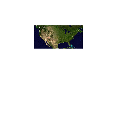
North America sample imagery (nurc:Img_Sample)
null
Manhattan (NY) landmarks (tiger:poly_landmarks)
Manhattan landmarks, identifies water, lakes, parks, interesting buildilngs
mosaic (nurc:mosaic)
null
Tasmania cities (topp:tasmania_cities)
Cities in Tasmania (actually, just the capital)
Spearfish archeological sites (sf:archsites)
Sample data from GRASS, archeological sites location, Spearfish, South Dakota, USA
Tasmania roads (topp:tasmania_roads)
Main Tasmania roads
Manhattan (NY) roads (tiger:tiger_roads)
Highly simplified road layout of Manhattan in New York..
Tasmania state boundaries (topp:tasmania_state_boundaries)
Tasmania state boundaries
tiger-ny (tiger-ny)
tasmania (tasmania)
spearfish (spearfish)
A sample ArcGrid file (nurc:Arc_Sample)
null
Spearfish bug locations (sf:bugsites)
Sample data from GRASS, bug sites location, Spearfish, South Dakota, USA
Tasmania water bodies (topp:tasmania_water_bodies)
Tasmania water bodies
Spearfish restricted areas (sf:restricted)
Sample data from GRASS, restricted areas, Spearfish, South Dakota, USA
Spearfish roads (sf:roads)
Sample data from GRASS, road layout, Spearfish, South Dakota, USA
World rectangle (tiger:giant_polygon)
A simple rectangular polygon covering most of the world, it's only used for the purpose of providing a background (WMS bgcolor could be used instead)
Spearfish streams (sf:streams)
Sample data from GRASS, streams, Spearfish, South Dakota, USA
USA Population (topp:states)
This is some census data on the states.
sfdem is a Tagged Image File Format with Geographic information (sf:sfdem)
null
Manhattan (NY) points of interest (tiger:poi)
Points of interest in New York, New York (on Manhattan). One of the attributes contains the name of a file with a picture of the point of interest.
Ortofotocarta 2008 - Orthophotokarte 2008 (cache_of2008)
Ortofotocarta versione 2008 in uso presso il SIT della Provincia Autonoma di Bolzano. Orthophotokarte in der Version 2008 im TIS der Autonomen Provinz Bozen eingesetzt.
Ortofotocarta 2011 - Orthophotokarte 2011 (cache_of2011)
Ortofotocarta 2011 Non copre aree oltre il limite amministrativo della Provincia Autonoma di Bolzano - Alto Adige. Dataset utilizzato: orthofoto_2011_truecolor_rgb_mosaic_buffer150m.ecw. Orthophotokarte 2011 Gebiete ausserhalb der administrativen Grenze der Autonomen Provinz Bozen - Suedtirol werden nicht abgedeckt. Verwendeter Datensatz: orthofoto_2011_truecolor_rgb_mosaic_buffer150m.ecw.
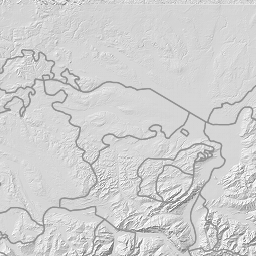
Basemap Southtyrol WGS84 (WMTS-WGS84_BASEMAP-APB-PAB)
Mappa di base nel sistema di coordinate WGS84 per la rappresnetazione del territorio della Provincia Autonoma di Bolzano. Layers utilizzati: inspire:EL.DSM-2P5M.HILLSHADE,inspire:EL.DTM-2P5M.HILLSHADE,apb-pab:gk10_2007,inspire:HY.PhysicalWaters.Waterbodies.Watercourse, inspire:LandUse.ExistingLandUseCoverage,apb-pab:mask_borders_suedtirol, inspire:HY.PhysicalWaters.Waterbodies,inspire:EL.ContourLine, inspire:TN.RailTransportNetwork.RailwayLink,inspire:TN.RoadTransportNetwork.RoadLink, trails:V_VIE,trails:V_WANDERWEGE,trails:GN.Schutzhuetten_Rifugi, inspire:TN.CableTransportNetwork.CablewayLink,inspire:GN.GeographicalNames Basiskartografie im Koordinatensystem WGS84 fuer die Darstellung des Gebietes der Autonomen Provinz Bozen - Suedtirol. Verwendete Layers: inspire:EL.DTM-DSM-2P5M.HILLSHADE apb-pab:gk10_2007, inspire:HY.PhysicalWaters.Waterbodies.Watercourse, inspire:LandUse.ExistingLandUseCoverage,apb-pab:mask_borders_suedtirol, inspire:HY.PhysicalWaters.Waterbodies,inspire:EL.ContourLine, inspire:TN.RailTransportNetwork.RailwayLink,inspire:TN.RoadTransportNetwork.RoadLink, trails:V_VIE,trails:V_WANDERWEGE,trails:GN.Schutzhuetten_Rifugi, inspire:TN.CableTransportNetwork.CablewayLink,inspire:GN.GeographicalNames
There are currently no notifications for the service, click the feed icon to subscribe.