U.S. Geological Survey - National Geos… |
|
USGS NHD Small Scale Vectors
http://basemap.nationalmap.gov/arcgis/services/NHD_Small/MapServer/WmsServer
| Service health Now: |
|---|
- Interface
- Web Service, OGC Web Map Service 1.3.0
- Keywords
- NHD Hydrography Vector Basemap
- Fees
- unknown
- Access constraints
- unknown
- Supported languages
- No INSPIRE Extended Capabilities (including service language support) given. See INSPIRE Technical Guidance - View Services for more information.
- Data provider
-
U.S. Geological Survey - National Geospatial Program, USGS The National Map (unverified)
Contact information:
U.S. Geological Survey - National Geospatial Program, USGS The National Map
- Service metadata
- No INSPIRE Extended Capabilities (including service metadata) given. See INSPIRE Technical Guidance - View Services for more information.
Ads by Google
Small-Scale NHD Hydrography vector basemap. The National Hydrography Dataset (NHD) is a comprehensive set of digital spatial data that encodes information about naturally occurring and constructed bodies of surface water (lakes, ponds, and reservoirs), paths through which water flows (canals, ditches, streams, and rivers), and related entities such as point features (springs, wells, stream gages, and dams). The information encoded about these features includes classification and other characteristics, delineation, geographic name, position and related measures, a "reach code" through which other information can be related to the NHD, and the direction of water flow. The network of reach codes delineating water and transported material flow allows users to trace movement in upstream and downstream directions. In addition to this geographic information, the dataset contains metadata that supports the exchange of future updates and improvements to the data. The NHD is available nationwide in two seamless datasets, one based on 1:24,000-scale maps and referred to as high resolution NHD, and the other based on 1:100,000-scale maps and referred to as medium resolution NHD. Additional selected areas in the United States are available based on larger scales, such as 1:5,000-scale or greater, and referred to as local resolution NHD. The NHD supports many applications, such as making maps, geocoding observations, flow modeling, data maintenance and stewardship. For additional information, go to http://nhd.usgs.gov.
Available map layers (1)
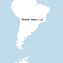
NHD Small Scale Vectors (0)
Small-Scale NHD Hydrography vector basemap. The National Hydrography Dataset (NHD) is a comprehensive set of digital spatial data that encodes information about naturally occurring and constructed bodies of surface water (lakes, ponds, and reservoirs), paths through which water flows (canals, ditches, streams, and rivers), and related entities such as point features (springs, wells, stream gages, and dams). The information encoded about these features includes classification and other characteristics, delineation, geographic name, position and related measures, a "reach code" through which other information can be related to the NHD, and the direction of water flow. The network of reach codes delineating water and transported material flow allows users to trace movement in upstream and downstream directions. In addition to this geographic information, the dataset contains metadata that supports the exchange of future updates and improvements to the data. The NHD is available nationwide in two seamless datasets, one based on 1:24,000-scale maps and referred to as high resolution NHD, and the other based on 1:100,000-scale maps and referred to as medium resolution NHD. Additional selected areas in the United States are available based on larger scales, such as 1:5,000-scale or greater, and referred to as local resolution NHD. The NHD supports many applications, such as making maps, geocoding observations, flow modeling, data maintenance and stewardship. For additional information, go to http://nhd.usgs.gov.
There are currently no notifications for the service, click the feed icon to subscribe.