Environment Canada |
|
Environment Canada MSC Weather and Environmental Monitoring OGC Web Services
| Service health Now: |
|---|
- Interface
- Web Service, OGC Web Map Service 1.1.1
- Keywords
- environment, weather, msc, wem, monitoring, hydrometric, water levels, ec, cise, ogc, cgdi
- Fees
- none
- Access constraints
- none
- Data provider
-
Environment Canada (unverified)
Contact information:
Joseph McIlhinney
Environment Canada
postal:
373 Sussex Drive, Block E1, K1A-0H3 Ottawa, CanadaEmail:
Phone: +01-613-943-5746
Ads by Google
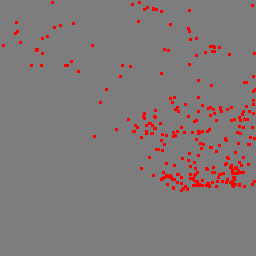
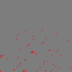
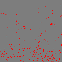
This service contains a number of map layers that represent Canadian climate and hydrometric (water quantity) monitoring stations, both active and inactive (discontinued)
Available map layers (18)
Environment Canada MSC Weather and Environmental Monitoring OGC Web Services (wem_en)
Hydrometric (Hydrometric)
Data From the Hydrometric Program
Real-time Hydrometric Monitoring Stations in Canada (Active_Station_View)
The purpose is to identify active hydrometric stations in Canada that provide Water Level data in near real-time. The real-time water level data is received via satellite (data collection platforms) or land-line (telephone) transmissions from hydrometric stations across Canada. Satellite transmissions of water level data are made on a scheduled basis, typically every 1 to 3 hours. Land-line hydrometric stations are polled on a scheduled basis varying from every hour to once a day, depending on the station.
Inactive Hydrometric Monitoring Stations in Canada (Discontinued_Station_View)
The purpose is to identify inactive (discontinued) hydrometric stations in Canada that provide archived Water Level and Streamflow (discharge) data.
Active Hydrometric Monitoring Stations in Canada (NotRT_Active_Station_View)
The purpose is to identify active hydrometric stations in Canada that provide only archived Water Level and Streamflow (discharge) data.
Real-time Hydrometric Water Levels in Canada (rtwl)
TBA
Water Level Conditions (Streamflow_Conditions)
Hydrological Conditions in Canada present current (near real-time) water level conditions at river and lake gauging stations across Canada. Colour-coded symbols are used to represent water level conditions ranging from low to normal to high. The symbols are dynamically generated based on the most recent data available in comparison with historical statistics.
Real time Conditions (rtc)
The purpose is to identify active hydrometric stations in Canada that provide Water Level data in near real-time. The real-time water level data is received via satellite (data collection platforms) or land-line (telephone) transmissions from hydrometric stations across Canada. Satellite transmissions of water level data are made on a scheduled basis, typically every 1 to 3 hours. Land-line hydrometric stations are polled on a scheduled basis varying from every hour to once a day, depending on the station.
Climate (Climate)
Data From the Climate Program
Active Climate Monitoring Stations in Canada (Active_Climate_Stations)
Surface climate data are used by a broad range of users, including researchers, policy makers, and service providers. Climate data are essential for climate, climate change and variability studies, for ensuring the safety and security of the public in terms of infrastructure planning such as building codes, flood-way planning and ice storm resilience planning. Increasingly, the industry demands timely, quality climate information for economic benefits of their programs, and the public also demands such climate information for decision-making and planning.
Inactive Climate Stations in Canada (Inactive_Station_View)
Surface climate data are used by a broad range of users, including researchers, policy makers, and service providers. Climate data are essential for climate and climate change and variability studies, for ensuring the safety and security of the public in terms of infrastructure planning such as building codes, flood-way planning, ice storm resilience planning, and so on. Increasingly, the industry demands timely, quality climate information for economic benefits of their programs, and the public also demands such climate information for decision-making and planning.
Sediment (Sediment)
Data From the Hydrometric Program (Sediment)
Active Suspended Sediment Stations in Canada (adss)
Active Suspended Sediment Stations in Canada
Inactive Suspended Sediment Monitoring Stations in Canada (ddss)
Inactive Suspended Sediment Monitoring Stations in Canada
Bed Load Monitoring Stations in Canada (iblss)
Bed Load Monitoring Stations in Canada
Depth-Integrated Suspended Sediment Monitoring Stations in Canada (idiss)
Depth-Integrated Suspended Sediment Monitoring Stations in Canada
Point-integrated suspended sediment stations in Canada (ipiss)
Point-integrated suspended sediment stations in Canada
Bed Material Monitoring Stations in Canada (ibmss)
Bed Material Monitoring Stations in Canada
There are currently no notifications for the service, click the feed icon to subscribe.